Paimpol elevation
Paimpol (Brittany, Département des Côtes-d’Armor), France elevation is 6 meters and Paimpol elevation in feet is 20 ft above sea level [src 1]. Paimpol is a populated place (feature code) with elevation that is 168 meters (551 ft) smaller than average city elevation in France.
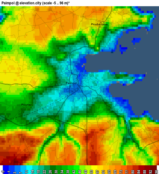
Below is the Elevation map of Paimpol, which displays elevation range with different colors. Scale of the first map is from -5 to 96 m (-16 to 315 ft) with average elevation of 44.4 meters (=146 ft) [note 1]
These maps also provides idea of topography and contour of this city, they are displayed at different zoom levels. More info about maps, scale and edge coordinates you can find below images.
| \ | Map #1 | Map #2 | Topo.Map |
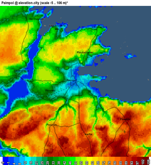
| Scale [m] | -5..96 m | -5..106 m | × |
| Scale [ft] | -16..315 ft | -16..348 ft | × |
| Average | 44.4 m = 146 ft | 55.3 m = 181 ft | × |
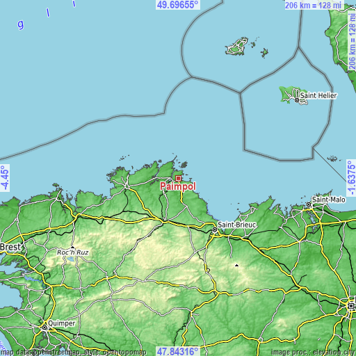
| Width | 6.44 km = 4 mi | 12.88 km = 8 mi | 206.1 km = 128.1 mi |
| Height | 6.44 km = 4 mi | 12.88 km = 8 mi | 206.1 km = 128.1 mi |
| ↑Max Latitude | 48.80736° | 48.836294° | 49.69655° |
| Latitude at center | 48.77841° | 48.77841° | 48.77841° |
| ↓Min Latitude | 48.749443° | 48.720459° | 47.84316° |
| ← Min Longitude | -3.087695° | -3.131641° | -4.45° |
| Longitude center | -3.04375° | -3.04375° | -3.04375° |
| →Max Longitude | -2.999805° | -2.955859° | -1.6375° |
Nearby cities:
Cities around Paimpol sort by population:
• Ploubazlanec elevation 59 m
2.5 km,  17°
17°
• Plouézec 96 m
5.3 km,  124°
124°
• Pleubian 48 m
10 km,  315°
315°
• Plourivo 71 m
4.2 km,  208°
208°
• Lézardrieux 25 m
4.6 km,  279°
279°
• Pontrieux 9 m
12.1 km,  224°
224°
• Ploëzal 75 m
13.6 km,  239°
239°
• Pleumeur-Gautier 80 m
8.6 km,  286°
286°
• Pléhédel 96 m
9.5 km,  164°
164°
• Quemper-Guézennec 65 m
9.4 km, 208°
• Trédarzec 49 m
11.6 km,  274°
274°
• Pleudaniel 46 m
7.2 km,  259°
259°
Multilingual:
 En español:
Paimpol elevación 6 m.
 En France:
Paimpol élévation 6 m.


Sources and notes:
- [note 1] Map square and city borders are not equal. Map elevation data is calculated only from area inside that square.
- [src 1] Elevation data from geonames database provided with same terms of usage.
- [src 2] The elevation map of Paimpol is generated using elevation data from NASA's 3 arcsec (90m) resolution SRTM data.
- [src 3] Base (background) map © OpenStreetMap contributors tiles are generated by Geofabrik and OpenTopoMap.
Copyright & License:
This Paimpol Elevation Map is licensed under CC BY-SA. You may reuse any part from this page, if you give a proper credit by linking to this URL:
 More info on terms of use page.