Parigné-le-Pôlin elevation
Parigné-le-Pôlin (Pays de la Loire, Sarthe), France elevation is 84 meters and Parigné-le-Pôlin elevation in feet is 276 ft above sea level [src 1]. Parigné-le-Pôlin is a populated place (feature code) with elevation that is 90 meters (295 ft) smaller than average city elevation in France.
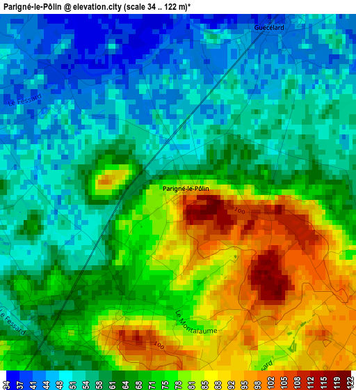
Below is the Elevation map of Parigné-le-Pôlin, which displays elevation range with different colors. Scale of the first map is from 34 to 122 m (112 to 400 ft) with average elevation of 65.4 meters (=215 ft) [note 1]
These maps also provides idea of topography and contour of this city, they are displayed at different zoom levels. More info about maps, scale and edge coordinates you can find below images.
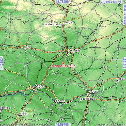
| \ | Map #1 | Topo.Map |
| Scale [m] | 34..122 m | × |
| Scale [ft] | 112..400 ft | × |
| Average | 65.4 m = 215 ft | × |
| Width | 6.56 km = 4.1 mi | 209.9 km = 130.4 mi |
| Height | 6.56 km = 4.1 mi | 209.8 km = 130.4 mi |
| ↑Max Latitude | 47.879352° | 48.78499° |
| Latitude at center | 47.84987° | 47.84987° |
| ↓Min Latitude | 47.820371° | 46.89758° |
| ← Min Longitude | 0.063105° | -1.2992° |
| Longitude center | 0.10705° | 0.10705° |
| →Max Longitude | 0.150995° | 1.5133° |
Nearby cities:
Cities around Parigné-le-Pôlin sort by population:
• La Suze-sur-Sarthe elevation 47 m
7.4 km,  304°
304°
• Guécélard 40 m
3.5 km,  28°
28°
• Roézé-sur-Sarthe 55 m
5.9 km,  329°
329°
• Moncé-en-Belin 57 m
8.4 km,  53°
53°
• Cérans-Foulletourte 70 m
3.4 km,  220°
220°
• Spay 42 m
8.9 km,  22°
22°
• Laigné-en-Belin 65 m
9.5 km,  71°
71°
• Saint-Gervais-en-Belin 62 m
8.8 km, 69°
• Yvré-le-Pôlin 95 m
4.8 km,  130°
130°
• Saint-Ouen-en-Belin 60 m
7.9 km,  103°
103°
• Fillé 41 m
5.8 km,  13°
13°
• Requeil 78 m
8.4 km,  151°
151°
Multilingual:
 En español:
Parigné-le-Pôlin elevación 84 m.
 En France:
Parigné-le-Pôlin élévation 84 m.
 Auf Deutsch:
Parigné-le-Pôlin höhe über dem Meeresspiegel ist 84 m.

Sources and notes:
- [note 1] Map square and city borders are not equal. Map elevation data is calculated only from area inside that square.
- [src 1] Elevation data from geonames database provided with same terms of usage.
- [src 2] The elevation map of Parigné-le-Pôlin is generated using elevation data from NASA's 3 arcsec (90m) resolution SRTM data.
- [src 3] Base (background) map © OpenStreetMap contributors tiles are generated by Geofabrik and OpenTopoMap.
Copyright & License:
This Parigné-le-Pôlin Elevation Map is licensed under CC BY-SA. You may reuse any part from this page, if you give a proper credit by linking to this URL:
 More info on terms of use page.