Paron elevation
Paron (Bourgogne-Franche-Comté, Département de l'Yonne), France elevation is 89 meters and Paron elevation in feet is 292 ft above sea level [src 1]. Paron is a populated place (feature code) with elevation that is 85 meters (279 ft) smaller than average city elevation in France.
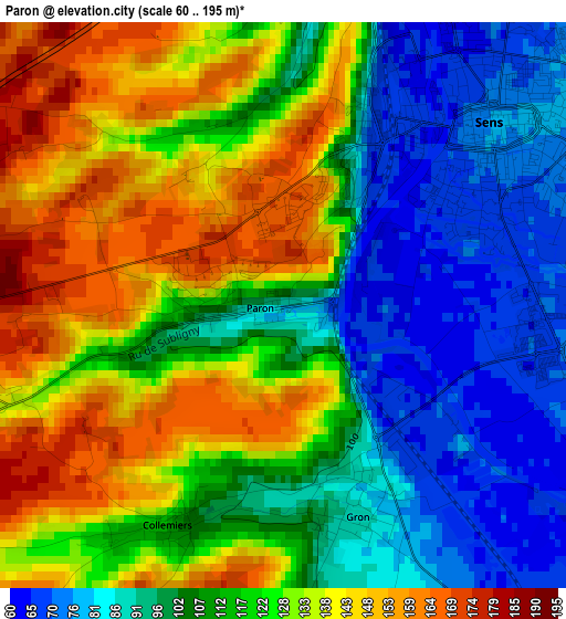
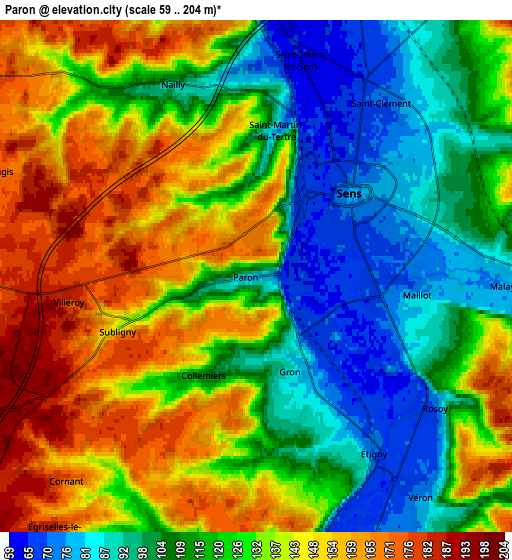
Below is the Elevation map of Paron, which displays elevation range with different colors. Scale of the first map is from 60 to 195 m (197 to 640 ft) with average elevation of 116.1 meters (=381 ft) [note 1]
These maps also provides idea of topography and contour of this city, they are displayed at different zoom levels. More info about maps, scale and edge coordinates you can find below images.
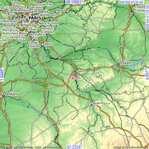
| \ | Map #1 | Map #2 | Topo.Map |
| Scale [m] | 60..195 m | 59..204 m | × |
| Scale [ft] | 197..640 ft | 194..669 ft | × |
| Average | 116.1 m = 381 ft | 126.3 m = 414 ft | × |
| Width | 6.52 km = 4.1 mi | 13.03 km = 8.1 mi | 208.5 km = 129.6 mi |
| Height | 6.52 km = 4.1 mi | 13.03 km = 8.1 mi | 208.5 km = 129.6 mi |
| ↑Max Latitude | 48.208175° | 48.237453° | 49.10801° |
| Latitude at center | 48.17888° | 48.17888° | 48.17888° |
| ↓Min Latitude | 48.149569° | 48.12024° | 47.2326° |
| ← Min Longitude | 3.206805° | 3.162859° | 1.8445° |
| Longitude center | 3.25075° | 3.25075° | 3.25075° |
| →Max Longitude | 3.294695° | 3.338641° | 4.657° |
Nearby cities:
Cities around Paron sort by population:
• Sens elevation 72 m
3.2 km,  49°
49°
• Villeneuve-sur-Yonne 80 m
11.3 km,  162°
162°
• Pont-sur-Yonne 81 m
12.1 km,  342°
342°
• Saint-Clément 70 m
5.4 km,  38°
38°
• Véron 75 m
7 km,  142°
142°
• Malay-le-Grand 80 m
6.8 km,  92°
92°
• Saint-Valérien 166 m
11.5 km,  269°
269°
• Saint-Martin-du-Tertre 69 m
4.3 km,  10°
10°
• Soucy 94 m
9.5 km,  34°
34°
• Gron 81 m
2.3 km, 156°
• Maillot 76 m
4.2 km, 94°
• Égriselles-le-Bocage 182 m
8.2 km,  218°
218°
Multilingual:
 En español:
Paron elevación 89 m.
 En France:
Paron élévation 89 m.


Sources and notes:
- [note 1] Map square and city borders are not equal. Map elevation data is calculated only from area inside that square.
- [src 1] Elevation data from geonames database provided with same terms of usage.
- [src 2] The elevation map of Paron is generated using elevation data from NASA's 3 arcsec (90m) resolution SRTM data.
- [src 3] Base (background) map © OpenStreetMap contributors tiles are generated by Geofabrik and OpenTopoMap.
Copyright & License:
This Paron Elevation Map is licensed under CC BY-SA. You may reuse any part from this page, if you give a proper credit by linking to this URL:
 More info on terms of use page.