Petite-Forêt elevation
Petite-Forêt (Hauts-de-France, Nord), France elevation is 45 meters and Petite-Forêt elevation in feet is 148 ft above sea level [src 1]. Petite-Forêt is a populated place (feature code) with elevation that is 129 meters (423 ft) smaller than average city elevation in France.
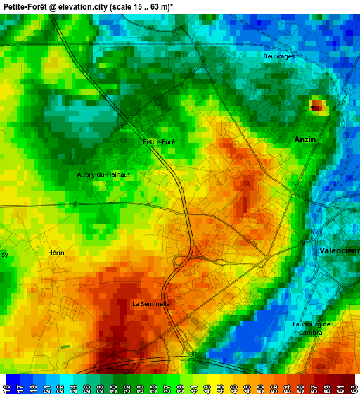
Below is the Elevation map of Petite-Forêt, which displays elevation range with different colors. Scale of the first map is from 15 to 63 m (49 to 207 ft) with average elevation of 37.3 meters (=122 ft) [note 1]
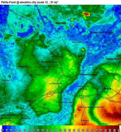
These maps also provides idea of topography and contour of this city, they are displayed at different zoom levels. More info about maps, scale and edge coordinates you can find below images.
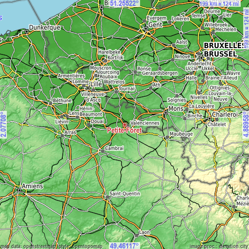
| \ | Map #1 | Map #2 | Topo.Map |
| Scale [m] | 15..63 m | 12..91 m | × |
| Scale [ft] | 49..207 ft | 39..299 ft | × |
| Average | 37.3 m = 122 ft | 35.7 m = 117 ft | × |
| Width | 6.23 km = 3.9 mi | 12.47 km = 7.7 mi | 199.5 km = 124 mi |
| Height | 6.23 km = 3.9 mi | 12.47 km = 7.7 mi | 199.5 km = 124 mi |
| ↑Max Latitude | 50.394693° | 50.4227° | 51.25522° |
| Latitude at center | 50.36667° | 50.36667° | 50.36667° |
| ↓Min Latitude | 50.33863° | 50.310574° | 49.46117° |
| ← Min Longitude | 3.439385° | 3.395439° | 2.07708° |
| Longitude center | 3.48333° | 3.48333° | 3.48333° |
| →Max Longitude | 3.527275° | 3.571221° | 4.88958° |
Nearby cities:
Cities around Petite-Forêt sort by population:
• Valenciennes elevation 31 m
3.1 km,  105°
105°
• Anzin 50 m
1.6 km,  67°
67°
• Raismes 33 m
1.9 km,  0°
0°
• Bruay-sur-l’Escaut 20 m
5.6 km,  49°
49°
• Marly 42 m
5.3 km,  116°
116°
• Saint-Saulve 28 m
5.2 km,  84°
84°
• Aulnoy-lez-Valenciennes 37 m
5.1 km,  136°
136°
• Beuvrages 29 m
2.1 km,  21°
21°
• Hérin 45 m
2.5 km,  240°
240°
• La Sentinelle 51 m
1.7 km,  177°
177°
• Aubry-du-Hainaut 40 m
1.2 km,  270°
270°
• Bellaing 41 m
4.1 km, 272°
Multilingual:
 En español:
Petite-Forêt elevación 45 m.
 En France:
Petite-Forêt élévation 45 m.
 Auf Deutsch:
Petite-Forêt höhe über dem Meeresspiegel ist 45 m.

Sources and notes:
- [note 1] Map square and city borders are not equal. Map elevation data is calculated only from area inside that square.
- [src 1] Elevation data from geonames database provided with same terms of usage.
- [src 2] The elevation map of Petite-Forêt is generated using elevation data from NASA's 3 arcsec (90m) resolution SRTM data.
- [src 3] Base (background) map © OpenStreetMap contributors tiles are generated by Geofabrik and OpenTopoMap.
Copyright & License:
This Petite-Forêt Elevation Map is licensed under CC BY-SA. You may reuse any part from this page, if you give a proper credit by linking to this URL:
 More info on terms of use page.