Pignan elevation
Pignan (Occitanie, Département de l'Hérault), France elevation is 48 meters and Pignan elevation in feet is 157 ft above sea level [src 1]. Pignan is a populated place (feature code) with elevation that is 126 meters (413 ft) smaller than average city elevation in France.
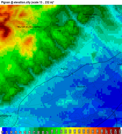
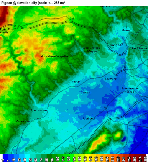
Below is the Elevation map of Pignan, which displays elevation range with different colors. Scale of the first map is from 13 to 232 m (43 to 761 ft) with average elevation of 70 meters (=230 ft) [note 1]
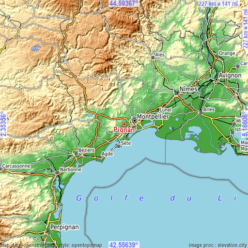
These maps also provides idea of topography and contour of this city, they are displayed at different zoom levels. More info about maps, scale and edge coordinates you can find below images.
| \ | Map #1 | Map #2 | Topo.Map |
| Scale [m] | 13..232 m | -4..285 m | × |
| Scale [ft] | 43..761 ft | -13..935 ft | × |
| Average | 70 m = 230 ft | 83.6 m = 274 ft | × |
| Width | 7.08 km = 4.4 mi | 14.16 km = 8.8 mi | 226.5 km = 140.7 mi |
| Height | 7.08 km = 4.4 mi | 14.16 km = 8.8 mi | 226.5 km = 140.7 mi |
| ↑Max Latitude | 43.615474° | 43.647282° | 44.59367° |
| Latitude at center | 43.58365° | 43.58365° | 43.58365° |
| ↓Min Latitude | 43.551809° | 43.519951° | 42.55639° |
| ← Min Longitude | 3.715865° | 3.671919° | 2.35356° |
| Longitude center | 3.75981° | 3.75981° | 3.75981° |
| →Max Longitude | 3.803755° | 3.847701° | 5.16606° |
Nearby cities:
Cities around Pignan sort by population:
• Saint-Jean-de-Védas elevation 48 m
5.4 km,  97°
97°
• Fabrègues 42 m
3.9 km,  160°
160°
• Juvignac 54 m
5.3 km,  50°
50°
• Grabels 66 m
7.8 km,  23°
23°
• Cournonterral 49 m
4.2 km,  229°
229°
• Mireval 18 m
9 km, 157°
• Lavérune 40 m
3.7 km,  85°
85°
• Montarnaud 124 m
8.7 km,  324°
324°
• Montbazin 47 m
9 km,  214°
214°
• Cournonsec 70 m
5.8 km, 228°
• Saussan 43 m
1.8 km,  136°
136°
• Murviel-lès-Montpellier 131 m
3 km, 323°
Multilingual:
 En español:
Pignan elevación 48 m.
 En France:
Pignan élévation 48 m.


Sources and notes:
- [note 1] Map square and city borders are not equal. Map elevation data is calculated only from area inside that square.
- [src 1] Elevation data from geonames database provided with same terms of usage.
- [src 2] The elevation map of Pignan is generated using elevation data from NASA's 3 arcsec (90m) resolution SRTM data.
- [src 3] Base (background) map © OpenStreetMap contributors tiles are generated by Geofabrik and OpenTopoMap.
Copyright & License:
This Pignan Elevation Map is licensed under CC BY-SA. You may reuse any part from this page, if you give a proper credit by linking to this URL:
 More info on terms of use page.