Pignans elevation
Pignans (Provence-Alpes-Côte d'Azur, Var), France elevation is 175 meters and Pignans elevation in feet is 574 ft above sea level [src 1]. Pignans is a populated place (feature code) with elevation that is 1 meters (3 ft) bigger than average city elevation in France.
Below is the Elevation map of Pignans, which displays elevation range with different colors. Scale of the first map is from 99 to 505 m (325 to 1657 ft) with average elevation of 241.9 meters (=794 ft) [note 1]
These maps also provides idea of topography and contour of this city, they are displayed at different zoom levels. More info about maps, scale and edge coordinates you can find below images.
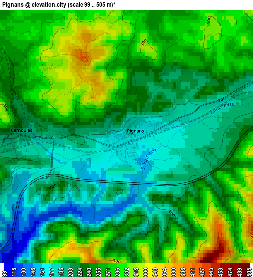
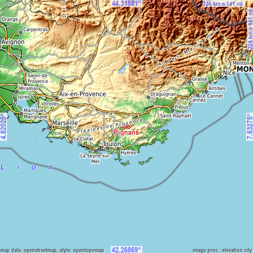
| \ | Map #1 | Topo.Map |
| Scale [m] | 99..505 m | × |
| Scale [ft] | 325..1657 ft | × |
| Average | 241.9 m = 794 ft | × |
| Width | 7.11 km = 4.4 mi | 227.6 km = 141.4 mi |
| Height | 7.11 km = 4.4 mi | 227.6 km = 141.4 mi |
| ↑Max Latitude | 43.332683° | 44.31551° |
| Latitude at center | 43.30071° | 43.30071° |
| ↓Min Latitude | 43.26872° | 42.26869° |
| ← Min Longitude | 6.182555° | 4.82025° |
| Longitude center | 6.2265° | 6.2265° |
| →Max Longitude | 6.270445° | 7.63275° |
Nearby cities:
Cities around Pignans sort by population:
• Le Luc elevation 180 m
12.5 km,  33°
33°
• Pierrefeu-du-Var 80 m
10.8 km,  217°
217°
• Le Cannet-des-Maures 130 m
13.7 km,  41°
41°
• Gonfaron 160 m
5.5 km,  66°
66°
• Puget-Ville 195 m
7.4 km,  260°
260°
• Rocbaron 350 m
11.9 km,  274°
274°
• Carnoules 219 m
3.2 km, 272°
• Flassans-sur-Issole 273 m
7.6 km,  356°
356°
• Besse-sur-Issole 250 m
6.7 km,  322°
322°
• Forcalqueiret 308 m
12.2 km,  288°
288°
• Sainte-Anastasie-sur-Issole 299 m
9.4 km,  299°
299°
• Collobrières 158 m
9.7 km,  136°
136°
Multilingual:
 En español:
Pignans elevación 175 m.
 En France:
Pignans élévation 175 m.


Sources and notes:
- [note 1] Map square and city borders are not equal. Map elevation data is calculated only from area inside that square.
- [src 1] Elevation data from geonames database provided with same terms of usage.
- [src 2] The elevation map of Pignans is generated using elevation data from NASA's 3 arcsec (90m) resolution SRTM data.
- [src 3] Base (background) map © OpenStreetMap contributors tiles are generated by Geofabrik and OpenTopoMap.
Copyright & License:
This Pignans Elevation Map is licensed under CC BY-SA. You may reuse any part from this page, if you give a proper credit by linking to this URL:
 More info on terms of use page.