Plaintel elevation
Plaintel (Brittany, Département des Côtes-d’Armor), France elevation is 206 meters and Plaintel elevation in feet is 676 ft above sea level [src 1]. Plaintel is a populated place (feature code) with elevation that is 32 meters (105 ft) bigger than average city elevation in France.
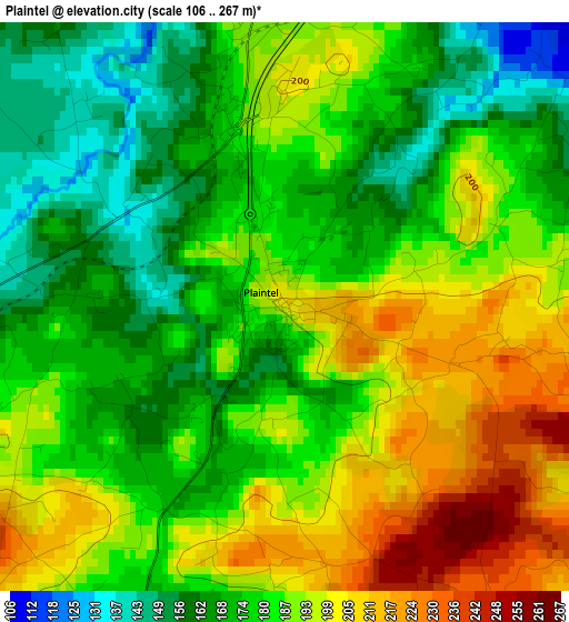
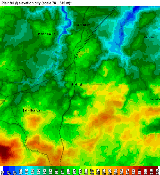
Below is the Elevation map of Plaintel, which displays elevation range with different colors. Scale of the first map is from 106 to 267 m (348 to 876 ft) with average elevation of 183.3 meters (=601 ft) [note 1]
These maps also provides idea of topography and contour of this city, they are displayed at different zoom levels. More info about maps, scale and edge coordinates you can find below images.
| \ | Map #1 | Map #2 | Topo.Map |
| Scale [m] | 106..267 m | 78..319 m | × |
| Scale [ft] | 348..876 ft | 256..1047 ft | × |
| Average | 183.3 m = 601 ft | 182 m = 597 ft | × |
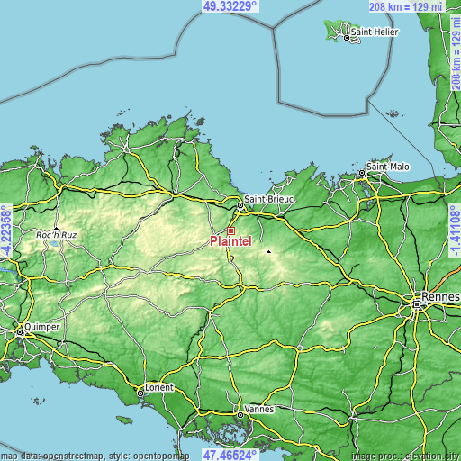
| Width | 6.49 km = 4 mi | 12.97 km = 8.1 mi | 207.6 km = 129 mi |
| Height | 6.49 km = 4 mi | 12.97 km = 8.1 mi | 207.6 km = 129 mi |
| ↑Max Latitude | 48.436494° | 48.465641° | 49.33229° |
| Latitude at center | 48.40733° | 48.40733° | 48.40733° |
| ↓Min Latitude | 48.378149° | 48.348952° | 47.46524° |
| ← Min Longitude | -2.861275° | -2.905221° | -4.22358° |
| Longitude center | -2.81733° | -2.81733° | -2.81733° |
| →Max Longitude | -2.773385° | -2.729439° | -1.41108° |
Nearby cities:
Cities around Plaintel sort by population:
• Ploufragan elevation 128 m
9.5 km,  10°
10°
• Plédran 153 m
6.8 km,  50°
50°
• Plœuc-sur-Lié 202 m
8.1 km,  142°
142°
• Quintin 179 m
6.9 km,  266°
266°
• Saint-Brandan 200 m
4.3 km,  243°
243°
• Saint-Julien 161 m
4.9 km,  4°
4°
• Hénon 150 m
10.2 km,  104°
104°
• Saint-Donan 174 m
8.5 km,  324°
324°
• Saint-Carreuc 196 m
6.5 km, 98°
• Plaine-Haute 193 m
4.9 km,  326°
326°
• Le Fœil 168 m
7.9 km,  291°
291°
• La Méaugon 117 m
10.3 km,  351°
351°
Multilingual:
 En español:
Plaintel elevación 206 m.
 En France:
Plaintel élévation 206 m.
 Auf Deutsch:
Plaintel höhe über dem Meeresspiegel ist 206 m.

Sources and notes:
- [note 1] Map square and city borders are not equal. Map elevation data is calculated only from area inside that square.
- [src 1] Elevation data from geonames database provided with same terms of usage.
- [src 2] The elevation map of Plaintel is generated using elevation data from NASA's 3 arcsec (90m) resolution SRTM data.
- [src 3] Base (background) map © OpenStreetMap contributors tiles are generated by Geofabrik and OpenTopoMap.
Copyright & License:
This Plaintel Elevation Map is licensed under CC BY-SA. You may reuse any part from this page, if you give a proper credit by linking to this URL:
 More info on terms of use page.