Plestin-les-Grèves elevation
Plestin-les-Grèves (Brittany, Département des Côtes-d’Armor), France elevation is 47 meters and Plestin-les-Grèves elevation in feet is 154 ft above sea level [src 1]. Plestin-les-Grèves is a populated place (feature code) with elevation that is 127 meters (417 ft) smaller than average city elevation in France.
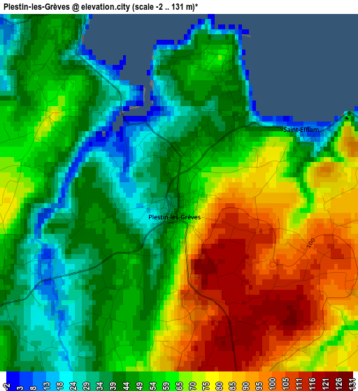
Below is the Elevation map of Plestin-les-Grèves, which displays elevation range with different colors. Scale of the first map is from -2 to 131 m (-7 to 430 ft) with average elevation of 59.1 meters (=194 ft) [note 1]
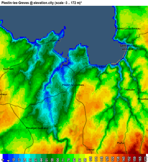
These maps also provides idea of topography and contour of this city, they are displayed at different zoom levels. More info about maps, scale and edge coordinates you can find below images.
| \ | Map #1 | Map #2 | Topo.Map |
| Scale [m] | -2..131 m | -3..172 m | × |
| Scale [ft] | -7..430 ft | -10..564 ft | × |
| Average | 59.1 m = 194 ft | 77.9 m = 256 ft | × |
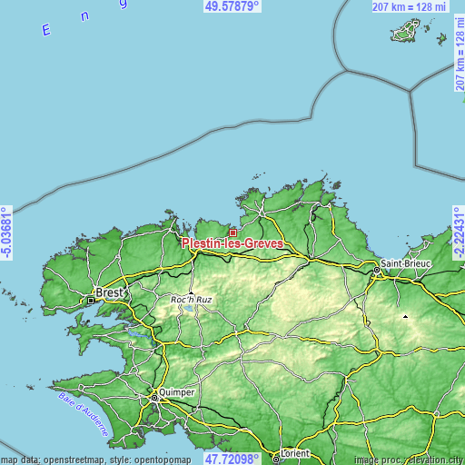
| Width | 6.46 km = 4 mi | 12.91 km = 8 mi | 206.6 km = 128.4 mi |
| Height | 6.46 km = 4 mi | 12.91 km = 8 mi | 206.6 km = 128.4 mi |
| ↑Max Latitude | 48.68746° | 48.716462° | 49.57879° |
| Latitude at center | 48.65844° | 48.65844° | 48.65844° |
| ↓Min Latitude | 48.629404° | 48.600351° | 47.72098° |
| ← Min Longitude | -3.674505° | -3.718451° | -5.03681° |
| Longitude center | -3.63056° | -3.63056° | -3.63056° |
| →Max Longitude | -3.586615° | -3.542669° | -2.22431° |
Nearby cities:
Cities around Plestin-les-Grèves sort by population:
• Plouigneau elevation 161 m
11.4 km,  206°
206°
• Pleumeur-Bodou 105 m
14.7 km,  34°
34°
• Trébeurden 77 m
12.9 km,  21°
21°
• Plougasnou 81 m
13.3 km,  290°
290°
• Ploubezre 83 m
14 km,  70°
70°
• Ploumilliau 109 m
8.8 km, 71°
• Plouaret 114 m
12.9 km,  111°
111°
• Lanmeur 110 m
6.4 km,  258°
258°
• Plouezoc'h 63 m
14 km, 258°
• Trédrez-Locquémeau 85 m
6.6 km,  45°
45°
• Locquirec 11 m
3.9 km,  343°
343°
• Locquémeau 44 m
8.9 km, 34°
Multilingual:
 En español:
Plestin-les-Grèves elevación 47 m.
 En France:
Plestin-les-Grèves élévation 47 m.
 Auf Deutsch:
Plestin-les-Grèves höhe über dem Meeresspiegel ist 47 m.

Sources and notes:
- [note 1] Map square and city borders are not equal. Map elevation data is calculated only from area inside that square.
- [src 1] Elevation data from geonames database provided with same terms of usage.
- [src 2] The elevation map of Plestin-les-Grèves is generated using elevation data from NASA's 3 arcsec (90m) resolution SRTM data.
- [src 3] Base (background) map © OpenStreetMap contributors tiles are generated by Geofabrik and OpenTopoMap.
Copyright & License:
This Plestin-les-Grèves Elevation Map is licensed under CC BY-SA. You may reuse any part from this page, if you give a proper credit by linking to this URL:
 More info on terms of use page.