Ploërmel elevation
Ploërmel (Brittany, Morbihan), France elevation is 78 meters and Ploërmel elevation in feet is 256 ft above sea level [src 1]. Ploërmel is a populated place (feature code) with elevation that is 96 meters (315 ft) smaller than average city elevation in France.
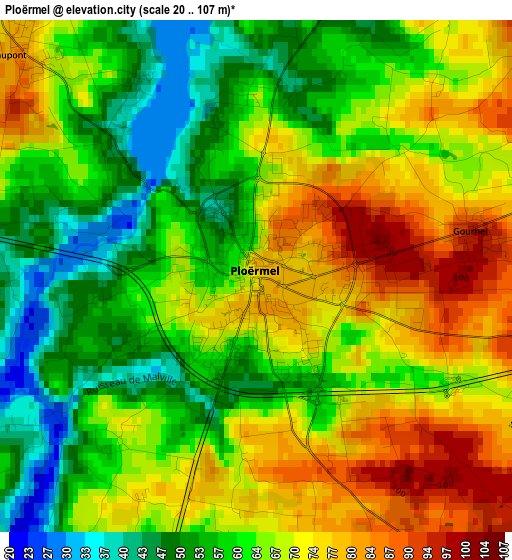
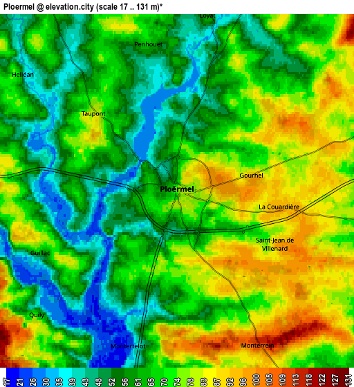
Below is the Elevation map of Ploërmel, which displays elevation range with different colors. Scale of the first map is from 20 to 107 m (66 to 351 ft) with average elevation of 64.9 meters (=213 ft) [note 1]
These maps also provides idea of topography and contour of this city, they are displayed at different zoom levels. More info about maps, scale and edge coordinates you can find below images.
| \ | Map #1 | Map #2 | Topo.Map |
| Scale [m] | 20..107 m | 17..131 m | × |
| Scale [ft] | 66..351 ft | 56..430 ft | × |
| Average | 64.9 m = 213 ft | 66.9 m = 219 ft | × |
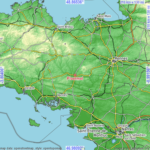
| Width | 6.55 km = 4.1 mi | 13.1 km = 8.1 mi | 209.5 km = 130.2 mi |
| Height | 6.55 km = 4.1 mi | 13.1 km = 8.1 mi | 209.5 km = 130.2 mi |
| ↑Max Latitude | 47.961156° | 47.990575° | 48.86536° |
| Latitude at center | 47.93172° | 47.93172° | 47.93172° |
| ↓Min Latitude | 47.902268° | 47.872798° | 46.98092° |
| ← Min Longitude | -2.441755° | -2.485701° | -3.80406° |
| Longitude center | -2.39781° | -2.39781° | -2.39781° |
| →Max Longitude | -2.353865° | -2.309919° | -0.99156° |
Nearby cities:
Cities around Ploërmel sort by population:
• Sérent elevation 72 m
14.5 km,  213°
213°
• Josselin 63 m
11.5 km,  284°
284°
• Malestroit 20 m
13.6 km,  175°
175°
• Guégon 89 m
12.4 km,  272°
272°
• Taupont 80 m
4.4 km,  315°
315°
• Campénéac 79 m
8.3 km,  69°
69°
• Loyat 62 m
6.5 km,  9°
9°
• Guilliers 89 m
12.4 km,  357°
357°
• Ruffiac 57 m
15.2 km,  145°
145°
• Augan 85 m
9 km,  98°
98°
• Guillac 61 m
5.6 km,  245°
245°
• Caro 111 m
9.5 km,  142°
142°
Multilingual:
 En español:
Ploërmel elevación 78 m.
 En France:
Ploërmel élévation 78 m.


Sources and notes:
- [note 1] Map square and city borders are not equal. Map elevation data is calculated only from area inside that square.
- [src 1] Elevation data from geonames database provided with same terms of usage.
- [src 2] The elevation map of Ploërmel is generated using elevation data from NASA's 3 arcsec (90m) resolution SRTM data.
- [src 3] Base (background) map © OpenStreetMap contributors tiles are generated by Geofabrik and OpenTopoMap.
Copyright & License:
This Ploërmel Elevation Map is licensed under CC BY-SA. You may reuse any part from this page, if you give a proper credit by linking to this URL:
 More info on terms of use page.