Plouay elevation
Plouay (Brittany, Morbihan), France elevation is 78 meters and Plouay elevation in feet is 256 ft above sea level [src 1]. Plouay is a populated place (feature code) with elevation that is 96 meters (315 ft) smaller than average city elevation in France.
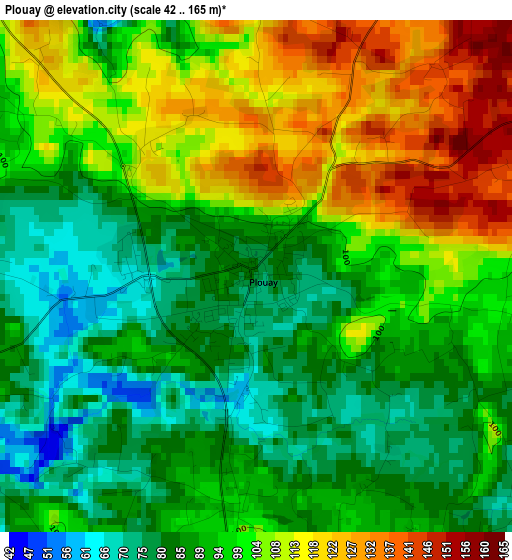
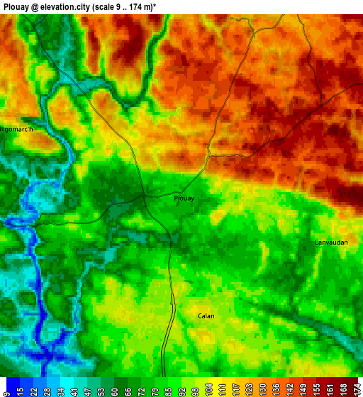
Below is the Elevation map of Plouay, which displays elevation range with different colors. Scale of the first map is from 42 to 165 m (138 to 541 ft) with average elevation of 96.9 meters (=318 ft) [note 1]
These maps also provides idea of topography and contour of this city, they are displayed at different zoom levels. More info about maps, scale and edge coordinates you can find below images.
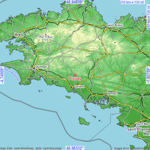
| \ | Map #1 | Map #2 | Topo.Map |
| Scale [m] | 42..165 m | 9..174 m | × |
| Scale [ft] | 138..541 ft | 30..571 ft | × |
| Average | 96.9 m = 318 ft | 98.4 m = 323 ft | × |
| Width | 6.55 km = 4.1 mi | 13.1 km = 8.1 mi | 209.6 km = 130.2 mi |
| Height | 6.55 km = 4.1 mi | 13.1 km = 8.1 mi | 209.6 km = 130.2 mi |
| ↑Max Latitude | 47.943886° | 47.973314° | 48.84839° |
| Latitude at center | 47.91444° | 47.91444° | 47.91444° |
| ↓Min Latitude | 47.884978° | 47.855499° | 46.96332° |
| ← Min Longitude | -3.377785° | -3.421731° | -4.74009° |
| Longitude center | -3.33384° | -3.33384° | -3.33384° |
| →Max Longitude | -3.289895° | -3.245949° | -1.92759° |
Nearby cities:
Cities around Plouay sort by population:
• Hennebont elevation 22 m
13 km,  159°
159°
• Caudan 47 m
11.8 km,  183°
183°
• Cléguer 48 m
7.6 km,  208°
208°
• Pont-Scorff 45 m
10.4 km, 209°
• Bubry 103 m
13.3 km,  65°
65°
• Rédené 45 m
12.2 km,  234°
234°
• Gestel 48 m
14.7 km, 213°
• Inguiniel 139 m
8 km,  29°
29°
• Arzano 89 m
8.1 km,  259°
259°
• Quistinic 134 m
14.9 km,  94°
94°
• Berné 107 m
10 km,  333°
333°
• Meslan 109 m
11.6 km,  320°
320°
Multilingual:
 En español:
Plouay elevación 78 m.
 En France:
Plouay élévation 78 m.


Sources and notes:
- [note 1] Map square and city borders are not equal. Map elevation data is calculated only from area inside that square.
- [src 1] Elevation data from geonames database provided with same terms of usage.
- [src 2] The elevation map of Plouay is generated using elevation data from NASA's 3 arcsec (90m) resolution SRTM data.
- [src 3] Base (background) map © OpenStreetMap contributors tiles are generated by Geofabrik and OpenTopoMap.
Copyright & License:
This Plouay Elevation Map is licensed under CC BY-SA. You may reuse any part from this page, if you give a proper credit by linking to this URL:
 More info on terms of use page.