Porto-Vecchio elevation
Porto-Vecchio (Corsica, Département de la Corse-du-Sud), France elevation is 57 meters and Porto-Vecchio elevation in feet is 187 ft above sea level [src 1]. Porto-Vecchio is a populated place (feature code) with elevation that is 117 meters (384 ft) smaller than average city elevation in France.
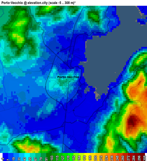
Below is the Elevation map of Porto-Vecchio, which displays elevation range with different colors. Scale of the first map is from -5 to 308 m (-16 to 1010 ft) with average elevation of 55.7 meters (=183 ft) [note 1]
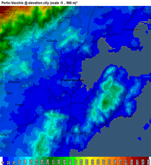
These maps also provides idea of topography and contour of this city, they are displayed at different zoom levels. More info about maps, scale and edge coordinates you can find below images.
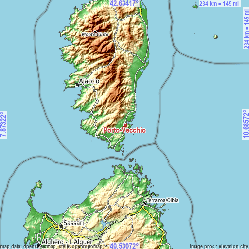
| \ | Map #1 | Map #2 | Topo.Map |
| Scale [m] | -5..308 m | -5..966 m | × |
| Scale [ft] | -16..1010 ft | -16..3169 ft | × |
| Average | 55.7 m = 183 ft | 101.2 m = 332 ft | × |
| Width | 7.31 km = 4.5 mi | 14.62 km = 9.1 mi | 233.9 km = 145.3 mi |
| Height | 7.31 km = 4.5 mi | 14.62 km = 9.1 mi | 233.9 km = 145.3 mi |
| ↑Max Latitude | 41.623868° | 41.65671° | 42.63417° |
| Latitude at center | 41.59101° | 41.59101° | 41.59101° |
| ↓Min Latitude | 41.558135° | 41.525243° | 40.53072° |
| ← Min Longitude | 9.235525° | 9.191579° | 7.87322° |
| Longitude center | 9.27947° | 9.27947° | 9.27947° |
| →Max Longitude | 9.323415° | 9.367361° | 10.68572° |
Nearby cities:
Cities around Porto-Vecchio sort by population:
• Sartène elevation 374 m
24.8 km,  276°
276°
• Propriano 14 m
32.6 km,  286°
286°
• Prunelli-di-Fiumorbo 568 m
46.8 km,  4°
4°
• Bonifacio 53 m
24.7 km,  203°
203°
• Ventiseri 423 m
39.5 km,  6°
6°
• Grosseto-Prugna 442 m
40.7 km,  319°
319°
• Zonza 761 m
19.8 km,  332°
332°
• Figari 251 m
16.9 km,  227°
227°
• Albitreccia 477 m
41.2 km, 317°
• Olmeto 360 m
33.2 km,  295°
295°
• Sari-Solenzara 389 m
28.3 km,  16°
16°
• Pietrosella 484 m
45.1 km,  307°
307°
Multilingual:
 En español:
Porto Vecchio elevación 57 m.
 En France:
Porto-Vecchio élévation 57 m.
 Auf Deutsch:
Porto-Vecchio höhe über dem Meeresspiegel ist 57 m.

Sources and notes:
- [note 1] Map square and city borders are not equal. Map elevation data is calculated only from area inside that square.
- [src 1] Elevation data from geonames database provided with same terms of usage.
- [src 2] The elevation map of Porto-Vecchio is generated using elevation data from NASA's 3 arcsec (90m) resolution SRTM data.
- [src 3] Base (background) map © OpenStreetMap contributors tiles are generated by Geofabrik and OpenTopoMap.
Copyright & License:
This Porto-Vecchio Elevation Map is licensed under CC BY-SA. You may reuse any part from this page, if you give a proper credit by linking to this URL:
 More info on terms of use page.