Pré-en-Pail elevation
Pré-en-Pail (Pays de la Loire, Mayenne), France elevation is 229 meters and Pré-en-Pail elevation in feet is 751 ft above sea level [src 1]. Pré-en-Pail is a populated place (feature code) with elevation that is 55 meters (180 ft) bigger than average city elevation in France.
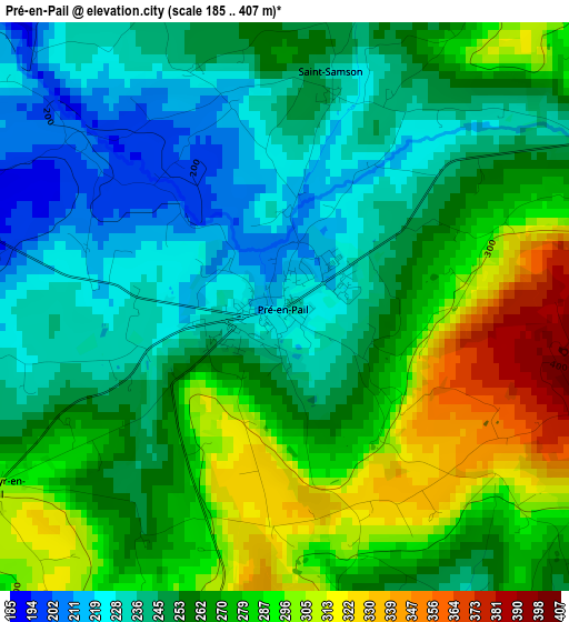
Below is the Elevation map of Pré-en-Pail, which displays elevation range with different colors. Scale of the first map is from 185 to 407 m (607 to 1335 ft) with average elevation of 263 meters (=863 ft) [note 1]
These maps also provides idea of topography and contour of this city, they are displayed at different zoom levels. More info about maps, scale and edge coordinates you can find below images.
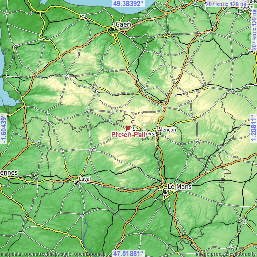
| \ | Map #1 | Topo.Map |
| Scale [m] | 185..407 m | × |
| Scale [ft] | 607..1335 ft | × |
| Average | 263 m = 863 ft | × |
| Width | 6.48 km = 4 mi | 207.4 km = 128.9 mi |
| Height | 6.48 km = 4 mi | 207.4 km = 128.9 mi |
| ↑Max Latitude | 48.489064° | 49.38392° |
| Latitude at center | 48.45993° | 48.45993° |
| ↓Min Latitude | 48.43078° | 47.51881° |
| ← Min Longitude | -0.242085° | -1.60439° |
| Longitude center | -0.19814° | -0.19814° |
| →Max Longitude | -0.154195° | 1.20811° |
Nearby cities:
Cities around Pré-en-Pail sort by population:
• La Ferté-Macé elevation 222 m
18.6 km,  320°
320°
• Villaines-la-Juhel 185 m
14.1 km,  204°
204°
• Damigny 147 m
19.6 km,  93°
93°
• Bagnoles-de-l'Orne 191 m
19.2 km,  304°
304°
• Condé-sur-Sarthe 141 m
17.4 km,  100°
100°
• Saint-Pierre-des-Nids 187 m
10 km,  133°
133°
• Javron-les-Chapelles 180 m
11.3 km,  245°
245°
• Magny-le-Désert 215 m
15.5 km, 322°
• Tessé-la-Madeleine 187 m
19.5 km, 300°
• Saint-Denis-sur-Sarthon 192 m
11.2 km, 93°
• Couterne 133 m
17.1 km,  290°
290°
• Courcité 181 m
17.5 km,  192°
192°
Multilingual:
 En español:
Pré-en-Pail elevación 229 m.
 En France:
Pré-en-Pail élévation 229 m.
 Auf Deutsch:
Pré-en-Pail höhe über dem Meeresspiegel ist 229 m.

Sources and notes:
- [note 1] Map square and city borders are not equal. Map elevation data is calculated only from area inside that square.
- [src 1] Elevation data from geonames database provided with same terms of usage.
- [src 2] The elevation map of Pré-en-Pail is generated using elevation data from NASA's 3 arcsec (90m) resolution SRTM data.
- [src 3] Base (background) map © OpenStreetMap contributors tiles are generated by Geofabrik and OpenTopoMap.
Copyright & License:
This Pré-en-Pail Elevation Map is licensed under CC BY-SA. You may reuse any part from this page, if you give a proper credit by linking to this URL:
 More info on terms of use page.