Prigonrieux elevation
Prigonrieux (Nouvelle-Aquitaine, Dordogne), France elevation is 27 meters and Prigonrieux elevation in feet is 89 ft above sea level [src 1]. Prigonrieux is a populated place (feature code) with elevation that is 147 meters (482 ft) smaller than average city elevation in France.
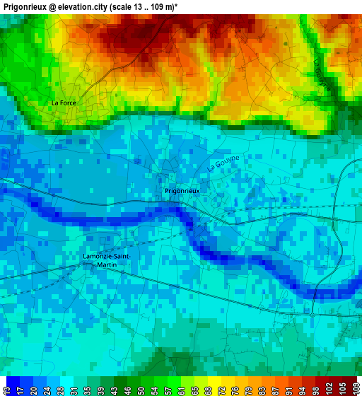
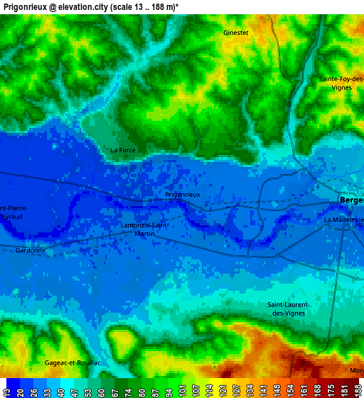
Below is the Elevation map of Prigonrieux, which displays elevation range with different colors. Scale of the first map is from 13 to 109 m (43 to 358 ft) with average elevation of 42.1 meters (=138 ft) [note 1]
These maps also provides idea of topography and contour of this city, they are displayed at different zoom levels. More info about maps, scale and edge coordinates you can find below images.
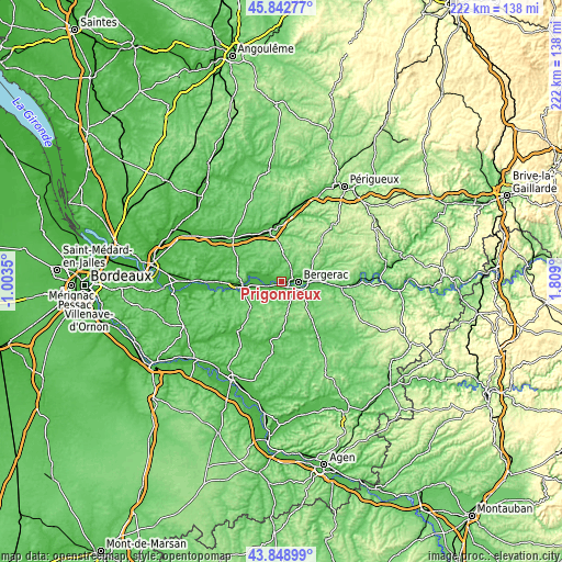
| \ | Map #1 | Map #2 | Topo.Map |
| Scale [m] | 13..109 m | 13..188 m | × |
| Scale [ft] | 43..358 ft | 43..617 ft | × |
| Average | 42.1 m = 138 ft | 60.2 m = 198 ft | × |
| Width | 6.93 km = 4.3 mi | 13.86 km = 8.6 mi | 221.7 km = 137.8 mi |
| Height | 6.93 km = 4.3 mi | 13.86 km = 8.6 mi | 221.7 km = 137.8 mi |
| ↑Max Latitude | 44.885654° | 44.916782° | 45.84277° |
| Latitude at center | 44.85451° | 44.85451° | 44.85451° |
| ↓Min Latitude | 44.823349° | 44.792171° | 43.84899° |
| ← Min Longitude | 0.358805° | 0.314859° | -1.0035° |
| Longitude center | 0.40275° | 0.40275° | 0.40275° |
| →Max Longitude | 0.446695° | 0.490641° | 1.809° |
Nearby cities:
Cities around Prigonrieux sort by population:
• Bergerac elevation 38 m
6.3 km,  93°
93°
• Sainte-Foy-la-Grande 18 m
14.9 km,  260°
260°
• Port-Sainte-Foy-et-Ponchapt 15 m
16.2 km, 261°
• La Force 65 m
2.7 km,  306°
306°
• Creysse 38 m
12.9 km, 89°
• Lamonzie-Saint-Martin 27 m
1.2 km,  228°
228°
• Gardonne 35 m
4.8 km,  240°
240°
• Le Fleix 19 m
12.1 km,  276°
276°
• Cours-de-Pile 45 m
11.5 km,  100°
100°
• Lembras 57 m
10.3 km,  71°
71°
• Mouleydier 68 m
15.4 km, 89°
• Monbazillac 172 m
9.8 km,  133°
133°
Multilingual:
 En español:
Prigonrieux elevación 27 m.
 En France:
Prigonrieux élévation 27 m.
 Auf Deutsch:
Prigonrieux höhe über dem Meeresspiegel ist 27 m.

Sources and notes:
- [note 1] Map square and city borders are not equal. Map elevation data is calculated only from area inside that square.
- [src 1] Elevation data from geonames database provided with same terms of usage.
- [src 2] The elevation map of Prigonrieux is generated using elevation data from NASA's 3 arcsec (90m) resolution SRTM data.
- [src 3] Base (background) map © OpenStreetMap contributors tiles are generated by Geofabrik and OpenTopoMap.
Copyright & License:
This Prigonrieux Elevation Map is licensed under CC BY-SA. You may reuse any part from this page, if you give a proper credit by linking to this URL:
 More info on terms of use page.