Pujaut elevation
Pujaut (Occitanie, Gard), France elevation is 67 meters and Pujaut elevation in feet is 220 ft above sea level [src 1]. Pujaut is a populated place (feature code) with elevation that is 107 meters (351 ft) smaller than average city elevation in France.
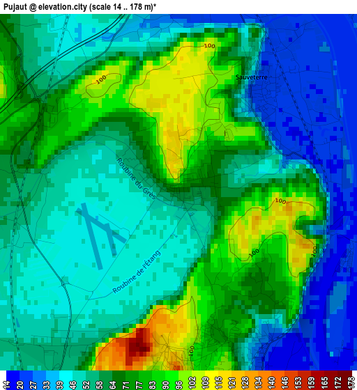
Below is the Elevation map of Pujaut, which displays elevation range with different colors. Scale of the first map is from 14 to 178 m (46 to 584 ft) with average elevation of 59.7 meters (=196 ft) [note 1]
These maps also provides idea of topography and contour of this city, they are displayed at different zoom levels. More info about maps, scale and edge coordinates you can find below images.
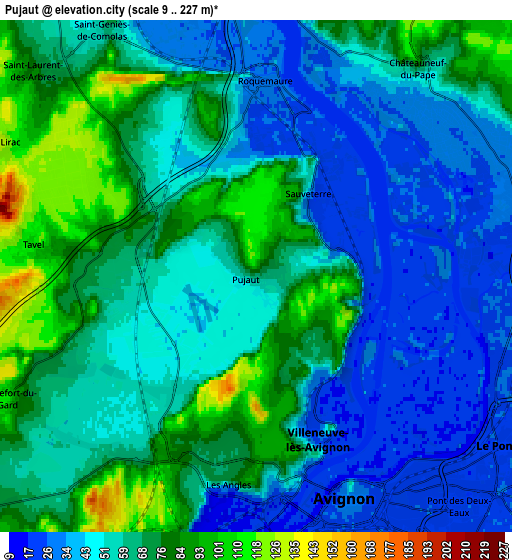
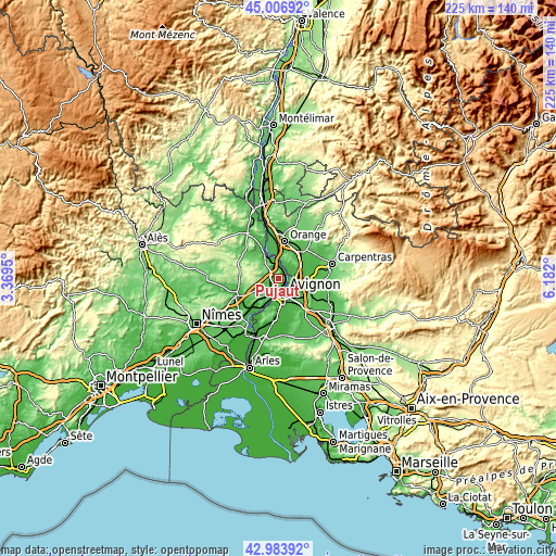
| \ | Map #1 | Map #2 | Topo.Map |
| Scale [m] | 14..178 m | 9..227 m | × |
| Scale [ft] | 46..584 ft | 30..745 ft | × |
| Average | 59.7 m = 196 ft | 58.3 m = 191 ft | × |
| Width | 7.03 km = 4.4 mi | 14.06 km = 8.7 mi | 224.9 km = 139.7 mi |
| Height | 7.03 km = 4.4 mi | 14.06 km = 8.7 mi | 224.9 km = 139.7 mi |
| ↑Max Latitude | 44.035641° | 44.067225° | 45.00692° |
| Latitude at center | 44.00404° | 44.00404° | 44.00404° |
| ↓Min Latitude | 43.972422° | 43.940787° | 42.98392° |
| ← Min Longitude | 4.731805° | 4.687859° | 3.3695° |
| Longitude center | 4.77575° | 4.77575° | 4.77575° |
| →Max Longitude | 4.819695° | 4.863641° | 6.182° |
Nearby cities:
Cities around Pujaut sort by population:
• Avignon elevation 31 m
6.7 km,  156°
156°
• Sorgues 30 m
7.9 km,  84°
84°
• Le Pontet 25 m
8.3 km,  125°
125°
• Villeneuve-lès-Avignon 21 m
4.3 km, 157°
• Les Angles 67 m
5.2 km,  190°
190°
• Rochefort-du-Gard 108 m
7.5 km,  245°
245°
• Roquemaure 26 m
5 km,  1°
1°
• Châteauneuf-du-Pape 74 m
7.4 km,  37°
37°
• Sauveterre 24 m
2.5 km,  34°
34°
• Saint-Geniès-de-Comolas 58 m
8.2 km,  327°
327°
• Tavel 108 m
6.3 km,  278°
278°
• Montfaucon 31 m
7.8 km,  347°
347°
Multilingual:
 En español:
Pujaut elevación 67 m.
 En France:
Pujaut élévation 67 m.


Sources and notes:
- [note 1] Map square and city borders are not equal. Map elevation data is calculated only from area inside that square.
- [src 1] Elevation data from geonames database provided with same terms of usage.
- [src 2] The elevation map of Pujaut is generated using elevation data from NASA's 3 arcsec (90m) resolution SRTM data.
- [src 3] Base (background) map © OpenStreetMap contributors tiles are generated by Geofabrik and OpenTopoMap.
Copyright & License:
This Pujaut Elevation Map is licensed under CC BY-SA. You may reuse any part from this page, if you give a proper credit by linking to this URL:
 More info on terms of use page.