Quarante elevation
Quarante (Occitanie, Département de l'Hérault), France elevation is 112 meters and Quarante elevation in feet is 367 ft above sea level [src 1]. Quarante is a populated place (feature code) with elevation that is 62 meters (203 ft) smaller than average city elevation in France.
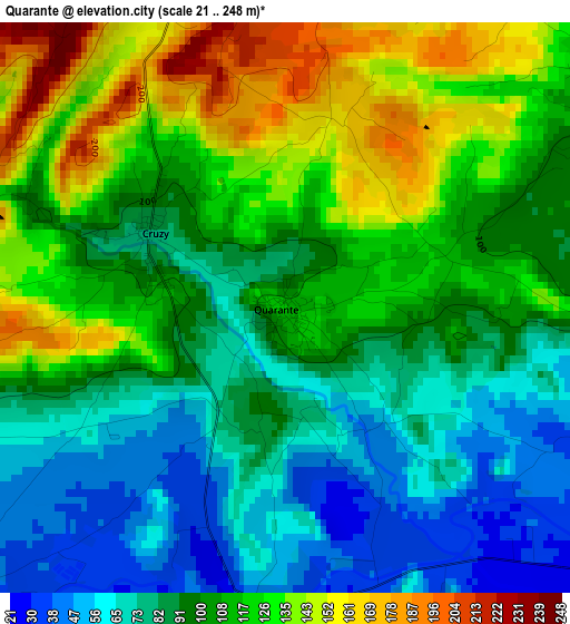
Below is the Elevation map of Quarante, which displays elevation range with different colors. Scale of the first map is from 21 to 248 m (69 to 814 ft) with average elevation of 102.4 meters (=336 ft) [note 1]
These maps also provides idea of topography and contour of this city, they are displayed at different zoom levels. More info about maps, scale and edge coordinates you can find below images.
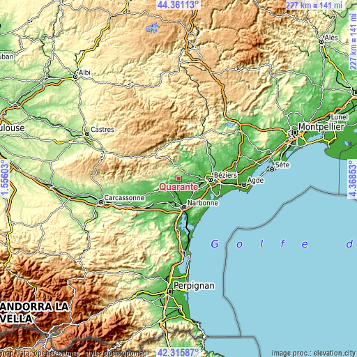
| \ | Map #1 | Topo.Map |
| Scale [m] | 21..248 m | × |
| Scale [ft] | 69..814 ft | × |
| Average | 102.4 m = 336 ft | × |
| Width | 7.11 km = 4.4 mi | 227.4 km = 141.3 mi |
| Height | 7.11 km = 4.4 mi | 227.4 km = 141.3 mi |
| ↑Max Latitude | 43.379059° | 44.36113° |
| Latitude at center | 43.34711° | 43.34711° |
| ↓Min Latitude | 43.315144° | 42.31587° |
| ← Min Longitude | 2.918335° | 1.55603° |
| Longitude center | 2.96228° | 2.96228° |
| →Max Longitude | 3.006225° | 4.36853° |
Nearby cities:
Cities around Quarante sort by population:
• Cazouls-lès-Béziers elevation 92 m
12.3 km,  65°
65°
• Capestang 26 m
7 km,  107°
107°
• Puisserguier 86 m
6.7 km, 70°
• Ouveillan 38 m
6.5 km,  173°
173°
• Saint-Chinian 124 m
8.5 km,  351°
351°
• Saint-Nazaire-d’Aude 26 m
12.6 km,  205°
205°
• Maureilhan 51 m
12.5 km,  88°
88°
• Saint-Marcel-sur-Aude 14 m
11 km,  192°
192°
• Argeliers 45 m
5.7 km,  227°
227°
• Ginestas 69 m
11.7 km,  219°
219°
• Creissan 109 m
5.1 km,  52°
52°
• Bize-Minervois 59 m
8.1 km,  245°
245°
Multilingual:
 En español:
Quarante elevación 112 m.
 En France:
Quarante élévation 112 m.
 Auf Deutsch:
Quarante höhe über dem Meeresspiegel ist 112 m.

Sources and notes:
- [note 1] Map square and city borders are not equal. Map elevation data is calculated only from area inside that square.
- [src 1] Elevation data from geonames database provided with same terms of usage.
- [src 2] The elevation map of Quarante is generated using elevation data from NASA's 3 arcsec (90m) resolution SRTM data.
- [src 3] Base (background) map © OpenStreetMap contributors tiles are generated by Geofabrik and OpenTopoMap.
Copyright & License:
This Quarante Elevation Map is licensed under CC BY-SA. You may reuse any part from this page, if you give a proper credit by linking to this URL:
 More info on terms of use page.