Raimbeaucourt elevation
Raimbeaucourt (Hauts-de-France, Nord), France elevation is 24 meters and Raimbeaucourt elevation in feet is 79 ft above sea level [src 1]. Raimbeaucourt is a populated place (feature code) with elevation that is 150 meters (492 ft) smaller than average city elevation in France.
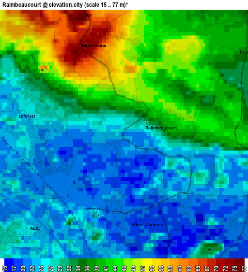
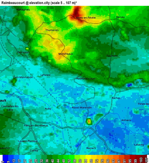
Below is the Elevation map of Raimbeaucourt, which displays elevation range with different colors. Scale of the first map is from 15 to 77 m (49 to 253 ft) with average elevation of 33.1 meters (=109 ft) [note 1]
These maps also provides idea of topography and contour of this city, they are displayed at different zoom levels. More info about maps, scale and edge coordinates you can find below images.
| \ | Map #1 | Map #2 | Topo.Map |
| Scale [m] | 15..77 m | 5..107 m | × |
| Scale [ft] | 49..253 ft | 16..351 ft | × |
| Average | 33.1 m = 109 ft | 33.2 m = 109 ft | × |
| Width | 6.22 km = 3.9 mi | 12.45 km = 7.7 mi | 199.2 km = 123.8 mi |
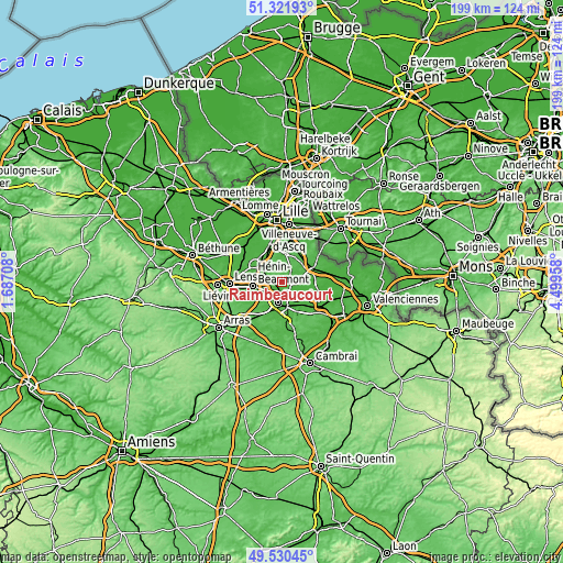
| Height | 6.22 km = 3.9 mi | 12.45 km = 7.7 mi | 199.2 km = 123.8 mi |
| ↑Max Latitude | 50.462643° | 50.49061° | 51.32193° |
| Latitude at center | 50.43466° | 50.43466° | 50.43466° |
| ↓Min Latitude | 50.40666° | 50.378644° | 49.53045° |
| ← Min Longitude | 3.049385° | 3.005439° | 1.68708° |
| Longitude center | 3.09333° | 3.09333° | 3.09333° |
| →Max Longitude | 3.137275° | 3.181221° | 4.49958° |
Nearby cities:
Cities around Raimbeaucourt sort by population:
• Waziers elevation 22 m
5.5 km,  163°
163°
• Auby 27 m
3.6 km,  231°
231°
• Leforest 28 m
2.1 km,  282°
282°
• Roost-Warendin 19 m
1.9 km, 156°
• Flers-en-Escrebieux 23 m
4.7 km,  209°
209°
• Ostricourt 29 m
4.6 km,  294°
294°
• Évin-Malmaison 25 m
4.4 km, 276°
• Thumeries 63 m
5.4 km,  329°
329°
• Râches 23 m
3.6 km,  122°
122°
• Mons-en-Pévèle 83 m
5 km,  3°
3°
• Faumont 37 m
4.2 km,  47°
47°
• Anhiers 20 m
5.3 km, 124°
Multilingual:
 En español:
Raimbeaucourt elevación 24 m.
 En France:
Raimbeaucourt élévation 24 m.
 Auf Deutsch:
Raimbeaucourt höhe über dem Meeresspiegel ist 24 m.

Sources and notes:
- [note 1] Map square and city borders are not equal. Map elevation data is calculated only from area inside that square.
- [src 1] Elevation data from geonames database provided with same terms of usage.
- [src 2] The elevation map of Raimbeaucourt is generated using elevation data from NASA's 3 arcsec (90m) resolution SRTM data.
- [src 3] Base (background) map © OpenStreetMap contributors tiles are generated by Geofabrik and OpenTopoMap.
Copyright & License:
This Raimbeaucourt Elevation Map is licensed under CC BY-SA. You may reuse any part from this page, if you give a proper credit by linking to this URL:
 More info on terms of use page.