Reichshoffen elevation
Reichshoffen (Grand Est, Bas-Rhin), France elevation is 175 meters and Reichshoffen elevation in feet is 574 ft above sea level [src 1]. Reichshoffen is a populated place (feature code) with elevation that is 1 meters (3 ft) bigger than average city elevation in France.
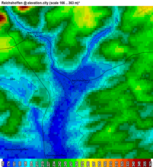
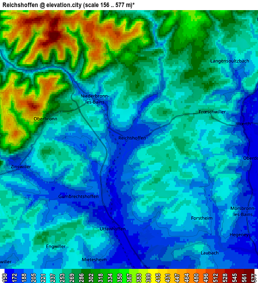
Below is the Elevation map of Reichshoffen, which displays elevation range with different colors. Scale of the first map is from 166 to 363 m (545 to 1191 ft) with average elevation of 219.9 meters (=721 ft) [note 1]
These maps also provides idea of topography and contour of this city, they are displayed at different zoom levels. More info about maps, scale and edge coordinates you can find below images.
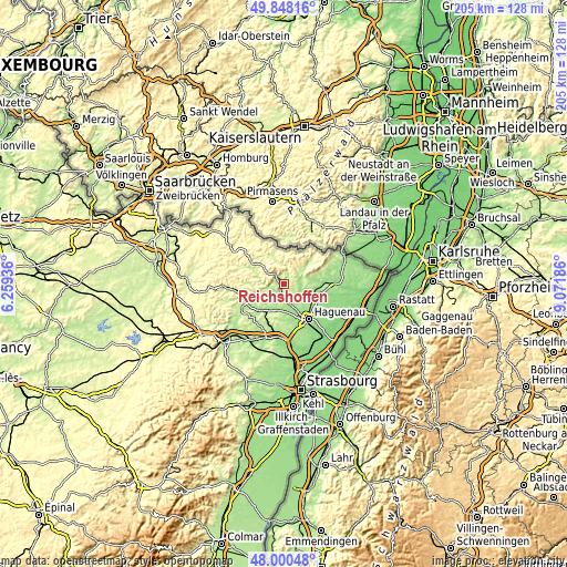
| \ | Map #1 | Map #2 | Topo.Map |
| Scale [m] | 166..363 m | 156..577 m | × |
| Scale [ft] | 545..1191 ft | 512..1893 ft | × |
| Average | 219.9 m = 721 ft | 251.5 m = 825 ft | × |
| Width | 6.42 km = 4 mi | 12.84 km = 8 mi | 205.4 km = 127.6 mi |
| Height | 6.42 km = 4 mi | 12.84 km = 8 mi | 205.4 km = 127.6 mi |
| ↑Max Latitude | 48.961731° | 48.990576° | 49.84816° |
| Latitude at center | 48.93287° | 48.93287° | 48.93287° |
| ↓Min Latitude | 48.903992° | 48.875097° | 48.00048° |
| ← Min Longitude | 7.621665° | 7.577719° | 6.25936° |
| Longitude center | 7.66561° | 7.66561° | 7.66561° |
| →Max Longitude | 7.709555° | 7.753501° | 9.07186° |
Nearby cities:
Cities around Reichshoffen sort by population:
• Niederbronn-les-Bains elevation 189 m
2.7 km,  321°
321°
• Mertzwiller 157 m
7.6 km,  171°
171°
• Gundershoffen 175 m
3 km,  186°
186°
• Pfaffenhoffen 171 m
11 km,  202°
202°
• Woerth 171 m
5.7 km,  82°
82°
• Oberbronn 272 m
4.4 km,  280°
280°
• Gumbrechtshoffen 174 m
4 km,  221°
221°
• Walbourg 168 m
10.4 km,  120°
120°
• Uberach 164 m
9.6 km, 196°
• Gœrsdorf 205 m
7.6 km, 75°
• Durrenbach 171 m
8.5 km, 118°
• Eschbach 187 m
8.3 km,  141°
141°
Multilingual:
 En español:
Reichshoffen elevación 175 m.
 En France:
Reichshoffen élévation 175 m.
 Auf Deutsch:
Reichshoffen höhe über dem Meeresspiegel ist 175 m.

Sources and notes:
- [note 1] Map square and city borders are not equal. Map elevation data is calculated only from area inside that square.
- [src 1] Elevation data from geonames database provided with same terms of usage.
- [src 2] The elevation map of Reichshoffen is generated using elevation data from NASA's 3 arcsec (90m) resolution SRTM data.
- [src 3] Base (background) map © OpenStreetMap contributors tiles are generated by Geofabrik and OpenTopoMap.
Copyright & License:
This Reichshoffen Elevation Map is licensed under CC BY-SA. You may reuse any part from this page, if you give a proper credit by linking to this URL:
 More info on terms of use page.