Roquebillière elevation
Roquebillière (Provence-Alpes-Côte d'Azur, Alpes-Maritimes), France elevation is 616 meters and Roquebillière elevation in feet is 2021 ft above sea level [src 1]. Roquebillière is a populated place (feature code) with elevation that is 442 meters (1450 ft) bigger than average city elevation in France.
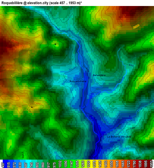
Below is the Elevation map of Roquebillière, which displays elevation range with different colors. Scale of the first map is from 457 to 1953 m (1499 to 6407 ft) with average elevation of 991.2 meters (=3252 ft) [note 1]
These maps also provides idea of topography and contour of this city, they are displayed at different zoom levels. More info about maps, scale and edge coordinates you can find below images.
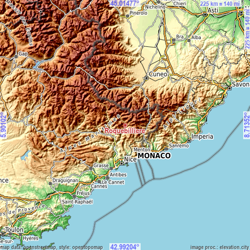
| \ | Map #1 | Topo.Map |
| Scale [m] | 457..1953 m | × |
| Scale [ft] | 1499..6407 ft | × |
| Average | 991.2 m = 3252 ft | × |
| Width | 7.03 km = 4.4 mi | 224.9 km = 139.7 mi |
| Height | 7.03 km = 4.4 mi | 224.9 km = 139.7 mi |
| ↑Max Latitude | 44.043627° | 45.01477° |
| Latitude at center | 44.01203° | 44.01203° |
| ↓Min Latitude | 43.980416° | 42.99204° |
| ← Min Longitude | 7.263325° | 5.90102° |
| Longitude center | 7.30727° | 7.30727° |
| →Max Longitude | 7.351215° | 8.71352° |
Nearby cities:
Cities around Roquebillière sort by population:
• Contes elevation 256 m
22.2 km,  178°
178°
• Levens 677 m
18.2 km,  201°
201°
• Sospel 347 m
18.7 km,  142°
142°
• L’Escarène 474 m
20.1 km,  168°
168°
• Saint-Martin-du-Var 105 m
23.5 km, 203°
• Breil-sur-Roya 422 m
18.6 km,  116°
116°
• Saint-Martin-Vésubie 1076 m
7.5 km,  326°
326°
• Blausasc 319 m
23.4 km, 168°
• Gilette 417 m
21.4 km,  212°
212°
• Berre-les-Alpes 542 m
20.3 km, 175°
• Lucéram 656 m
15 km,  163°
163°
• Lantosque 477 m
4.2 km, 175°
Multilingual:
 En español:
Roquebillière elevación 616 m.
 En France:
Roquebillière élévation 616 m.
 Auf Deutsch:
Roquebillière höhe über dem Meeresspiegel ist 616 m.

Sources and notes:
- [note 1] Map square and city borders are not equal. Map elevation data is calculated only from area inside that square.
- [src 1] Elevation data from geonames database provided with same terms of usage.
- [src 2] The elevation map of Roquebillière is generated using elevation data from NASA's 3 arcsec (90m) resolution SRTM data.
- [src 3] Base (background) map © OpenStreetMap contributors tiles are generated by Geofabrik and OpenTopoMap.
Copyright & License:
This Roquebillière Elevation Map is licensed under CC BY-SA. You may reuse any part from this page, if you give a proper credit by linking to this URL:
 More info on terms of use page.