Rostrenen elevation
Rostrenen (Brittany, Département des Côtes-d’Armor), France elevation is 233 meters and Rostrenen elevation in feet is 764 ft above sea level [src 1]. Rostrenen is a populated place (feature code) with elevation that is 59 meters (194 ft) bigger than average city elevation in France.
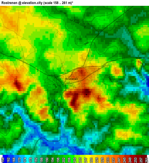
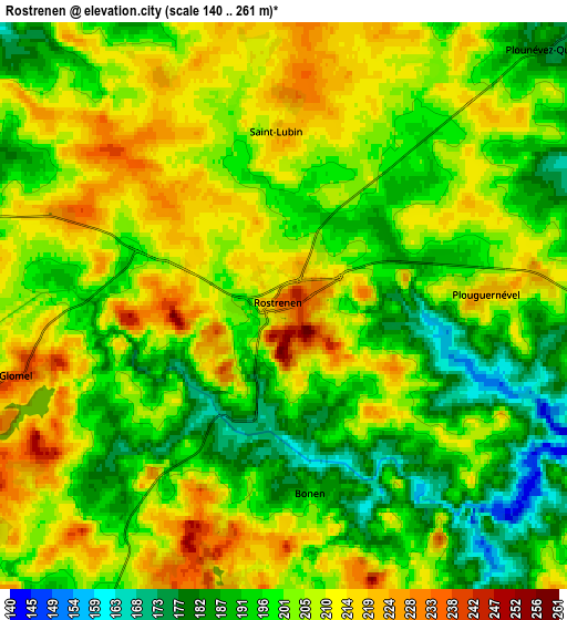
Below is the Elevation map of Rostrenen, which displays elevation range with different colors. Scale of the first map is from 158 to 261 m (518 to 856 ft) with average elevation of 203.2 meters (=667 ft) [note 1]
These maps also provides idea of topography and contour of this city, they are displayed at different zoom levels. More info about maps, scale and edge coordinates you can find below images.
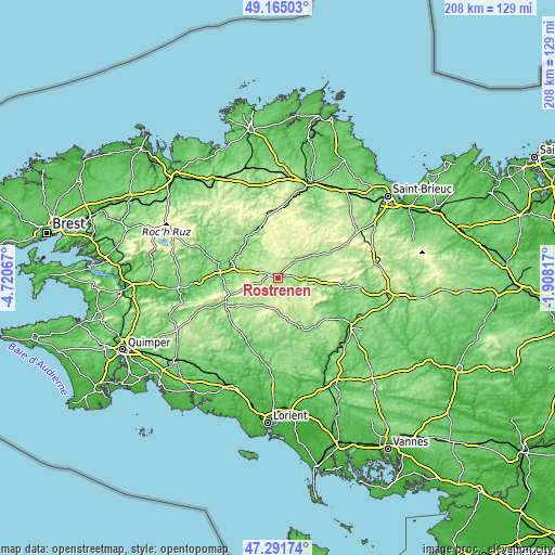
| \ | Map #1 | Map #2 | Topo.Map |
| Scale [m] | 158..261 m | 140..261 m | × |
| Scale [ft] | 518..856 ft | 459..856 ft | × |
| Average | 203.2 m = 667 ft | 202.2 m = 663 ft | × |
| Width | 6.51 km = 4 mi | 13.02 km = 8.1 mi | 208.3 km = 129.4 mi |
| Height | 6.51 km = 4 mi | 13.02 km = 8.1 mi | 208.3 km = 129.4 mi |
| ↑Max Latitude | 48.266221° | 48.295466° | 49.16503° |
| Latitude at center | 48.23696° | 48.23696° | 48.23696° |
| ↓Min Latitude | 48.207682° | 48.178387° | 47.29174° |
| ← Min Longitude | -3.358365° | -3.402311° | -4.72067° |
| Longitude center | -3.31442° | -3.31442° | -3.31442° |
| →Max Longitude | -3.270475° | -3.226529° | -1.90817° |
Nearby cities:
Cities around Rostrenen sort by population:
• Carhaix-Plouguer elevation 145 m
19.6 km,  282°
282°
• Callac 160 m
20.3 km,  335°
335°
• Plouguernével 220 m
4.7 km,  86°
86°
• Langonnet 189 m
19.8 km,  222°
222°
• Saint-Nicolas-du-Pélem 180 m
13.9 km,  52°
52°
• Glomel 237 m
6.3 km,  255°
255°
• Maël-Carhaix 206 m
9.6 km,  303°
303°
• Ploërdut 196 m
16.8 km,  172°
172°
• Priziac 161 m
20.4 km,  201°
201°
• Plouray 194 m
11.5 km,  207°
207°
• Plounévez-Quintin 203 m
7.9 km, 49°
• Gouarec 134 m
10 km,  96°
96°
Multilingual:
 En español:
Rostrenen elevación 233 m.
 En France:
Rostrenen élévation 233 m.
 Auf Deutsch:
Rostrenen höhe über dem Meeresspiegel ist 233 m.

Sources and notes:
- [note 1] Map square and city borders are not equal. Map elevation data is calculated only from area inside that square.
- [src 1] Elevation data from geonames database provided with same terms of usage.
- [src 2] The elevation map of Rostrenen is generated using elevation data from NASA's 3 arcsec (90m) resolution SRTM data.
- [src 3] Base (background) map © OpenStreetMap contributors tiles are generated by Geofabrik and OpenTopoMap.
Copyright & License:
This Rostrenen Elevation Map is licensed under CC BY-SA. You may reuse any part from this page, if you give a proper credit by linking to this URL:
 More info on terms of use page.