Roubaix elevation
Roubaix (Hauts-de-France, Nord), France elevation is 33 meters and Roubaix elevation in feet is 108 ft above sea level [src 1]. Roubaix is a populated place (feature code) with elevation that is 141 meters (463 ft) smaller than average city elevation in France.
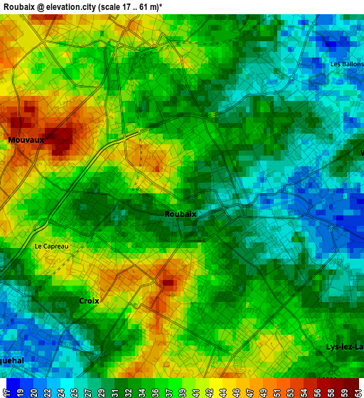
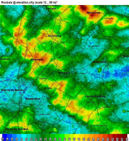
Below is the Elevation map of Roubaix, which displays elevation range with different colors. Scale of the first map is from 17 to 61 m (56 to 200 ft) with average elevation of 34.8 meters (=114 ft) [note 1]
These maps also provides idea of topography and contour of this city, they are displayed at different zoom levels. More info about maps, scale and edge coordinates you can find below images.
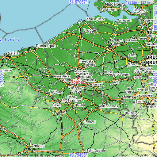
| \ | Map #1 | Map #2 | Topo.Map |
| Scale [m] | 17..61 m | 12..69 m | × |
| Scale [ft] | 56..200 ft | 39..226 ft | × |
| Average | 34.8 m = 114 ft | 33.1 m = 109 ft | × |
| Width | 6.19 km = 3.8 mi | 12.38 km = 7.7 mi | 198.1 km = 123.1 mi |
| Height | 6.19 km = 3.8 mi | 12.38 km = 7.7 mi | 198.1 km = 123.1 mi |
| ↑Max Latitude | 50.722039° | 50.749852° | 51.57657° |
| Latitude at center | 50.69421° | 50.69421° | 50.69421° |
| ↓Min Latitude | 50.666364° | 50.638502° | 49.79493° |
| ← Min Longitude | 3.130615° | 3.086669° | 1.76831° |
| Longitude center | 3.17456° | 3.17456° | 3.17456° |
| →Max Longitude | 3.218505° | 3.262451° | 4.58081° |
Nearby cities:
Cities around Roubaix sort by population:
• Tourcoing elevation 49 m
3.4 km,  344°
344°
• Wattrelos 31 m
3.2 km,  75°
75°
• Croix 34 m
2.5 km,  225°
225°
• Hem 31 m
4.7 km,  169°
169°
• Wasquehal 22 m
3.9 km, 227°
• Lys-lez-Lannoy 33 m
4.3 km,  135°
135°
• Mouvaux 51 m
2.9 km,  281°
281°
• Bondues 42 m
5.7 km, 278°
• Leers 30 m
5.1 km,  105°
105°
• Toufflers 38 m
5.6 km,  132°
132°
• Sailly-lez-Lannoy 43 m
5.7 km,  148°
148°
• Lannoy 35 m
4 km, 140°
Multilingual:
 En español:
Roubaix elevación 33 m.
 En France:
Roubaix élévation 33 m.


Sources and notes:
- [note 1] Map square and city borders are not equal. Map elevation data is calculated only from area inside that square.
- [src 1] Elevation data from geonames database provided with same terms of usage.
- [src 2] The elevation map of Roubaix is generated using elevation data from NASA's 3 arcsec (90m) resolution SRTM data.
- [src 3] Base (background) map © OpenStreetMap contributors tiles are generated by Geofabrik and OpenTopoMap.
Copyright & License:
This Roubaix Elevation Map is licensed under CC BY-SA. You may reuse any part from this page, if you give a proper credit by linking to this URL:
 More info on terms of use page.