Roullet-Saint-Estèphe elevation
Roullet-Saint-Estèphe (Nouvelle-Aquitaine, Charente), France elevation is 51 meters and Roullet-Saint-Estèphe elevation in feet is 167 ft above sea level [src 1]. Roullet-Saint-Estèphe is a populated place (feature code) with elevation that is 123 meters (404 ft) smaller than average city elevation in France.
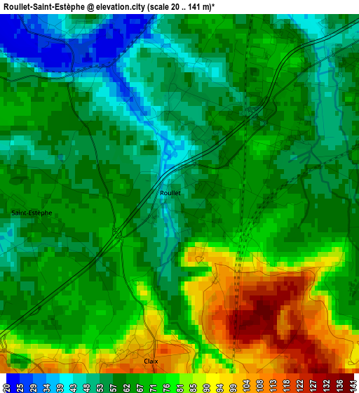
Below is the Elevation map of Roullet-Saint-Estèphe, which displays elevation range with different colors. Scale of the first map is from 20 to 141 m (66 to 463 ft) with average elevation of 66.2 meters (=217 ft) [note 1]
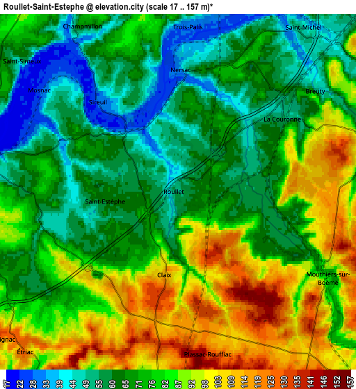
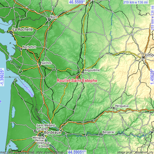
These maps also provides idea of topography and contour of this city, they are displayed at different zoom levels. More info about maps, scale and edge coordinates you can find below images.
| \ | Map #1 | Map #2 | Topo.Map |
| Scale [m] | 20..141 m | 17..157 m | × |
| Scale [ft] | 66..463 ft | 56..515 ft | × |
| Average | 66.2 m = 217 ft | 76.2 m = 250 ft | × |
| Width | 6.84 km = 4.3 mi | 13.68 km = 8.5 mi | 218.9 km = 136 mi |
| Height | 6.84 km = 4.3 mi | 13.68 km = 8.5 mi | 218.9 km = 136 mi |
| ↑Max Latitude | 45.614078° | 45.644808° | 46.5589° |
| Latitude at center | 45.58333° | 45.58333° | 45.58333° |
| ↓Min Latitude | 45.552566° | 45.521784° | 44.59051° |
| ← Min Longitude | 0.006055° | -0.037891° | -1.35625° |
| Longitude center | 0.05° | 0.05° | 0.05° |
| →Max Longitude | 0.093945° | 0.137891° | 1.45625° |
Nearby cities:
Cities around Roullet-Saint-Estèphe sort by population:
• Angoulême elevation 103 m
10.7 km,  46°
46°
• La Couronne 47 m
4.9 km, 51°
• Châteauneuf-sur-Charente 21 m
8 km,  283°
283°
• Saint-Michel 27 m
8.4 km,  27°
27°
• Fléac 32 m
10 km,  22°
22°
• Nersac 32 m
5.6 km,  0°
0°
• Mouthiers-sur-Boëme 106 m
6.4 km,  125°
125°
• Linars 40 m
7.9 km, 19°
• Vœuil-et-Giget 75 m
7.8 km,  90°
90°
• Sireuil 42 m
4.5 km,  325°
325°
• Saint-Saturnin 73 m
9.3 km, 0°
• Hiersac 74 m
10 km,  337°
337°
Multilingual:
 En español:
Roullet-Saint-Estèphe elevación 51 m.
 En France:
Roullet-Saint-Estèphe élévation 51 m.
 Auf Deutsch:
Roullet-Saint-Estèphe höhe über dem Meeresspiegel ist 51 m.

Sources and notes:
- [note 1] Map square and city borders are not equal. Map elevation data is calculated only from area inside that square.
- [src 1] Elevation data from geonames database provided with same terms of usage.
- [src 2] The elevation map of Roullet-Saint-Estèphe is generated using elevation data from NASA's 3 arcsec (90m) resolution SRTM data.
- [src 3] Base (background) map © OpenStreetMap contributors tiles are generated by Geofabrik and OpenTopoMap.
Copyright & License:
This Roullet-Saint-Estèphe Elevation Map is licensed under CC BY-SA. You may reuse any part from this page, if you give a proper credit by linking to this URL:
 More info on terms of use page.