Saint-André-lez-Lille elevation
Saint-André-lez-Lille (Hauts-de-France, Nord), France elevation is 22 meters and Saint-André-lez-Lille elevation in feet is 72 ft above sea level [src 1]. Saint-André-lez-Lille is a populated place (feature code) with elevation that is 152 meters (499 ft) smaller than average city elevation in France.
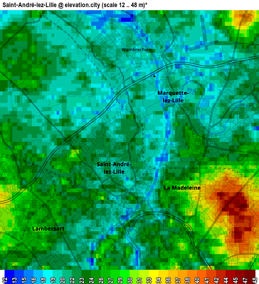
Below is the Elevation map of Saint-André-lez-Lille, which displays elevation range with different colors. Scale of the first map is from 12 to 48 m (39 to 157 ft) with average elevation of 23.3 meters (=76 ft) [note 1]
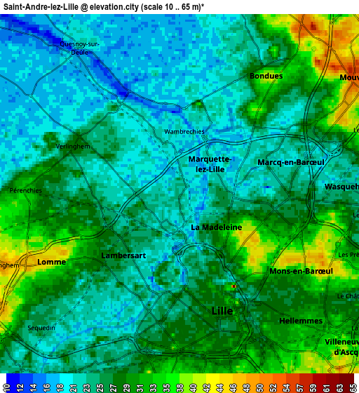
These maps also provides idea of topography and contour of this city, they are displayed at different zoom levels. More info about maps, scale and edge coordinates you can find below images.
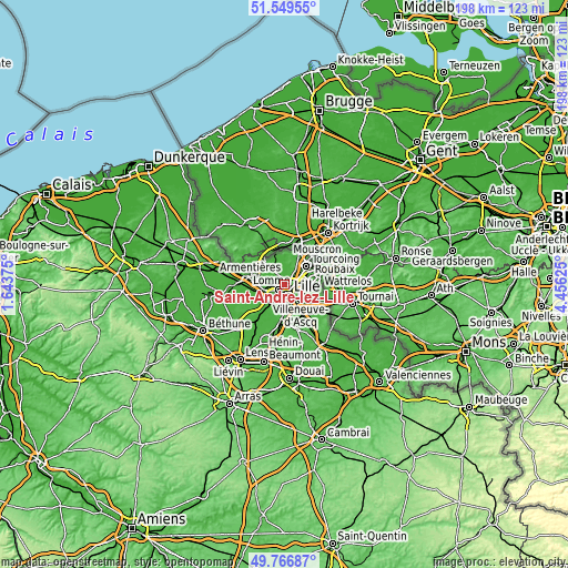
| \ | Map #1 | Map #2 | Topo.Map |
| Scale [m] | 12..48 m | 10..65 m | × |
| Scale [ft] | 39..157 ft | 33..213 ft | × |
| Average | 23.3 m = 76 ft | 26.1 m = 86 ft | × |
| Width | 6.19 km = 3.8 mi | 12.39 km = 7.7 mi | 198.2 km = 123.2 mi |
| Height | 6.19 km = 3.8 mi | 12.39 km = 7.7 mi | 198.2 km = 123.2 mi |
| ↑Max Latitude | 50.694516° | 50.722345° | 51.54955° |
| Latitude at center | 50.66667° | 50.66667° | 50.66667° |
| ↓Min Latitude | 50.638808° | 50.610929° | 49.76687° |
| ← Min Longitude | 3.006055° | 2.962109° | 1.64375° |
| Longitude center | 3.05° | 3.05° | 3.05° |
| →Max Longitude | 3.093945° | 3.137891° | 4.45625° |
Nearby cities:
Cities around Saint-André-lez-Lille sort by population:
• Lille elevation 27 m
3.8 km,  170°
170°
• Marcq-en-Barœul 20 m
2.3 km,  90°
90°
• Lomme 39 m
5.1 km,  239°
239°
• Lambersart 24 m
2.2 km,  212°
212°
• La Madeleine 29 m
2.9 km,  141°
141°
• Wasquehal 22 m
5.9 km, 85°
• Bondues 42 m
5 km,  38°
38°
• Marquette-lez-Lille 20 m
1.6 km,  46°
46°
• Wambrechies 19 m
1.8 km,  355°
355°
• Pérenchies 32 m
5.6 km,  273°
273°
• Verlinghem 28 m
4 km,  296°
296°
• Lompret 25 m
4.3 km, 273°
Multilingual:
 En español:
Saint-André-lez-Lille elevación 22 m.
 En France:
Saint-André-lez-Lille élévation 22 m.
 Auf Deutsch:
Saint-André-lez-Lille höhe über dem Meeresspiegel ist 22 m.
 На русском:
Сент-Андре-ле-Лилль высота над уровнем моря 22 м
Sources and notes:
- [note 1] Map square and city borders are not equal. Map elevation data is calculated only from area inside that square.
- [src 1] Elevation data from geonames database provided with same terms of usage.
- [src 2] The elevation map of Saint-André-lez-Lille is generated using elevation data from NASA's 3 arcsec (90m) resolution SRTM data.
- [src 3] Base (background) map © OpenStreetMap contributors tiles are generated by Geofabrik and OpenTopoMap.
Copyright & License:
This Saint-André-lez-Lille Elevation Map is licensed under CC BY-SA. You may reuse any part from this page, if you give a proper credit by linking to this URL:
 More info on terms of use page.