Saint-Céré elevation
Saint-Céré (Occitanie, Lot), France elevation is 153 meters and Saint-Céré elevation in feet is 502 ft above sea level [src 1]. Saint-Céré is a populated place (feature code) with elevation that is 21 meters (69 ft) smaller than average city elevation in France.
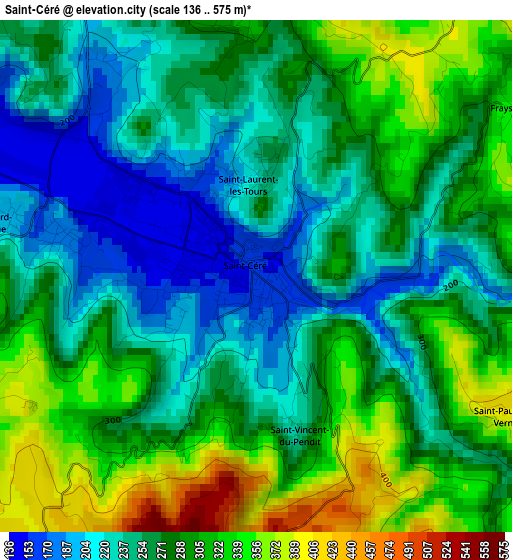
Below is the Elevation map of Saint-Céré, which displays elevation range with different colors. Scale of the first map is from 136 to 575 m (446 to 1886 ft) with average elevation of 275.3 meters (=903 ft) [note 1]
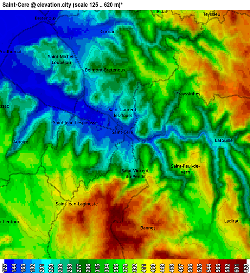
These maps also provides idea of topography and contour of this city, they are displayed at different zoom levels. More info about maps, scale and edge coordinates you can find below images.
| \ | Map #1 | Map #2 | Topo.Map |
| Scale [m] | 136..575 m | 125..620 m | × |
| Scale [ft] | 446..1886 ft | 410..2034 ft | × |
| Average | 275.3 m = 903 ft | 331.5 m = 1088 ft | × |
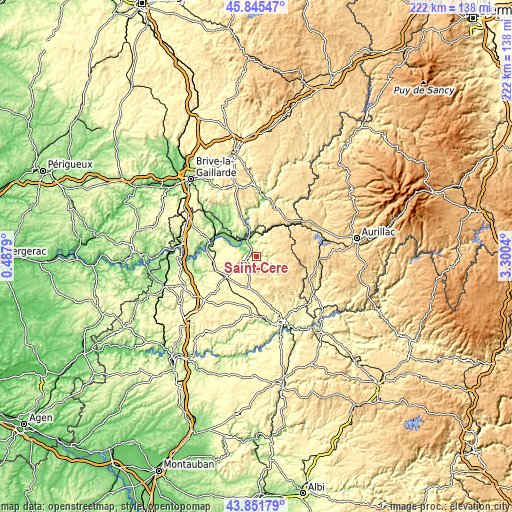
| Width | 6.93 km = 4.3 mi | 13.85 km = 8.6 mi | 221.7 km = 137.8 mi |
| Height | 6.93 km = 4.3 mi | 13.85 km = 8.6 mi | 221.7 km = 137.8 mi |
| ↑Max Latitude | 44.888403° | 44.919529° | 45.84547° |
| Latitude at center | 44.85726° | 44.85726° | 44.85726° |
| ↓Min Latitude | 44.8261° | 44.794924° | 43.85179° |
| ← Min Longitude | 1.850205° | 1.806259° | 0.4879° |
| Longitude center | 1.89415° | 1.89415° | 1.89415° |
| →Max Longitude | 1.938095° | 1.982041° | 3.3004° |
Nearby cities:
Cities around Saint-Céré sort by population:
• Gramat elevation 310 m
16.2 km,  238°
238°
• Argentat 196 m
26.5 km,  7°
7°
• Maurs 291 m
29 km,  124°
124°
• Biars-sur-Cère 141 m
8.3 km,  337°
337°
• Martel 238 m
24.2 km,  291°
291°
• Lacapelle-Marival 376 m
14.6 km,  170°
170°
• Bretenoux 137 m
7.7 km,  326°
326°
• Beaulieu-sur-Dordogne 151 m
14.2 km, 341°
• Vayrac 141 m
18.4 km,  305°
305°
• Meyssac 207 m
28 km,  321°
321°
• Laroquebrou 488 m
26.5 km,  62°
62°
• Leyme 474 m
7.9 km,  177°
177°
Multilingual:
 En español:
Saint-Céré elevación 153 m.
 En France:
Saint-Céré élévation 153 m.
 Auf Deutsch:
Saint-Céré höhe über dem Meeresspiegel ist 153 m.

Sources and notes:
- [note 1] Map square and city borders are not equal. Map elevation data is calculated only from area inside that square.
- [src 1] Elevation data from geonames database provided with same terms of usage.
- [src 2] The elevation map of Saint-Céré is generated using elevation data from NASA's 3 arcsec (90m) resolution SRTM data.
- [src 3] Base (background) map © OpenStreetMap contributors tiles are generated by Geofabrik and OpenTopoMap.
Copyright & License:
This Saint-Céré Elevation Map is licensed under CC BY-SA. You may reuse any part from this page, if you give a proper credit by linking to this URL:
 More info on terms of use page.