Saint-Germain-des-Fossés elevation
Saint-Germain-des-Fossés (Auvergne-Rhône-Alpes, Département de l'Allier), France elevation is 277 meters and Saint-Germain-des-Fossés elevation in feet is 909 ft above sea level [src 1]. Saint-Germain-des-Fossés is a populated place (feature code) with elevation that is 103 meters (338 ft) bigger than average city elevation in France.
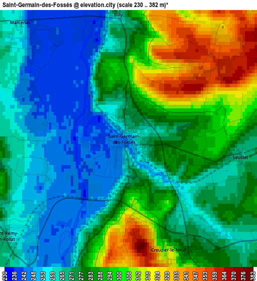
Below is the Elevation map of Saint-Germain-des-Fossés, which displays elevation range with different colors. Scale of the first map is from 230 to 382 m (755 to 1253 ft) with average elevation of 278.9 meters (=915 ft) [note 1]
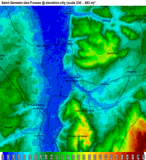
These maps also provides idea of topography and contour of this city, they are displayed at different zoom levels. More info about maps, scale and edge coordinates you can find below images.
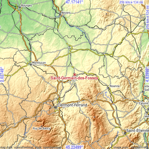
| \ | Map #1 | Map #2 | Topo.Map |
| Scale [m] | 230..382 m | 230..483 m | × |
| Scale [ft] | 755..1253 ft | 755..1585 ft | × |
| Average | 278.9 m = 915 ft | 294.5 m = 966 ft | × |
| Width | 6.76 km = 4.2 mi | 13.53 km = 8.4 mi | 216.4 km = 134.5 mi |
| Height | 6.76 km = 4.2 mi | 13.53 km = 8.4 mi | 216.4 km = 134.5 mi |
| ↑Max Latitude | 46.237224° | 46.267612° | 47.17141° |
| Latitude at center | 46.20682° | 46.20682° | 46.20682° |
| ↓Min Latitude | 46.176399° | 46.145961° | 45.22499° |
| ← Min Longitude | 3.389795° | 3.345849° | 2.02749° |
| Longitude center | 3.43374° | 3.43374° | 3.43374° |
| →Max Longitude | 3.477685° | 3.521631° | 4.83999° |
Nearby cities:
Cities around Saint-Germain-des-Fossés sort by population:
• Vichy elevation 274 m
8.9 km,  183°
183°
• Cusset 282 m
8.2 km,  167°
167°
• Bellerive-sur-Allier 275 m
10.3 km,  192°
192°
• Varennes-sur-Allier 244 m
12.1 km,  348°
348°
• Creuzier-le-Vieux 339 m
4.9 km, 180°
• Abrest 324 m
12.1 km, 176°
• Vendat 297 m
7.8 km,  232°
232°
• Saint-Rémy-en-Rollat 260 m
4.2 km, 231°
• Brugheas 325 m
15.3 km,  199°
199°
• Broût-Vernet 306 m
12.5 km,  260°
260°
• Hauterive 259 m
13.2 km, 175°
• Saint-Gérand-le-Puy 320 m
8.3 km,  46°
46°
Multilingual:
 En español:
Saint-Germain-des-Fossés elevación 277 m.
 En France:
Saint-Germain-des-Fossés élévation 277 m.
 Auf Deutsch:
Saint-Germain-des-Fossés höhe über dem Meeresspiegel ist 277 m.
 На русском:
Сен-Жермен-де-Фоссе высота над уровнем моря 277 м
Sources and notes:
- [note 1] Map square and city borders are not equal. Map elevation data is calculated only from area inside that square.
- [src 1] Elevation data from geonames database provided with same terms of usage.
- [src 2] The elevation map of Saint-Germain-des-Fossés is generated using elevation data from NASA's 3 arcsec (90m) resolution SRTM data.
- [src 3] Base (background) map © OpenStreetMap contributors tiles are generated by Geofabrik and OpenTopoMap.
Copyright & License:
This Saint-Germain-des-Fossés Elevation Map is licensed under CC BY-SA. You may reuse any part from this page, if you give a proper credit by linking to this URL:
 More info on terms of use page.