Saint-Héand elevation
Saint-Héand (Auvergne-Rhône-Alpes, Département de la Loire), France elevation is 719 meters and Saint-Héand elevation in feet is 2359 ft above sea level [src 1]. Saint-Héand is a populated place (feature code) with elevation that is 545 meters (1788 ft) bigger than average city elevation in France.
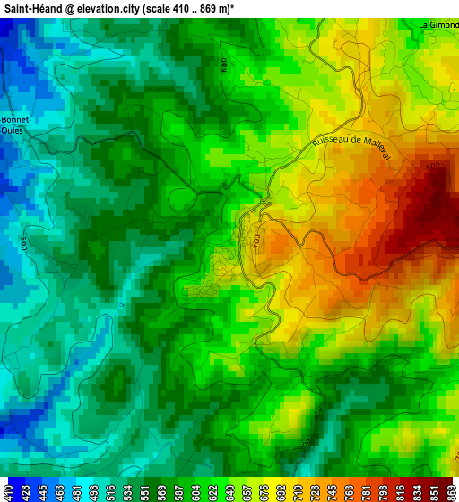
Below is the Elevation map of Saint-Héand, which displays elevation range with different colors. Scale of the first map is from 410 to 869 m (1345 to 2851 ft) with average elevation of 604.4 meters (=1983 ft) [note 1]
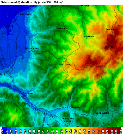
These maps also provides idea of topography and contour of this city, they are displayed at different zoom levels. More info about maps, scale and edge coordinates you can find below images.
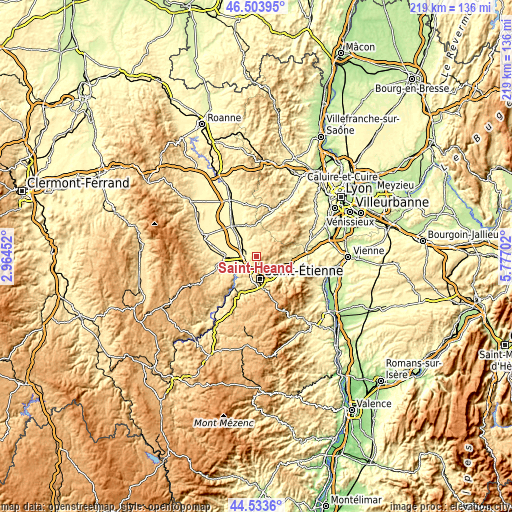
| \ | Map #1 | Map #2 | Topo.Map |
| Scale [m] | 410..869 m | 366..900 m | × |
| Scale [ft] | 1345..2851 ft | 1201..2953 ft | × |
| Average | 604.4 m = 1983 ft | 564 m = 1850 ft | × |
| Width | 6.85 km = 4.3 mi | 13.69 km = 8.5 mi | 219.1 km = 136.1 mi |
| Height | 6.85 km = 4.3 mi | 13.69 km = 8.5 mi | 219.1 km = 136.1 mi |
| ↑Max Latitude | 45.558178° | 45.58894° | 46.50395° |
| Latitude at center | 45.5274° | 45.5274° | 45.5274° |
| ↓Min Latitude | 45.496605° | 45.465793° | 44.5336° |
| ← Min Longitude | 4.326825° | 4.282879° | 2.96452° |
| Longitude center | 4.37077° | 4.37077° | 4.37077° |
| →Max Longitude | 4.414715° | 4.458661° | 5.77702° |
Nearby cities:
Cities around Saint-Héand sort by population:
• Andrézieux-Bouthéon elevation 387 m
8.6 km,  269°
269°
• Villars 468 m
6.7 km,  190°
190°
• Veauche 391 m
7.3 km,  302°
302°
• Sorbiers 536 m
6.8 km,  126°
126°
• La Talaudière 502 m
7.2 km,  142°
142°
• Saint-Priest-en-Jarez 478 m
6 km,  175°
175°
• La Fouillouse 458 m
5 km,  239°
239°
• L’Étrat 548 m
4.6 km, 175°
• Chambœuf 386 m
7.5 km,  325°
325°
• Saint-Bonnet-les-Oules 497 m
4.3 km, 304°
• Aveizieux 602 m
4.2 km,  359°
359°
• La Tour-en-Jarez 575 m
5.1 km,  162°
162°
Multilingual:
 En español:
Saint-Héand elevación 719 m.
 En France:
Saint-Héand élévation 719 m.
 Auf Deutsch:
Saint-Héand höhe über dem Meeresspiegel ist 719 m.

Sources and notes:
- [note 1] Map square and city borders are not equal. Map elevation data is calculated only from area inside that square.
- [src 1] Elevation data from geonames database provided with same terms of usage.
- [src 2] The elevation map of Saint-Héand is generated using elevation data from NASA's 3 arcsec (90m) resolution SRTM data.
- [src 3] Base (background) map © OpenStreetMap contributors tiles are generated by Geofabrik and OpenTopoMap.
Copyright & License:
This Saint-Héand Elevation Map is licensed under CC BY-SA. You may reuse any part from this page, if you give a proper credit by linking to this URL:
 More info on terms of use page.