Saint-Leu-la-Forêt elevation
Saint-Leu-la-Forêt (Île-de-France, Département du Val-d’Oise), France elevation is 81 meters and Saint-Leu-la-Forêt elevation in feet is 266 ft above sea level [src 1]. Saint-Leu-la-Forêt is a populated place (feature code) with elevation that is 93 meters (305 ft) smaller than average city elevation in France.
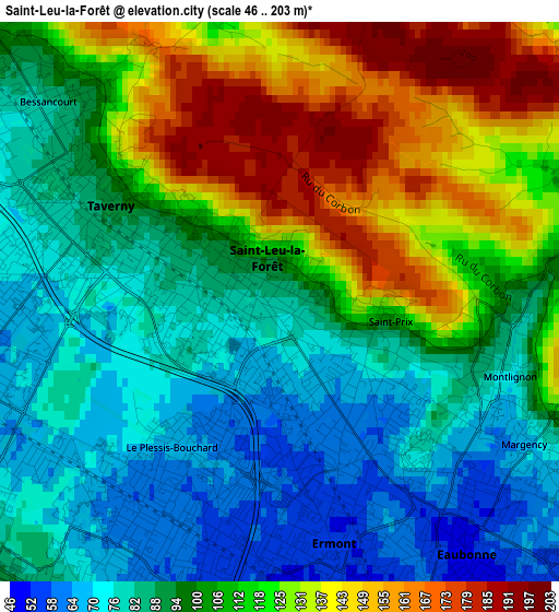
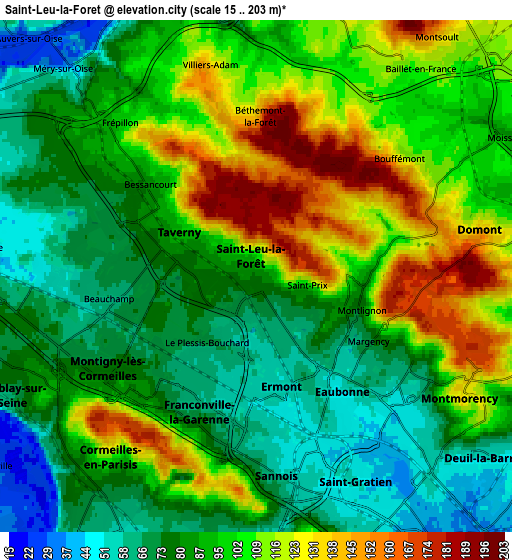
Below is the Elevation map of Saint-Leu-la-Forêt, which displays elevation range with different colors. Scale of the first map is from 46 to 203 m (151 to 666 ft) with average elevation of 104.6 meters (=343 ft) [note 1]
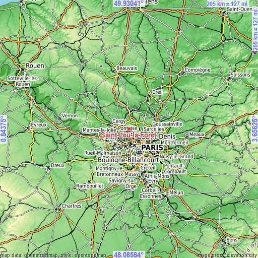
These maps also provides idea of topography and contour of this city, they are displayed at different zoom levels. More info about maps, scale and edge coordinates you can find below images.
| \ | Map #1 | Map #2 | Topo.Map |
| Scale [m] | 46..203 m | 15..203 m | × |
| Scale [ft] | 151..666 ft | 49..666 ft | × |
| Average | 104.6 m = 343 ft | 94 m = 308 ft | × |
| Width | 6.41 km = 4 mi | 12.82 km = 8 mi | 205.1 km = 127.4 mi |
| Height | 6.41 km = 4 mi | 12.82 km = 8 mi | 205.1 km = 127.4 mi |
| ↑Max Latitude | 49.045483° | 49.074279° | 49.93041° |
| Latitude at center | 49.01667° | 49.01667° | 49.01667° |
| ↓Min Latitude | 48.987841° | 48.958994° | 48.08584° |
| ← Min Longitude | 2.206055° | 2.162109° | 0.84375° |
| Longitude center | 2.25° | 2.25° | 2.25° |
| →Max Longitude | 2.293945° | 2.337891° | 3.65625° |
Nearby cities:
Cities around Saint-Leu-la-Forêt sort by population:
• Franconville elevation 71 m
3.9 km,  198°
198°
• Ermont 54 m
3 km,  168°
168°
• Taverny 82 m
2.6 km,  291°
291°
• Eaubonne 55 m
3.2 km,  132°
132°
• Beauchamp 69 m
3.6 km,  270°
270°
• Bessancourt 81 m
3.8 km,  308°
308°
• Le Plessis-Bouchard 63 m
2.2 km,  213°
213°
• Saint-Prix 132 m
1.2 km,  90°
90°
• Bouffémont 121 m
4.6 km,  49°
49°
• Margency 70 m
4.1 km,  116°
116°
• Montlignon 74 m
2.9 km,  112°
112°
• Andilly 170 m
3.9 km,  102°
102°
Multilingual:
 En español:
Saint-Leu-la-Forêt elevación 81 m.
 En France:
Saint-Leu-la-Forêt élévation 81 m.
 Auf Deutsch:
Saint-Leu-la-Forêt höhe über dem Meeresspiegel ist 81 m.

Sources and notes:
- [note 1] Map square and city borders are not equal. Map elevation data is calculated only from area inside that square.
- [src 1] Elevation data from geonames database provided with same terms of usage.
- [src 2] The elevation map of Saint-Leu-la-Forêt is generated using elevation data from NASA's 3 arcsec (90m) resolution SRTM data.
- [src 3] Base (background) map © OpenStreetMap contributors tiles are generated by Geofabrik and OpenTopoMap.
Copyright & License:
This Saint-Leu-la-Forêt Elevation Map is licensed under CC BY-SA. You may reuse any part from this page, if you give a proper credit by linking to this URL:
 More info on terms of use page.