Saint-Omer elevation
Saint-Omer (Hauts-de-France, Pas-de-Calais), France elevation is 5 meters and Saint-Omer elevation in feet is 16 ft above sea level [src 1]. Saint-Omer is a seat of a third-order administrative division (feature code) with elevation that is 169 meters (554 ft) smaller than average city elevation in France.
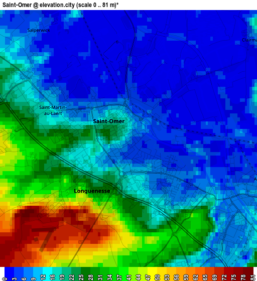
Below is the Elevation map of Saint-Omer, which displays elevation range with different colors. Scale of the first map is from 0 to 81 m (0 to 266 ft) with average elevation of 17.9 meters (=59 ft) [note 1]
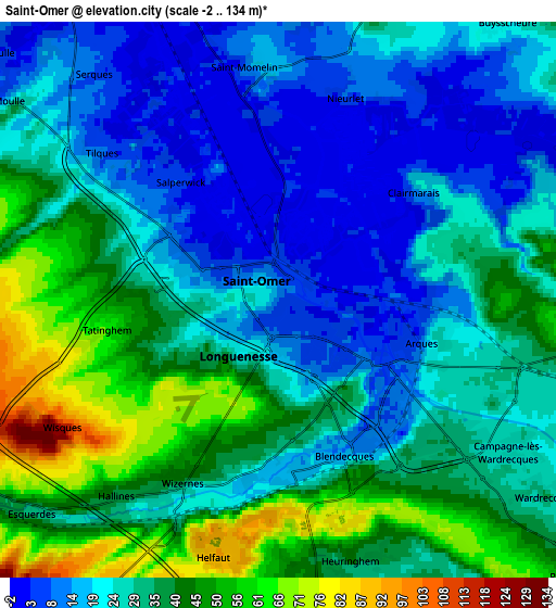
These maps also provides idea of topography and contour of this city, they are displayed at different zoom levels. More info about maps, scale and edge coordinates you can find below images.
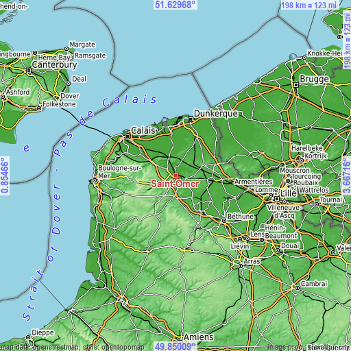
| \ | Map #1 | Map #2 | Topo.Map |
| Scale [m] | 0..81 m | -2..134 m | × |
| Scale [ft] | 0..266 ft | -7..440 ft | × |
| Average | 17.9 m = 59 ft | 29.9 m = 98 ft | × |
| Width | 6.18 km = 3.8 mi | 12.37 km = 7.7 mi | 197.9 km = 123 mi |
| Height | 6.18 km = 3.8 mi | 12.37 km = 7.7 mi | 197.9 km = 123 mi |
| ↑Max Latitude | 50.776137° | 50.803918° | 51.62968° |
| Latitude at center | 50.74834° | 50.74834° | 50.74834° |
| ↓Min Latitude | 50.720526° | 50.692696° | 49.85009° |
| ← Min Longitude | 2.216965° | 2.173019° | 0.85466° |
| Longitude center | 2.26091° | 2.26091° | 2.26091° |
| →Max Longitude | 2.304855° | 2.348801° | 3.66716° |
Nearby cities:
Cities around Saint-Omer sort by population:
• Longuenesse elevation 45 m
2.4 km,  228°
228°
• Arques 9 m
3.3 km,  119°
119°
• Blendecques 12 m
3.8 km,  152°
152°
• Saint-Martin-au-Laërt 12 m
1.5 km,  284°
284°
• Wizernes 24 m
4.3 km,  197°
197°
• Tatinghem 63 m
3.8 km,  261°
261°
• Helfaut 93 m
5.8 km,  193°
193°
• Esquerdes 35 m
7.1 km, 226°
• Hallines 34 m
4.8 km,  210°
210°
• Heuringhem 43 m
6 km,  164°
164°
• Serques 8 m
6.5 km,  320°
320°
• Tilques 12 m
5.4 km,  306°
306°
Multilingual:
 En español:
Saint-Omer elevación 5 m.
 En France:
Saint-Omer élévation 5 m.
 Auf Deutsch:
Saint-Omer höhe über dem Meeresspiegel ist 5 m.

Sources and notes:
- [note 1] Map square and city borders are not equal. Map elevation data is calculated only from area inside that square.
- [src 1] Elevation data from geonames database provided with same terms of usage.
- [src 2] The elevation map of Saint-Omer is generated using elevation data from NASA's 3 arcsec (90m) resolution SRTM data.
- [src 3] Base (background) map © OpenStreetMap contributors tiles are generated by Geofabrik and OpenTopoMap.
Copyright & License:
This Saint-Omer Elevation Map is licensed under CC BY-SA. You may reuse any part from this page, if you give a proper credit by linking to this URL:
 More info on terms of use page.