Saint-Romain-de-Colbosc elevation
Saint-Romain-de-Colbosc (Normandy, Seine-Maritime), France elevation is 118 meters and Saint-Romain-de-Colbosc elevation in feet is 387 ft above sea level [src 1]. Saint-Romain-de-Colbosc is a populated place (feature code) with elevation that is 56 meters (184 ft) smaller than average city elevation in France.
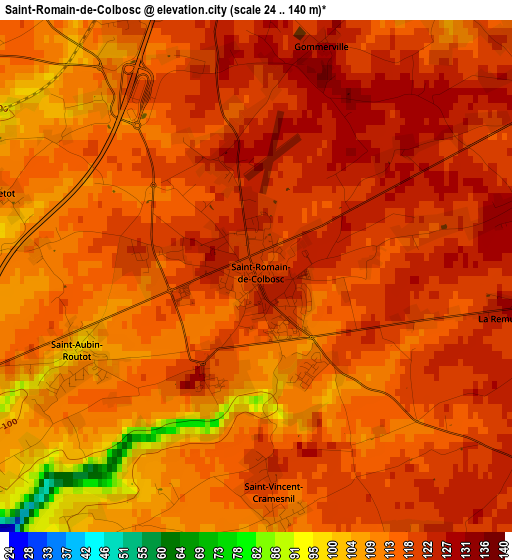
Below is the Elevation map of Saint-Romain-de-Colbosc, which displays elevation range with different colors. Scale of the first map is from 24 to 140 m (79 to 459 ft) with average elevation of 116 meters (=381 ft) [note 1]
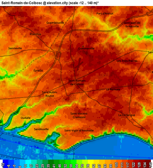
These maps also provides idea of topography and contour of this city, they are displayed at different zoom levels. More info about maps, scale and edge coordinates you can find below images.
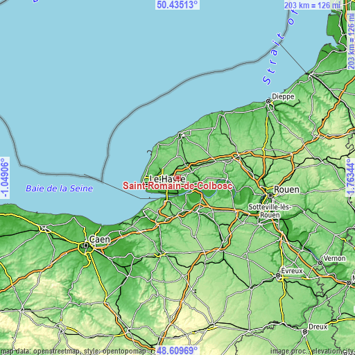
| \ | Map #1 | Map #2 | Topo.Map |
| Scale [m] | 24..140 m | -12..140 m | × |
| Scale [ft] | 79..459 ft | -39..459 ft | × |
| Average | 116 m = 381 ft | 94 m = 308 ft | × |
| Width | 6.34 km = 3.9 mi | 12.69 km = 7.9 mi | 203 km = 126.1 mi |
| Height | 6.34 km = 3.9 mi | 12.69 km = 7.9 mi | 203 km = 126.1 mi |
| ↑Max Latitude | 49.559444° | 49.587941° | 50.43513° |
| Latitude at center | 49.53093° | 49.53093° | 49.53093° |
| ↓Min Latitude | 49.5024° | 49.473852° | 48.60969° |
| ← Min Longitude | 0.313245° | 0.269299° | -1.04906° |
| Longitude center | 0.35719° | 0.35719° | 0.35719° |
| →Max Longitude | 0.401135° | 0.445081° | 1.76344° |
Nearby cities:
Cities around Saint-Romain-de-Colbosc sort by population:
• Gainneville elevation 98 m
7 km,  258°
258°
• Saint-Laurent-de-Brévedent 85 m
7.4 km,  265°
265°
• Saint-Martin-du-Manoir 97 m
8.6 km, 270°
• Angerville-l’Orcher 115 m
8.4 km,  319°
319°
• Rogerville 94 m
7.3 km,  244°
244°
• Saint-Eustache-la-Forêt 105 m
7.5 km,  72°
72°
• La Remuée 127 m
3.3 km,  96°
96°
• La Cerlangue 119 m
4.9 km,  124°
124°
• Manéglise 70 m
8.3 km,  297°
297°
• Saint-Aubin-Routot 101 m
2.4 km,  249°
249°
• Beuzeville-la-Grenier 118 m
8.4 km,  36°
36°
• Étainhus 114 m
5.1 km, 321°
Multilingual:
 En español:
Saint-Romain-de-Colbosc elevación 118 m.
 En France:
Saint-Romain-de-Colbosc élévation 118 m.
 Auf Deutsch:
Saint-Romain-de-Colbosc höhe über dem Meeresspiegel ist 118 m.
 На русском:
Saint-Romain-de-Colbosc высота над уровнем моря 118 м
Sources and notes:
- [note 1] Map square and city borders are not equal. Map elevation data is calculated only from area inside that square.
- [src 1] Elevation data from geonames database provided with same terms of usage.
- [src 2] The elevation map of Saint-Romain-de-Colbosc is generated using elevation data from NASA's 3 arcsec (90m) resolution SRTM data.
- [src 3] Base (background) map © OpenStreetMap contributors tiles are generated by Geofabrik and OpenTopoMap.
Copyright & License:
This Saint-Romain-de-Colbosc Elevation Map is licensed under CC BY-SA. You may reuse any part from this page, if you give a proper credit by linking to this URL:
 More info on terms of use page.