Saint-Yrieix-la-Perche elevation
Saint-Yrieix-la-Perche (Nouvelle-Aquitaine, Haute-Vienne), France elevation is 388 meters and Saint-Yrieix-la-Perche elevation in feet is 1273 ft above sea level [src 1]. Saint-Yrieix-la-Perche is a populated place (feature code) with elevation that is 214 meters (702 ft) bigger than average city elevation in France.
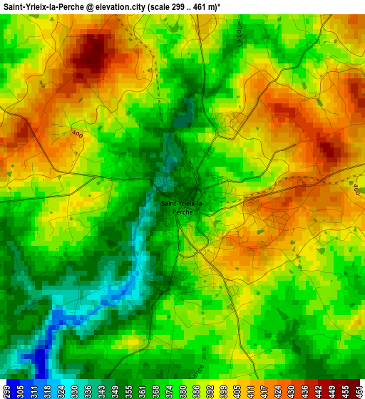
Below is the Elevation map of Saint-Yrieix-la-Perche, which displays elevation range with different colors. Scale of the first map is from 299 to 461 m (981 to 1512 ft) with average elevation of 383.7 meters (=1259 ft) [note 1]
These maps also provides idea of topography and contour of this city, they are displayed at different zoom levels. More info about maps, scale and edge coordinates you can find below images.
| \ | Map #1 | Map #2 | Topo.Map |
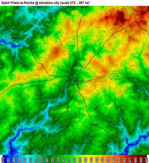
| Scale [m] | 299..461 m | 272..497 m | × |
| Scale [ft] | 981..1512 ft | 892..1631 ft | × |
| Average | 383.7 m = 1259 ft | 372.5 m = 1222 ft | × |
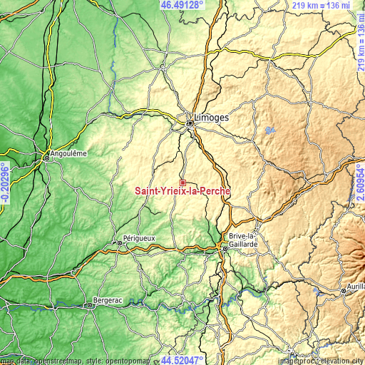
| Width | 6.85 km = 4.3 mi | 13.7 km = 8.5 mi | 219.1 km = 136.1 mi |
| Height | 6.85 km = 4.3 mi | 13.7 km = 8.5 mi | 219.1 km = 136.1 mi |
| ↑Max Latitude | 45.545285° | 45.576054° | 46.49128° |
| Latitude at center | 45.5145° | 45.5145° | 45.5145° |
| ↓Min Latitude | 45.483698° | 45.452879° | 44.52047° |
| ← Min Longitude | 1.159345° | 1.115399° | -0.20296° |
| Longitude center | 1.20329° | 1.20329° | 1.20329° |
| →Max Longitude | 1.247235° | 1.291181° | 2.60954° |
Nearby cities:
Cities around Saint-Yrieix-la-Perche sort by population:
• Nexon elevation 351 m
18.4 km,  355°
355°
• Lubersac 372 m
17.5 km,  116°
116°
• Excideuil 162 m
23.2 km,  211°
211°
• Bussière-Galant 438 m
18 km,  313°
313°
• Coussac-Bonneval 346 m
9.4 km,  92°
92°
• La Coquille 343 m
17.9 km,  279°
279°
• Jumilhac-le-Grand 283 m
11.1 km,  258°
258°
• Arnac-Pompadour 360 m
17.5 km,  131°
131°
• Ladignac-le-Long 394 m
10.3 km,  317°
317°
• Vicq-sur-Breuilh 350 m
20.2 km,  43°
43°
• Payzac 354 m
12.8 km,  175°
175°
• Lanouaille 315 m
14.2 km,  200°
200°
Multilingual:
 En español:
Saint-Yrieix-la-Perche elevación 388 m.
 En France:
Saint-Yrieix-la-Perche élévation 388 m.
 Auf Deutsch:
Saint-Yrieix-la-Perche höhe über dem Meeresspiegel ist 388 m.
 На русском:
Saint-Yrieix-la-Perche высота над уровнем моря 388 м
Sources and notes:
- [note 1] Map square and city borders are not equal. Map elevation data is calculated only from area inside that square.
- [src 1] Elevation data from geonames database provided with same terms of usage.
- [src 2] The elevation map of Saint-Yrieix-la-Perche is generated using elevation data from NASA's 3 arcsec (90m) resolution SRTM data.
- [src 3] Base (background) map © OpenStreetMap contributors tiles are generated by Geofabrik and OpenTopoMap.
Copyright & License:
This Saint-Yrieix-la-Perche Elevation Map is licensed under CC BY-SA. You may reuse any part from this page, if you give a proper credit by linking to this URL:
 More info on terms of use page.