Sarralbe elevation
Sarralbe (Grand Est, Moselle), France elevation is 214 meters and Sarralbe elevation in feet is 702 ft above sea level [src 1]. Sarralbe is a populated place (feature code) with elevation that is 40 meters (131 ft) bigger than average city elevation in France.
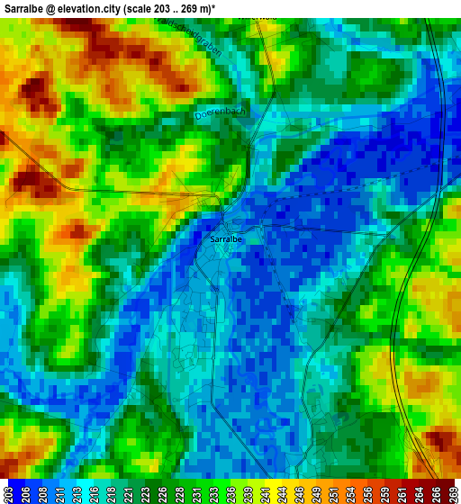
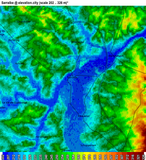
Below is the Elevation map of Sarralbe, which displays elevation range with different colors. Scale of the first map is from 203 to 269 m (666 to 883 ft) with average elevation of 225.4 meters (=740 ft) [note 1]
These maps also provides idea of topography and contour of this city, they are displayed at different zoom levels. More info about maps, scale and edge coordinates you can find below images.
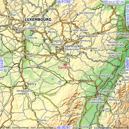
| \ | Map #1 | Map #2 | Topo.Map |
| Scale [m] | 203..269 m | 202..326 m | × |
| Scale [ft] | 666..883 ft | 663..1070 ft | × |
| Average | 225.4 m = 740 ft | 236.9 m = 777 ft | × |
| Width | 6.41 km = 4 mi | 12.82 km = 8 mi | 205.2 km = 127.5 mi |
| Height | 6.41 km = 4 mi | 12.82 km = 8 mi | 205.2 km = 127.5 mi |
| ↑Max Latitude | 49.027403° | 49.05621° | 49.91266° |
| Latitude at center | 48.99858° | 48.99858° | 48.99858° |
| ↓Min Latitude | 48.96974° | 48.940884° | 48.06741° |
| ← Min Longitude | 6.986795° | 6.942849° | 5.62449° |
| Longitude center | 7.03074° | 7.03074° | 7.03074° |
| →Max Longitude | 7.074685° | 7.118631° | 8.43699° |
Nearby cities:
Cities around Sarralbe sort by population:
• Sarre-Union elevation 247 m
8.1 km,  145°
145°
• Woustviller 227 m
8.9 km,  347°
347°
• Hambach 247 m
6.8 km,  2°
2°
• Herbitzheim 229 m
4.2 km,  63°
63°
• Rémelfing 231 m
10.9 km,  22°
22°
• Keskastel 215 m
3.2 km,  162°
162°
• Oermingen 256 m
7.2 km,  88°
88°
• Neufgrange 231 m
9.1 km, 16°
• Sarreinsming 217 m
11.8 km,  29°
29°
• Willerwald 240 m
3 km,  9°
9°
• Holving 232 m
5 km,  286°
286°
• Sarrewerden 230 m
9.3 km, 155°
Multilingual:
 En español:
Sarralbe elevación 214 m.
 En France:
Sarralbe élévation 214 m.
 Auf Deutsch:
Sarralbe höhe über dem Meeresspiegel ist 214 m.

Sources and notes:
- [note 1] Map square and city borders are not equal. Map elevation data is calculated only from area inside that square.
- [src 1] Elevation data from geonames database provided with same terms of usage.
- [src 2] The elevation map of Sarralbe is generated using elevation data from NASA's 3 arcsec (90m) resolution SRTM data.
- [src 3] Base (background) map © OpenStreetMap contributors tiles are generated by Geofabrik and OpenTopoMap.
Copyright & License:
This Sarralbe Elevation Map is licensed under CC BY-SA. You may reuse any part from this page, if you give a proper credit by linking to this URL:
 More info on terms of use page.