Sathonay-Camp elevation
Sathonay-Camp (Auvergne-Rhône-Alpes, Département du Rhône), France elevation is 269 meters and Sathonay-Camp elevation in feet is 883 ft above sea level [src 1]. Sathonay-Camp is a populated place (feature code) with elevation that is 95 meters (312 ft) bigger than average city elevation in France.
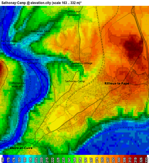
Below is the Elevation map of Sathonay-Camp, which displays elevation range with different colors. Scale of the first map is from 163 to 332 m (535 to 1089 ft) with average elevation of 243.4 meters (=799 ft) [note 1]
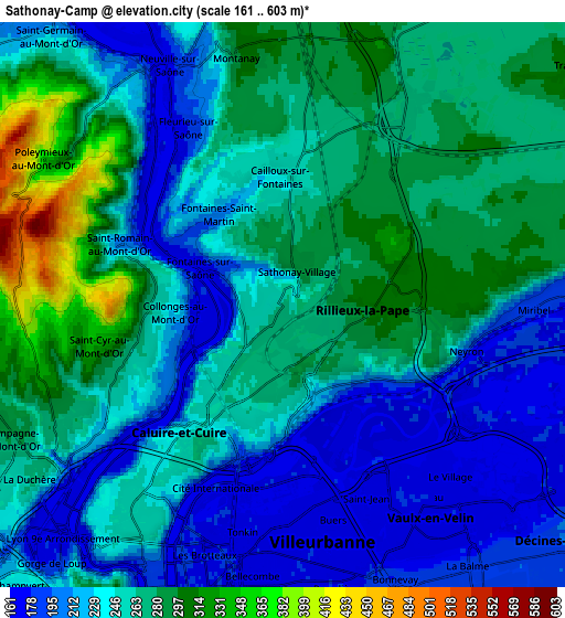
These maps also provides idea of topography and contour of this city, they are displayed at different zoom levels. More info about maps, scale and edge coordinates you can find below images.
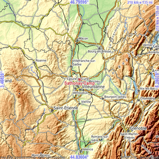
| \ | Map #1 | Map #2 | Topo.Map |
| Scale [m] | 163..332 m | 161..603 m | × |
| Scale [ft] | 535..1089 ft | 528..1978 ft | × |
| Average | 243.4 m = 799 ft | 250.2 m = 821 ft | × |
| Width | 6.81 km = 4.2 mi | 13.62 km = 8.5 mi | 217.9 km = 135.4 mi |
| Height | 6.81 km = 4.2 mi | 13.62 km = 8.5 mi | 217.9 km = 135.4 mi |
| ↑Max Latitude | 45.855235° | 45.885834° | 46.79595° |
| Latitude at center | 45.82462° | 45.82462° | 45.82462° |
| ↓Min Latitude | 45.793988° | 45.763339° | 44.83604° |
| ← Min Longitude | 4.830585° | 4.786639° | 3.46828° |
| Longitude center | 4.87453° | 4.87453° | 4.87453° |
| →Max Longitude | 4.918475° | 4.962421° | 6.28078° |
Nearby cities:
Cities around Sathonay-Camp sort by population:
• Caluire-et-Cuire elevation 237 m
4 km,  213°
213°
• Vaulx-en-Velin 173 m
5.7 km,  136°
136°
• Rillieux-la-Pape 287 m
2.2 km,  114°
114°
• Fontaines-sur-Saône 235 m
2.6 km,  298°
298°
• Fontaines-Saint-Martin 239 m
2.7 km,  322°
322°
• Albigny-sur-Saône 171 m
5.7 km,  325°
325°
• Montanay 306 m
6.1 km,  351°
351°
• Couzon-au-Mont-d’Or 187 m
4.2 km, 301°
• Cailloux-sur-Fontaines 261 m
3.1 km,  0°
0°
• Sathonay-Village 292 m
1 km,  16°
16°
• Fleurieu-sur-Saône 262 m
4.6 km, 331°
• Rochetaillée-sur-Saône 235 m
3.4 km, 326°
Multilingual:
 En español:
Sathonay-Camp elevación 269 m.
 En France:
Sathonay-Camp élévation 269 m.
 Auf Deutsch:
Sathonay-Camp höhe über dem Meeresspiegel ist 269 m.

Sources and notes:
- [note 1] Map square and city borders are not equal. Map elevation data is calculated only from area inside that square.
- [src 1] Elevation data from geonames database provided with same terms of usage.
- [src 2] The elevation map of Sathonay-Camp is generated using elevation data from NASA's 3 arcsec (90m) resolution SRTM data.
- [src 3] Base (background) map © OpenStreetMap contributors tiles are generated by Geofabrik and OpenTopoMap.
Copyright & License:
This Sathonay-Camp Elevation Map is licensed under CC BY-SA. You may reuse any part from this page, if you give a proper credit by linking to this URL:
 More info on terms of use page.