Selles-sur-Cher elevation
Selles-sur-Cher (Centre, Département du Loir-et-Cher), France elevation is 80 meters and Selles-sur-Cher elevation in feet is 262 ft above sea level [src 1]. Selles-sur-Cher is a populated place (feature code) with elevation that is 94 meters (308 ft) smaller than average city elevation in France.
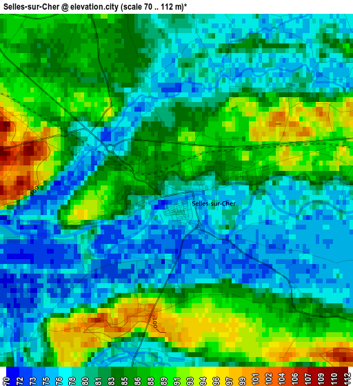
Below is the Elevation map of Selles-sur-Cher, which displays elevation range with different colors. Scale of the first map is from 70 to 112 m (230 to 367 ft) with average elevation of 83.2 meters (=273 ft) [note 1]
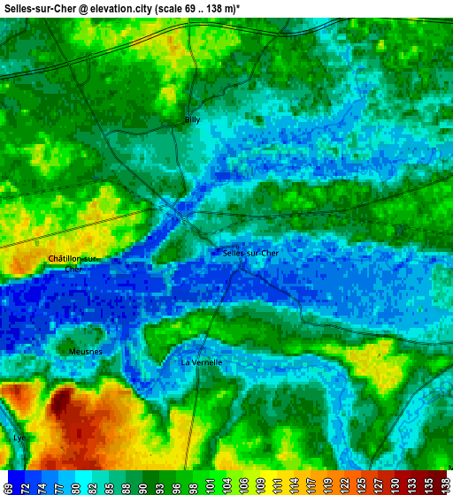
These maps also provides idea of topography and contour of this city, they are displayed at different zoom levels. More info about maps, scale and edge coordinates you can find below images.
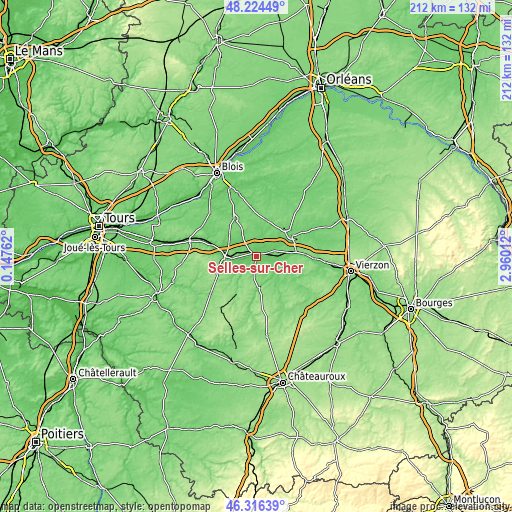
| \ | Map #1 | Map #2 | Topo.Map |
| Scale [m] | 70..112 m | 69..138 m | × |
| Scale [ft] | 230..367 ft | 226..453 ft | × |
| Average | 83.2 m = 273 ft | 90.2 m = 296 ft | × |
| Width | 6.63 km = 4.1 mi | 13.26 km = 8.2 mi | 212.2 km = 131.9 mi |
| Height | 6.63 km = 4.1 mi | 13.26 km = 8.2 mi | 212.1 km = 131.8 mi |
| ↑Max Latitude | 47.308845° | 47.338634° | 48.22449° |
| Latitude at center | 47.27904° | 47.27904° | 47.27904° |
| ↓Min Latitude | 47.249218° | 47.219379° | 46.31639° |
| ← Min Longitude | 1.509925° | 1.465979° | 0.14762° |
| Longitude center | 1.55387° | 1.55387° | 1.55387° |
| →Max Longitude | 1.597815° | 1.641761° | 2.96012° |
Nearby cities:
Cities around Selles-sur-Cher sort by population:
• Saint-Aignan elevation 85 m
13.5 km,  265°
265°
• Valençay 118 m
13.1 km,  175°
175°
• Noyers-sur-Cher 76 m
11.4 km, 268°
• Chabris 86 m
7.9 km,  111°
111°
• Villefranche-sur-Cher 99 m
16.2 km,  81°
81°
• Pruniers-en-Sologne 80 m
9.5 km,  63°
63°
• Gièvres 93 m
8.7 km,  90°
90°
• Châtillon-sur-Cher 111 m
4.5 km, 265°
• Soings-en-Sologne 111 m
15 km,  351°
351°
• Saint-Romain-sur-Cher 85 m
12.4 km,  290°
290°
• Mur-de-Sologne 117 m
15.4 km,  15°
15°
• Seigy 82 m
11.9 km,  258°
258°
Multilingual:
 En español:
Selles-sur-Cher elevación 80 m.
 En France:
Selles-sur-Cher élévation 80 m.
 Auf Deutsch:
Selles-sur-Cher höhe über dem Meeresspiegel ist 80 m.

Sources and notes:
- [note 1] Map square and city borders are not equal. Map elevation data is calculated only from area inside that square.
- [src 1] Elevation data from geonames database provided with same terms of usage.
- [src 2] The elevation map of Selles-sur-Cher is generated using elevation data from NASA's 3 arcsec (90m) resolution SRTM data.
- [src 3] Base (background) map © OpenStreetMap contributors tiles are generated by Geofabrik and OpenTopoMap.
Copyright & License:
This Selles-sur-Cher Elevation Map is licensed under CC BY-SA. You may reuse any part from this page, if you give a proper credit by linking to this URL:
 More info on terms of use page.