Somain elevation
Somain (Hauts-de-France, Nord), France elevation is 26 meters and Somain elevation in feet is 85 ft above sea level [src 1]. Somain is a populated place (feature code) with elevation that is 148 meters (486 ft) smaller than average city elevation in France.
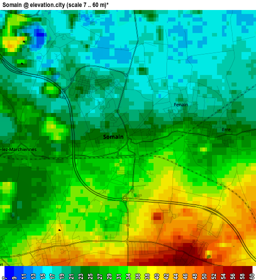
Below is the Elevation map of Somain, which displays elevation range with different colors. Scale of the first map is from 7 to 60 m (23 to 197 ft) with average elevation of 27.9 meters (=92 ft) [note 1]
These maps also provides idea of topography and contour of this city, they are displayed at different zoom levels. More info about maps, scale and edge coordinates you can find below images.
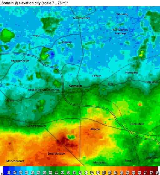
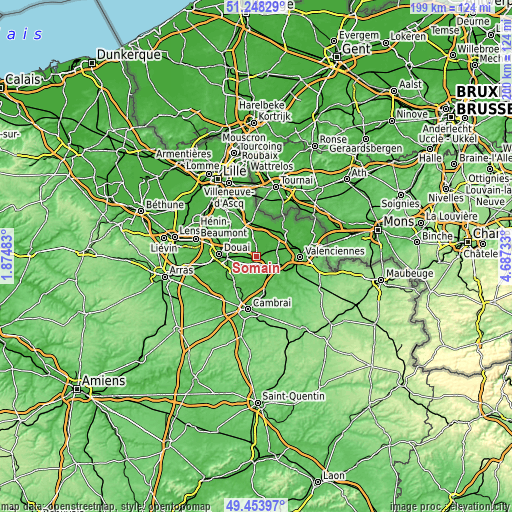
| \ | Map #1 | Map #2 | Topo.Map |
| Scale [m] | 7..60 m | 7..76 m | × |
| Scale [ft] | 23..197 ft | 23..249 ft | × |
| Average | 27.9 m = 92 ft | 30.2 m = 99 ft | × |
| Width | 6.23 km = 3.9 mi | 12.47 km = 7.7 mi | 199.5 km = 124 mi |
| Height | 6.23 km = 3.9 mi | 12.47 km = 7.7 mi | 199.5 km = 124 mi |
| ↑Max Latitude | 50.387637° | 50.415648° | 51.24829° |
| Latitude at center | 50.35961° | 50.35961° | 50.35961° |
| ↓Min Latitude | 50.331566° | 50.303506° | 49.45397° |
| ← Min Longitude | 3.237135° | 3.193189° | 1.87483° |
| Longitude center | 3.28108° | 3.28108° | 3.28108° |
| →Max Longitude | 3.325025° | 3.368971° | 4.68733° |
Nearby cities:
Cities around Somain sort by population:
• Aniche elevation 48 m
3.8 km,  210°
210°
• Pecquencourt 20 m
5.3 km,  293°
293°
• Fenain 21 m
1.6 km,  59°
59°
• Marchiennes 16 m
4.5 km,  2°
2°
• Auberchicourt 31 m
4.5 km,  229°
229°
• Abscon 57 m
3.2 km,  155°
155°
• Hornaing 22 m
4.1 km,  76°
76°
• Écaillon 28 m
4.7 km,  257°
257°
• Rieulay 17 m
2.9 km,  316°
316°
• Erre 23 m
2.5 km, 82°
• Bruille-lez-Marchiennes 25 m
2.6 km,  272°
272°
• Wandignies-Hamage 15 m
4.7 km,  30°
30°
Multilingual:
 En español:
Somain elevación 26 m.
 En France:
Somain élévation 26 m.


Sources and notes:
- [note 1] Map square and city borders are not equal. Map elevation data is calculated only from area inside that square.
- [src 1] Elevation data from geonames database provided with same terms of usage.
- [src 2] The elevation map of Somain is generated using elevation data from NASA's 3 arcsec (90m) resolution SRTM data.
- [src 3] Base (background) map © OpenStreetMap contributors tiles are generated by Geofabrik and OpenTopoMap.
Copyright & License:
This Somain Elevation Map is licensed under CC BY-SA. You may reuse any part from this page, if you give a proper credit by linking to this URL:
 More info on terms of use page.