Sommières elevation
Sommières (Occitanie, Gard), France elevation is 33 meters and Sommières elevation in feet is 108 ft above sea level [src 1]. Sommières is a populated place (feature code) with elevation that is 141 meters (463 ft) smaller than average city elevation in France.
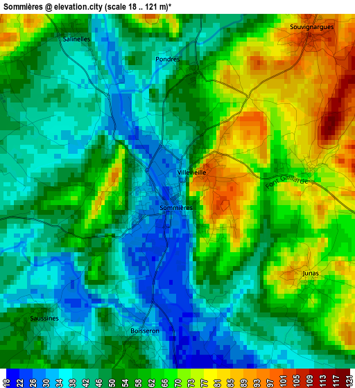
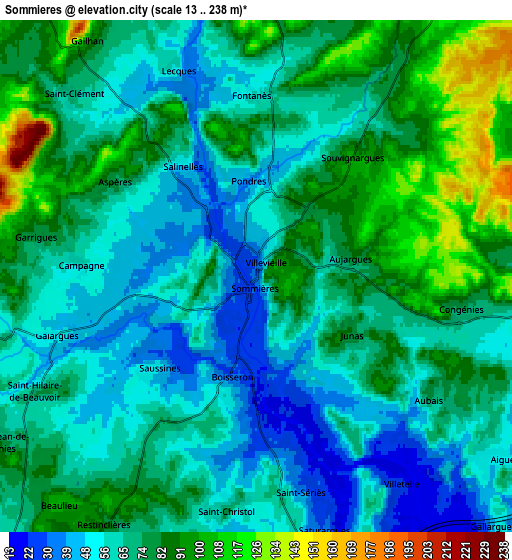
Below is the Elevation map of Sommières, which displays elevation range with different colors. Scale of the first map is from 18 to 121 m (59 to 397 ft) with average elevation of 54.8 meters (=180 ft) [note 1]
These maps also provides idea of topography and contour of this city, they are displayed at different zoom levels. More info about maps, scale and edge coordinates you can find below images.
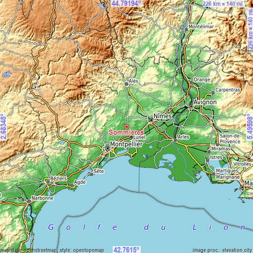
| \ | Map #1 | Map #2 | Topo.Map |
| Scale [m] | 18..121 m | 13..238 m | × |
| Scale [ft] | 59..397 ft | 43..781 ft | × |
| Average | 54.8 m = 180 ft | 70.4 m = 231 ft | × |
| Width | 7.06 km = 4.4 mi | 14.11 km = 8.8 mi | 225.8 km = 140.3 mi |
| Height | 7.06 km = 4.4 mi | 14.11 km = 8.8 mi | 225.8 km = 140.3 mi |
| ↑Max Latitude | 43.817057° | 43.848758° | 44.79194° |
| Latitude at center | 43.78534° | 43.78534° | 43.78534° |
| ↓Min Latitude | 43.753606° | 43.721855° | 42.7615° |
| ← Min Longitude | 4.045785° | 4.001839° | 2.68348° |
| Longitude center | 4.08973° | 4.08973° | 4.08973° |
| →Max Longitude | 4.133675° | 4.177621° | 5.49598° |
Nearby cities:
Cities around Sommières sort by population:
• Calvisson elevation 53 m
8.6 km,  88°
88°
• Gallargues-le-Montueux 14 m
9.8 km,  141°
141°
• Aigues-Vives 51 m
9 km,  125°
125°
• Aubais 63 m
5.7 km, 127°
• Beaulieu 103 m
8.3 km,  220°
220°
• Restinclières 93 m
8.3 km,  212°
212°
• Saint-Christol 70 m
6.4 km,  187°
187°
• Boisseron 45 m
3.2 km, 194°
• Villevieille 100 m
0.7 km,  65°
65°
• Congénies 56 m
6.5 km,  108°
108°
• Mus 52 m
10.4 km,  119°
119°
• Villetelle 25 m
7.1 km,  148°
148°
Multilingual:
 En español:
Sommières elevación 33 m.
 En France:
Sommières élévation 33 m.
 Auf Deutsch:
Sommières höhe über dem Meeresspiegel ist 33 m.

Sources and notes:
- [note 1] Map square and city borders are not equal. Map elevation data is calculated only from area inside that square.
- [src 1] Elevation data from geonames database provided with same terms of usage.
- [src 2] The elevation map of Sommières is generated using elevation data from NASA's 3 arcsec (90m) resolution SRTM data.
- [src 3] Base (background) map © OpenStreetMap contributors tiles are generated by Geofabrik and OpenTopoMap.
Copyright & License:
This Sommières Elevation Map is licensed under CC BY-SA. You may reuse any part from this page, if you give a proper credit by linking to this URL:
 More info on terms of use page.