Tartas elevation
Tartas (Nouvelle-Aquitaine, Landes), France elevation is 19 meters and Tartas elevation in feet is 62 ft above sea level [src 1]. Tartas is a populated place (feature code) with elevation that is 155 meters (509 ft) smaller than average city elevation in France.
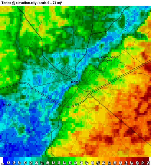
Below is the Elevation map of Tartas, which displays elevation range with different colors. Scale of the first map is from 9 to 74 m (30 to 243 ft) with average elevation of 36.9 meters (=121 ft) [note 1]
These maps also provides idea of topography and contour of this city, they are displayed at different zoom levels. More info about maps, scale and edge coordinates you can find below images.
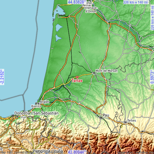
| \ | Map #1 | Topo.Map |
| Scale [m] | 9..74 m | × |
| Scale [ft] | 30..243 ft | × |
| Average | 36.9 m = 121 ft | × |
| Width | 7.05 km = 4.4 mi | 225.6 km = 140.2 mi |
| Height | 7.05 km = 4.4 mi | 225.6 km = 140.2 mi |
| ↑Max Latitude | 43.864172° | 44.83828° |
| Latitude at center | 43.83248° | 43.83248° |
| ↓Min Latitude | 43.800771° | 42.80944° |
| ← Min Longitude | -0.852895° | -2.2152° |
| Longitude center | -0.80895° | -0.80895° |
| →Max Longitude | -0.765005° | 0.5973° |
Nearby cities:
Cities around Tartas sort by population:
• Saint-Sever elevation 105 m
20.7 km,  113°
113°
• Saint-Vincent-de-Paul 21 m
18.7 km,  238°
238°
• Pontonx-sur-l'Adour 27 m
10.6 km, 241°
• Rion-des-Landes 68 m
14.6 km,  320°
320°
• Mugron 82 m
10.3 km,  153°
153°
• Montfort-en-Chalosse 108 m
13.7 km,  190°
190°
• Ygos-Saint-Saturnin 73 m
17 km,  19°
19°
• Hinx 50 m
17.3 km,  212°
212°
• Souprosse 50 m
9.3 km,  121°
121°
• Saint-Perdon 81 m
17.9 km,  78°
78°
• Meilhan 67 m
9 km,  66°
66°
• Bégaar 15 m
3.4 km,  252°
252°
Multilingual:
 En español:
Tartas elevación 19 m.
 En France:
Tartas élévation 19 m.


Sources and notes:
- [note 1] Map square and city borders are not equal. Map elevation data is calculated only from area inside that square.
- [src 1] Elevation data from geonames database provided with same terms of usage.
- [src 2] The elevation map of Tartas is generated using elevation data from NASA's 3 arcsec (90m) resolution SRTM data.
- [src 3] Base (background) map © OpenStreetMap contributors tiles are generated by Geofabrik and OpenTopoMap.
Copyright & License:
This Tartas Elevation Map is licensed under CC BY-SA. You may reuse any part from this page, if you give a proper credit by linking to this URL:
 More info on terms of use page.