Thouars elevation
Thouars (Nouvelle-Aquitaine, Département des Deux-Sèvres), France elevation is 94 meters and Thouars elevation in feet is 308 ft above sea level [src 1]. Thouars is a populated place (feature code) with elevation that is 80 meters (262 ft) smaller than average city elevation in France.
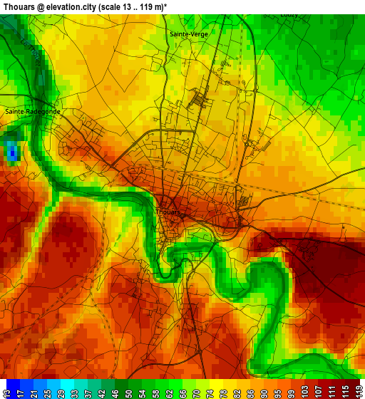
Below is the Elevation map of Thouars, which displays elevation range with different colors. Scale of the first map is from 13 to 119 m (43 to 390 ft) with average elevation of 83.3 meters (=273 ft) [note 1]
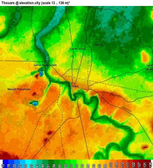
These maps also provides idea of topography and contour of this city, they are displayed at different zoom levels. More info about maps, scale and edge coordinates you can find below images.
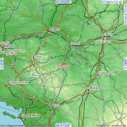
| \ | Map #1 | Map #2 | Topo.Map |
| Scale [m] | 13..119 m | 13..136 m | × |
| Scale [ft] | 43..390 ft | 43..446 ft | × |
| Average | 83.3 m = 273 ft | 80.3 m = 263 ft | × |
| Width | 6.67 km = 4.1 mi | 13.33 km = 8.3 mi | 213.4 km = 132.6 mi |
| Height | 6.67 km = 4.1 mi | 13.33 km = 8.3 mi | 213.3 km = 132.5 mi |
| ↑Max Latitude | 47.011473° | 47.041428° | 47.93229° |
| Latitude at center | 46.9815° | 46.9815° | 46.9815° |
| ↓Min Latitude | 46.951511° | 46.921504° | 46.01349° |
| ← Min Longitude | -0.255695° | -0.299641° | -1.618° |
| Longitude center | -0.21175° | -0.21175° | -0.21175° |
| →Max Longitude | -0.167805° | -0.123859° | 1.1945° |
Nearby cities:
Cities around Thouars sort by population:
• Montreuil-Bellay elevation 59 m
17.2 km,  15°
15°
• Airvault 118 m
18.1 km,  161°
161°
• Saint-Varent 102 m
10.3 km,  188°
188°
• Mauzé-Thouarsais 109 m
5.1 km,  263°
263°
• Sainte-Radegonde 96 m
2.9 km,  274°
274°
• Saint-Jean-de-Thouars 96 m
2 km,  179°
179°
• Sainte-Verge 68 m
2.9 km,  1°
1°
• Le Puy-Notre-Dame 91 m
16.1 km,  353°
353°
• Louzy 54 m
3.9 km,  29°
29°
• Saint-Léger-de-Montbrun 100 m
6.3 km,  70°
70°
• Vaudelnay 54 m
17.4 km, 1°
• Bouillé-Loretz 46 m
11.8 km,  337°
337°
Multilingual:
 En español:
Thouars elevación 94 m.
 En France:
Thouars élévation 94 m.


Sources and notes:
- [note 1] Map square and city borders are not equal. Map elevation data is calculated only from area inside that square.
- [src 1] Elevation data from geonames database provided with same terms of usage.
- [src 2] The elevation map of Thouars is generated using elevation data from NASA's 3 arcsec (90m) resolution SRTM data.
- [src 3] Base (background) map © OpenStreetMap contributors tiles are generated by Geofabrik and OpenTopoMap.
Copyright & License:
This Thouars Elevation Map is licensed under CC BY-SA. You may reuse any part from this page, if you give a proper credit by linking to this URL:
 More info on terms of use page.