Tourlaville elevation
Tourlaville (Normandy, Manche), France elevation is 27 meters and Tourlaville elevation in feet is 89 ft above sea level [src 1]. Tourlaville is a populated place (feature code) with elevation that is 147 meters (482 ft) smaller than average city elevation in France.
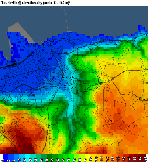
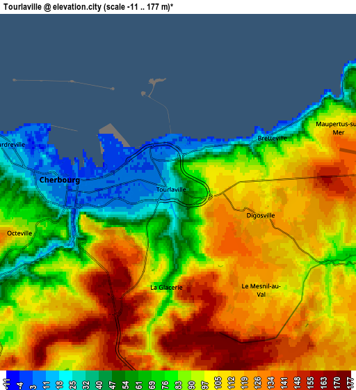
Below is the Elevation map of Tourlaville, which displays elevation range with different colors. Scale of the first map is from -5 to 169 m (-16 to 554 ft) with average elevation of 72 meters (=236 ft) [note 1]
These maps also provides idea of topography and contour of this city, they are displayed at different zoom levels. More info about maps, scale and edge coordinates you can find below images.
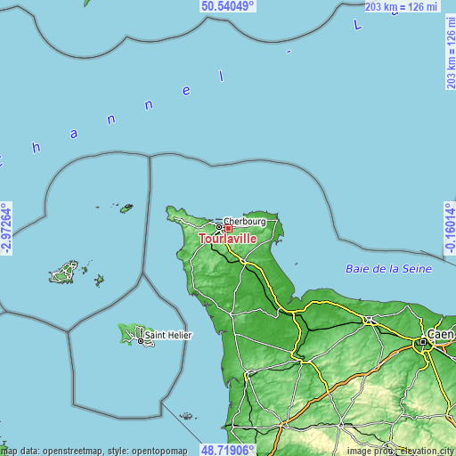
| \ | Map #1 | Map #2 | Topo.Map |
| Scale [m] | -5..169 m | -11..177 m | × |
| Scale [ft] | -16..554 ft | -36..581 ft | × |
| Average | 72 m = 236 ft | 96 m = 315 ft | × |
| Width | 6.33 km = 3.9 mi | 12.66 km = 7.9 mi | 202.5 km = 125.8 mi |
| Height | 6.33 km = 3.9 mi | 12.66 km = 7.9 mi | 202.5 km = 125.8 mi |
| ↑Max Latitude | 49.666741° | 49.695176° | 50.54049° |
| Latitude at center | 49.63829° | 49.63829° | 49.63829° |
| ↓Min Latitude | 49.609822° | 49.581338° | 48.71906° |
| ← Min Longitude | -1.610335° | -1.654281° | -2.97264° |
| Longitude center | -1.56639° | -1.56639° | -1.56639° |
| →Max Longitude | -1.522445° | -1.478499° | -0.16014° |
Nearby cities:
Cities around Tourlaville sort by population:
• Cherbourg-Octeville elevation 6 m
3.6 km,  272°
272°
• Équeurdreville-Hainneville 21 m
6.3 km,  280°
280°
• Octeville 95 m
5.7 km,  256°
256°
• Querqueville 5 m
9.4 km,  286°
286°
• La Glacerie 138 m
3.8 km,  196°
196°
• Brix 147 m
10.4 km,  185°
185°
• Saint-Pierre-Église 75 m
12.2 km,  74°
74°
• Digosville 112 m
3 km,  105°
105°
• Fermanville 18 m
9.2 km,  54°
54°
• Tollevast 90 m
8.4 km,  211°
211°
• Martinvast 60 m
8.5 km,  236°
236°
• Bretteville 19 m
3.2 km,  56°
56°
Multilingual:
 En español:
Tourlaville elevación 27 m.
 En France:
Tourlaville élévation 27 m.
 Auf Deutsch:
Tourlaville höhe über dem Meeresspiegel ist 27 m.

Sources and notes:
- [note 1] Map square and city borders are not equal. Map elevation data is calculated only from area inside that square.
- [src 1] Elevation data from geonames database provided with same terms of usage.
- [src 2] The elevation map of Tourlaville is generated using elevation data from NASA's 3 arcsec (90m) resolution SRTM data.
- [src 3] Base (background) map © OpenStreetMap contributors tiles are generated by Geofabrik and OpenTopoMap.
Copyright & License:
This Tourlaville Elevation Map is licensed under CC BY-SA. You may reuse any part from this page, if you give a proper credit by linking to this URL:
 More info on terms of use page.