Trélazé elevation
Trélazé (Pays de la Loire, Département de Maine-et-Loire), France elevation is 22 meters and Trélazé elevation in feet is 72 ft above sea level [src 1]. Trélazé is a populated place (feature code) with elevation that is 152 meters (499 ft) smaller than average city elevation in France.
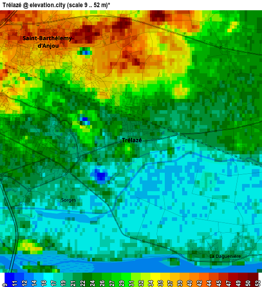
Below is the Elevation map of Trélazé, which displays elevation range with different colors. Scale of the first map is from 9 to 52 m (30 to 171 ft) with average elevation of 24.5 meters (=80 ft) [note 1]
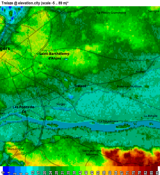
These maps also provides idea of topography and contour of this city, they are displayed at different zoom levels. More info about maps, scale and edge coordinates you can find below images.
| \ | Map #1 | Map #2 | Topo.Map |
| Scale [m] | 9..52 m | -5..89 m | × |
| Scale [ft] | 30..171 ft | -16..292 ft | × |
| Average | 24.5 m = 80 ft | 29 m = 95 ft | × |
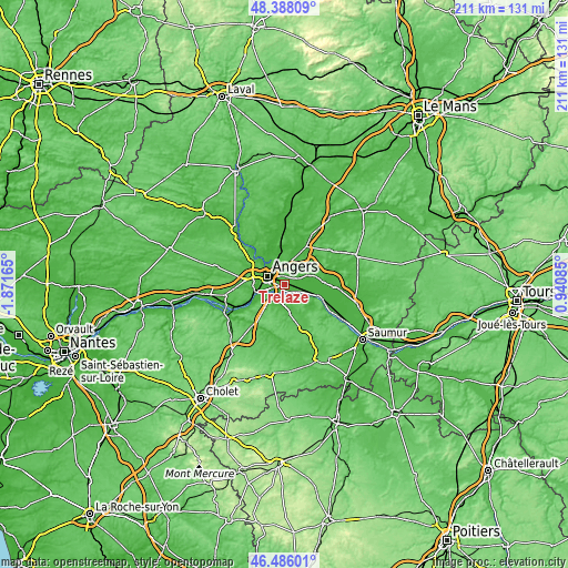
| Width | 6.61 km = 4.1 mi | 13.22 km = 8.2 mi | 211.5 km = 131.4 mi |
| Height | 6.61 km = 4.1 mi | 13.22 km = 8.2 mi | 211.5 km = 131.4 mi |
| ↑Max Latitude | 47.475361° | 47.505056° | 48.38809° |
| Latitude at center | 47.44565° | 47.44565° | 47.44565° |
| ↓Min Latitude | 47.415922° | 47.386177° | 46.48601° |
| ← Min Longitude | -0.509345° | -0.553291° | -1.87165° |
| Longitude center | -0.4654° | -0.4654° | -0.4654° |
| →Max Longitude | -0.421455° | -0.377509° | 0.94085° |
Nearby cities:
Cities around Trélazé sort by population:
• Angers elevation 39 m
6.9 km,  296°
296°
• Les Ponts-de-Cé 24 m
5.1 km,  240°
240°
• Mûrs-Erigné 22 m
8.1 km,  231°
231°
• Sainte-Gemmes-sur-Loire 28 m
7.3 km,  249°
249°
• Juigné-sur-Loire 25 m
4.3 km,  191°
191°
• Andard 22 m
5.2 km,  76°
76°
• Le Plessis-Grammoire 37 m
6.5 km,  24°
24°
• Saint-Jean-des-Mauvrets 31 m
5.4 km,  166°
166°
• La Daguenière 21 m
3.9 km,  138°
138°
• La Bohalle 23 m
5.8 km,  118°
118°
• Saint-Saturnin-sur-Loire 81 m
6.1 km,  158°
158°
• Blaison-Gohier 30 m
8.4 km,  127°
127°
Multilingual:
 En español:
Trélazé elevación 22 m.
 En France:
Trélazé élévation 22 m.


Sources and notes:
- [note 1] Map square and city borders are not equal. Map elevation data is calculated only from area inside that square.
- [src 1] Elevation data from geonames database provided with same terms of usage.
- [src 2] The elevation map of Trélazé is generated using elevation data from NASA's 3 arcsec (90m) resolution SRTM data.
- [src 3] Base (background) map © OpenStreetMap contributors tiles are generated by Geofabrik and OpenTopoMap.
Copyright & License:
This Trélazé Elevation Map is licensed under CC BY-SA. You may reuse any part from this page, if you give a proper credit by linking to this URL:
 More info on terms of use page.