Troissereux elevation
Troissereux (Hauts-de-France, Département de l'Oise), France elevation is 80 meters and Troissereux elevation in feet is 262 ft above sea level [src 1]. Troissereux is a populated place (feature code) with elevation that is 94 meters (308 ft) smaller than average city elevation in France.
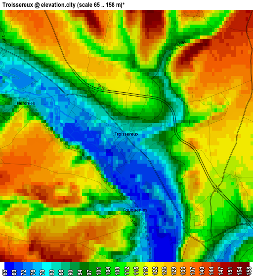
Below is the Elevation map of Troissereux, which displays elevation range with different colors. Scale of the first map is from 65 to 158 m (213 to 518 ft) with average elevation of 111 meters (=364 ft) [note 1]
These maps also provides idea of topography and contour of this city, they are displayed at different zoom levels. More info about maps, scale and edge coordinates you can find below images.
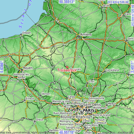
| \ | Map #1 | Topo.Map |
| Scale [m] | 65..158 m | × |
| Scale [ft] | 213..518 ft | × |
| Average | 111 m = 364 ft | × |
| Width | 6.35 km = 3.9 mi | 203.2 km = 126.3 mi |
| Height | 6.35 km = 3.9 mi | 203.2 km = 126.3 mi |
| ↑Max Latitude | 49.508524° | 50.38513° |
| Latitude at center | 49.47998° | 49.47998° |
| ↓Min Latitude | 49.45142° | 48.55778° |
| ← Min Longitude | 2.000905° | 0.6386° |
| Longitude center | 2.04485° | 2.04485° |
| →Max Longitude | 2.088795° | 3.4511° |
Nearby cities:
Cities around Troissereux sort by population:
• Beauvais elevation 71 m
5.9 km,  151°
151°
• Crèvecœur-le-Grand 176 m
13.6 km,  11°
11°
• Auneuil 126 m
12.7 km,  195°
195°
• Milly-sur-Thérain 83 m
4.3 km,  305°
305°
• Lachapelle-aux-Pots 110 m
10.9 km,  251°
251°
• Saint-Paul 110 m
6.2 km,  205°
205°
• Ons-en-Bray 122 m
11.3 km,  231°
231°
• Allonne 81 m
9.4 km, 147°
• Saint-Omer-en-Chaussée 104 m
6.5 km,  332°
332°
• Warluis 63 m
12.3 km, 145°
• Goincourt 76 m
6 km,  185°
185°
• Tillé 112 m
5.1 km,  110°
110°
Multilingual:
 En español:
Troissereux elevación 80 m.
 En France:
Troissereux élévation 80 m.
 Auf Deutsch:
Troissereux höhe über dem Meeresspiegel ist 80 m.

Sources and notes:
- [note 1] Map square and city borders are not equal. Map elevation data is calculated only from area inside that square.
- [src 1] Elevation data from geonames database provided with same terms of usage.
- [src 2] The elevation map of Troissereux is generated using elevation data from NASA's 3 arcsec (90m) resolution SRTM data.
- [src 3] Base (background) map © OpenStreetMap contributors tiles are generated by Geofabrik and OpenTopoMap.
Copyright & License:
This Troissereux Elevation Map is licensed under CC BY-SA. You may reuse any part from this page, if you give a proper credit by linking to this URL:
 More info on terms of use page.