Tulle elevation
Tulle (Nouvelle-Aquitaine, Département de la Corrèze), France elevation is 307 meters and Tulle elevation in feet is 1007 ft above sea level [src 1]. Tulle is a seat of a second-order administrative division (feature code) with elevation that is 133 meters (436 ft) bigger than average city elevation in France.
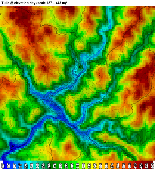
Below is the Elevation map of Tulle, which displays elevation range with different colors. Scale of the first map is from 187 to 443 m (614 to 1453 ft) with average elevation of 319.1 meters (=1047 ft) [note 1]
These maps also provides idea of topography and contour of this city, they are displayed at different zoom levels. More info about maps, scale and edge coordinates you can find below images.
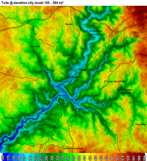
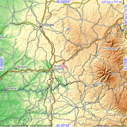
| \ | Map #1 | Map #2 | Topo.Map |
| Scale [m] | 187..443 m | 159..584 m | × |
| Scale [ft] | 614..1453 ft | 522..1916 ft | × |
| Average | 319.1 m = 1047 ft | 373.5 m = 1225 ft | × |
| Width | 6.88 km = 4.3 mi | 13.76 km = 8.6 mi | 220.1 km = 136.8 mi |
| Height | 6.88 km = 4.3 mi | 13.76 km = 8.6 mi | 220.1 km = 136.8 mi |
| ↑Max Latitude | 45.296741° | 45.327645° | 46.24694° |
| Latitude at center | 45.26582° | 45.26582° | 45.26582° |
| ↓Min Latitude | 45.234882° | 45.203927° | 44.26745° |
| ← Min Longitude | 1.728385° | 1.684439° | 0.36608° |
| Longitude center | 1.77233° | 1.77233° | 1.77233° |
| →Max Longitude | 1.816275° | 1.860221° | 3.17858° |
Nearby cities:
Cities around Tulle sort by population:
• Naves elevation 412 m
5.4 km,  355°
355°
• Sainte-Fortunade 501 m
6.6 km,  180°
180°
• Seilhac 495 m
12.2 km,  337°
337°
• Sainte-Féréole 384 m
15.4 km,  254°
254°
• Chameyrat 366 m
6.8 km,  238°
238°
• Laguenne 220 m
2.7 km,  164°
164°
• Cornil 325 m
8.8 km,  225°
225°
• Beynat 403 m
16.2 km,  193°
193°
• Corrèze 477 m
14.3 km,  34°
34°
• Chamboulive 433 m
19.2 km, 343°
• Saint-Mexant 416 m
9.2 km,  283°
283°
• Saint-Clément 436 m
10.8 km,  320°
320°
Multilingual:
 En español:
Tulle elevación 307 m.
 En France:
Tulle élévation 307 m.


Sources and notes:
- [note 1] Map square and city borders are not equal. Map elevation data is calculated only from area inside that square.
- [src 1] Elevation data from geonames database provided with same terms of usage.
- [src 2] The elevation map of Tulle is generated using elevation data from NASA's 3 arcsec (90m) resolution SRTM data.
- [src 3] Base (background) map © OpenStreetMap contributors tiles are generated by Geofabrik and OpenTopoMap.
Copyright & License:
This Tulle Elevation Map is licensed under CC BY-SA. You may reuse any part from this page, if you give a proper credit by linking to this URL:
 More info on terms of use page.