Ustaritz elevation
Ustaritz (Nouvelle-Aquitaine, Département des Pyrénées-Atlantiques), France elevation is 19 meters and Ustaritz elevation in feet is 62 ft above sea level [src 1]. Ustaritz is a populated place (feature code) with elevation that is 155 meters (509 ft) smaller than average city elevation in France.
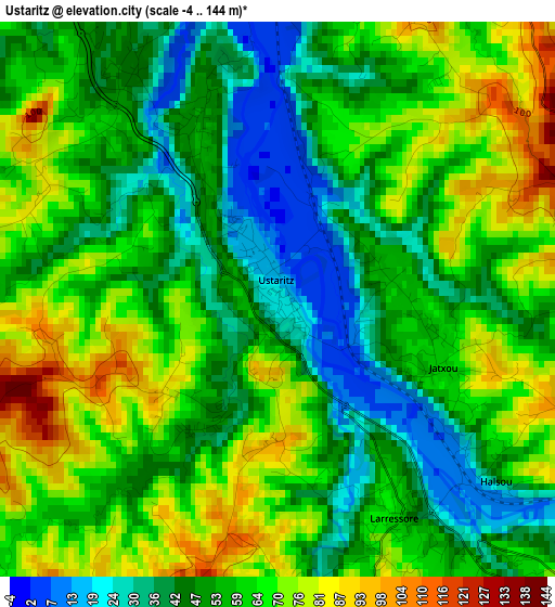
Below is the Elevation map of Ustaritz, which displays elevation range with different colors. Scale of the first map is from -4 to 144 m (-13 to 472 ft) with average elevation of 57.1 meters (=187 ft) [note 1]
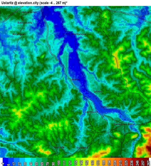
These maps also provides idea of topography and contour of this city, they are displayed at different zoom levels. More info about maps, scale and edge coordinates you can find below images.
| \ | Map #1 | Map #2 | Topo.Map |
| Scale [m] | -4..144 m | -4..267 m | × |
| Scale [ft] | -13..472 ft | -13..876 ft | × |
| Average | 57.1 m = 187 ft | 70.1 m = 230 ft | × |
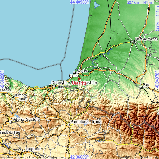
| Width | 7.1 km = 4.4 mi | 14.2 km = 8.8 mi | 227.2 km = 141.2 mi |
| Height | 7.1 km = 4.4 mi | 14.2 km = 8.8 mi | 227.2 km = 141.2 mi |
| ↑Max Latitude | 43.428423° | 43.460329° | 44.40968° |
| Latitude at center | 43.3965° | 43.3965° | 43.3965° |
| ↓Min Latitude | 43.36456° | 43.332604° | 42.36609° |
| ← Min Longitude | -1.499975° | -1.543921° | -2.86228° |
| Longitude center | -1.45603° | -1.45603° | -1.45603° |
| →Max Longitude | -1.412085° | -1.368139° | -0.04978° |
Nearby cities:
Cities around Ustaritz sort by population:
• Cambo-les-Bains elevation 70 m
6.1 km,  133°
133°
• Saint-Pée-sur-Nivelle 21 m
8.9 km,  239°
239°
• Mouguerre 99 m
8.5 km,  21°
21°
• Arcangues 50 m
6.6 km,  305°
305°
• Bassussarry 70 m
7.1 km,  316°
316°
• Villefranque 52 m
4.4 km,  2°
2°
• Espelette 77 m
6.3 km,  173°
173°
• Itxassou 76 m
8.5 km,  151°
151°
• Arbonne 36 m
8.7 km,  297°
297°
• Larressore 72 m
3.4 km,  157°
157°
• Ahetze 24 m
9.4 km,  275°
275°
• Souraïde 71 m
6.3 km,  194°
194°
Multilingual:
 En español:
Uztaritze elevación 19 m.
 En France:
Ustaritz élévation 19 m.


Sources and notes:
- [note 1] Map square and city borders are not equal. Map elevation data is calculated only from area inside that square.
- [src 1] Elevation data from geonames database provided with same terms of usage.
- [src 2] The elevation map of Ustaritz is generated using elevation data from NASA's 3 arcsec (90m) resolution SRTM data.
- [src 3] Base (background) map © OpenStreetMap contributors tiles are generated by Geofabrik and OpenTopoMap.
Copyright & License:
This Ustaritz Elevation Map is licensed under CC BY-SA. You may reuse any part from this page, if you give a proper credit by linking to this URL:
 More info on terms of use page.