Uzès elevation
Uzès (Occitanie, Gard), France elevation is 135 meters and Uzès elevation in feet is 443 ft above sea level [src 1]. Uzès is a populated place (feature code) with elevation that is 39 meters (128 ft) smaller than average city elevation in France.
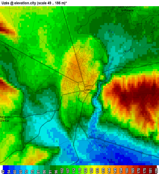
Below is the Elevation map of Uzès, which displays elevation range with different colors. Scale of the first map is from 49 to 186 m (161 to 610 ft) with average elevation of 106 meters (=348 ft) [note 1]
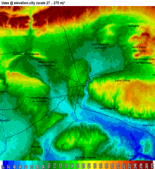
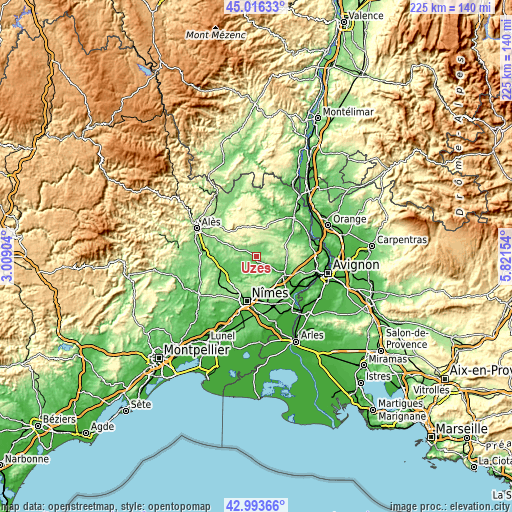
These maps also provides idea of topography and contour of this city, they are displayed at different zoom levels. More info about maps, scale and edge coordinates you can find below images.
| \ | Map #1 | Map #2 | Topo.Map |
| Scale [m] | 49..186 m | 27..275 m | × |
| Scale [ft] | 161..610 ft | 89..902 ft | × |
| Average | 106 m = 348 ft | 127.8 m = 419 ft | × |
| Width | 7.03 km = 4.4 mi | 14.06 km = 8.7 mi | 224.9 km = 139.7 mi |
| Height | 7.03 km = 4.4 mi | 14.06 km = 8.7 mi | 224.9 km = 139.7 mi |
| ↑Max Latitude | 44.045216° | 44.076795° | 45.01633° |
| Latitude at center | 44.01362° | 44.01362° | 44.01362° |
| ↓Min Latitude | 43.982007° | 43.950378° | 42.99366° |
| ← Min Longitude | 4.371345° | 4.327399° | 3.00904° |
| Longitude center | 4.41529° | 4.41529° | 4.41529° |
| →Max Longitude | 4.459235° | 4.503181° | 5.82154° |
Nearby cities:
Cities around Uzès sort by population:
• Poulx elevation 174 m
11.7 km,  179°
179°
• Saint-Quentin-la-Poterie 109 m
4.1 km,  34°
34°
• Remoulins 27 m
14.7 km,  124°
124°
• La Calmette 85 m
15.6 km,  229°
229°
• Vers-Pont-du-Gard 68 m
10.8 km, 118°
• Montaren-et-Saint-Médiers 115 m
3.3 km,  300°
300°
• Saint-Chaptes 75 m
11.9 km,  246°
246°
• Lédenon 121 m
13.7 km,  144°
144°
• Cabrières 143 m
13 km,  159°
159°
• Moussac 90 m
15.5 km,  256°
256°
• Castillon-du-Gard 61 m
12.3 km, 116°
• Blauzac 116 m
6.9 km,  212°
212°
Multilingual:
 En español:
Uzès elevación 135 m.
 En France:
Uzès élévation 135 m.


Sources and notes:
- [note 1] Map square and city borders are not equal. Map elevation data is calculated only from area inside that square.
- [src 1] Elevation data from geonames database provided with same terms of usage.
- [src 2] The elevation map of Uzès is generated using elevation data from NASA's 3 arcsec (90m) resolution SRTM data.
- [src 3] Base (background) map © OpenStreetMap contributors tiles are generated by Geofabrik and OpenTopoMap.
Copyright & License:
This Uzès Elevation Map is licensed under CC BY-SA. You may reuse any part from this page, if you give a proper credit by linking to this URL:
 More info on terms of use page.