Vieille Chapelle elevation
Vieille Chapelle (Provence-Alpes-Côte d'Azur, Département des Bouches-du-Rhône), France elevation is 16 meters and Vieille Chapelle elevation in feet is 52 ft above sea level [src 1]. Vieille Chapelle is a section of populated place (feature code) with elevation that is 158 meters (518 ft) smaller than average city elevation in France.
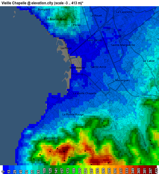
Below is the Elevation map of Vieille Chapelle, which displays elevation range with different colors. Scale of the first map is from -3 to 413 m (-10 to 1355 ft) with average elevation of 79.9 meters (=262 ft) [note 1]
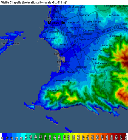
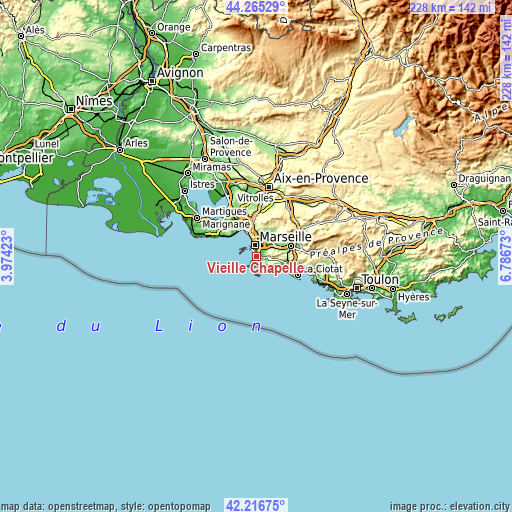
These maps also provides idea of topography and contour of this city, they are displayed at different zoom levels. More info about maps, scale and edge coordinates you can find below images.
| \ | Map #1 | Map #2 | Topo.Map |
| Scale [m] | -3..413 m | -8..611 m | × |
| Scale [ft] | -10..1355 ft | -26..2005 ft | × |
| Average | 79.9 m = 262 ft | 111.3 m = 365 ft | × |
| Width | 7.12 km = 4.4 mi | 14.24 km = 8.8 mi | 227.8 km = 141.5 mi |
| Height | 7.12 km = 4.4 mi | 14.24 km = 8.8 mi | 227.8 km = 141.5 mi |
| ↑Max Latitude | 43.28163° | 43.313614° | 44.26529° |
| Latitude at center | 43.24963° | 43.24963° | 43.24963° |
| ↓Min Latitude | 43.217613° | 43.185579° | 42.21675° |
| ← Min Longitude | 5.336535° | 5.292589° | 3.97423° |
| Longitude center | 5.38048° | 5.38048° | 5.38048° |
| →Max Longitude | 5.424425° | 5.468371° | 6.78673° |
Nearby cities:
Cities around Vieille Chapelle sort by population:
• Marseille 08 elevation 24 m
2.4 km,  3°
3°
• Marseille 09 31 m
2.1 km,  75°
75°
• Sainte-Marguerite 27 m
2.2 km,  50°
50°
• Mazargues 37 m
1.5 km,  105°
105°
• Saint-Giniez 17 m
2.2 km,  10°
10°
• Périer 20 m
3.1 km,  358°
358°
• Le Cabot 112 m
3.2 km,  71°
71°
• Sainte-Anne 22 m
1.4 km, 51°
• La Pointe Rouge 67 m
1.3 km,  193°
193°
• Bonneveine 12 m
0.2 km, 79°
• Montredon 16 m
1.6 km,  227°
227°
• La Page 8 m
1.9 km,  343°
343°
Multilingual:
 En español:
Vieille Chapelle elevación 16 m.
 En France:
Vieille Chapelle élévation 16 m.
 Auf Deutsch:
Vieille Chapelle höhe über dem Meeresspiegel ist 16 m.

Sources and notes:
- [note 1] Map square and city borders are not equal. Map elevation data is calculated only from area inside that square.
- [src 1] Elevation data from geonames database provided with same terms of usage.
- [src 2] The elevation map of Vieille Chapelle is generated using elevation data from NASA's 3 arcsec (90m) resolution SRTM data.
- [src 3] Base (background) map © OpenStreetMap contributors tiles are generated by Geofabrik and OpenTopoMap.
Copyright & License:
This Vieille Chapelle Elevation Map is licensed under CC BY-SA. You may reuse any part from this page, if you give a proper credit by linking to this URL:
 More info on terms of use page.