Warcq elevation
Warcq (Grand Est, Ardennes), France elevation is 146 meters and Warcq elevation in feet is 479 ft above sea level [src 1]. Warcq is a populated place (feature code) with elevation that is 28 meters (92 ft) smaller than average city elevation in France.
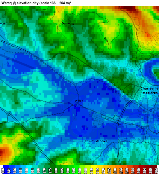
Below is the Elevation map of Warcq, which displays elevation range with different colors. Scale of the first map is from 136 to 264 m (446 to 866 ft) with average elevation of 168 meters (=551 ft) [note 1]
These maps also provides idea of topography and contour of this city, they are displayed at different zoom levels. More info about maps, scale and edge coordinates you can find below images.
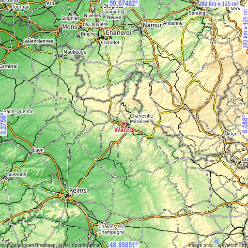
| \ | Map #1 | Topo.Map |
| Scale [m] | 136..264 m | × |
| Scale [ft] | 446..866 ft | × |
| Average | 168 m = 551 ft | × |
| Width | 6.31 km = 3.9 mi | 202 km = 125.5 mi |
| Height | 6.31 km = 3.9 mi | 201.9 km = 125.5 mi |
| ↑Max Latitude | 49.803541° | 50.67482° |
| Latitude at center | 49.77517° | 49.77517° |
| ↓Min Latitude | 49.746782° | 48.85851° |
| ← Min Longitude | 4.637805° | 3.2755° |
| Longitude center | 4.68175° | 4.68175° |
| →Max Longitude | 4.725695° | 6.088° |
Nearby cities:
Cities around Warcq sort by population:
• Charleville-Mézières elevation 150 m
3.2 km,  103°
103°
• Nouzonville 153 m
6.4 km,  47°
47°
• Villers-Semeuse 167 m
6 km,  128°
128°
• Aiglemont 255 m
6 km,  84°
84°
• La Francheville 161 m
5.6 km,  156°
156°
• Montcy-Notre-Dame 165 m
4.4 km,  90°
90°
• Prix-lès-Mézières 144 m
2.3 km, 162°
• Renwez 278 m
9 km,  321°
321°
• Lumes 158 m
8.8 km,  121°
121°
• Neufmanil 178 m
9.2 km,  64°
64°
• Saint-Laurent 252 m
6.6 km, 100°
• Tournes 164 m
3.9 km,  308°
308°
Multilingual:
 En español:
Warcq elevación 146 m.
 En France:
Warcq élévation 146 m.


Sources and notes:
- [note 1] Map square and city borders are not equal. Map elevation data is calculated only from area inside that square.
- [src 1] Elevation data from geonames database provided with same terms of usage.
- [src 2] The elevation map of Warcq is generated using elevation data from NASA's 3 arcsec (90m) resolution SRTM data.
- [src 3] Base (background) map © OpenStreetMap contributors tiles are generated by Geofabrik and OpenTopoMap.
Copyright & License:
This Warcq Elevation Map is licensed under CC BY-SA. You may reuse any part from this page, if you give a proper credit by linking to this URL:
 More info on terms of use page.