Eura elevation
Eura (Satakunta, Rauma), Finland elevation is 41 meters and Eura elevation in feet is 135 ft above sea level [src 1]. Eura is a seat of a third-order administrative division (feature code) with elevation that is 36 meters (118 ft) smaller than average city elevation in Finland.
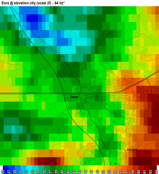
Below is the Elevation map of Eura, which displays elevation range with different colors. Scale of the first map is from 25 to 64 m (82 to 210 ft) with average elevation of 43.1 meters (=141 ft) [note 1]
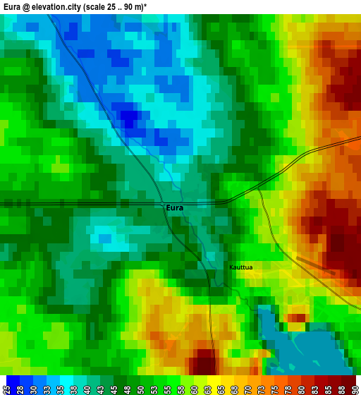
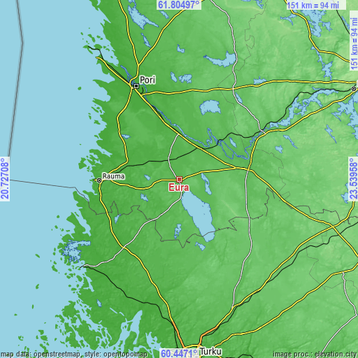
These maps also provides idea of topography and contour of this city, they are displayed at different zoom levels. More info about maps, scale and edge coordinates you can find below images.
| \ | Map #1 | Map #2 | Topo.Map |
| Scale [m] | 25..64 m | 25..90 m | × |
| Scale [ft] | 82..210 ft | 82..295 ft | × |
| Average | 43.1 m = 141 ft | 51.6 m = 169 ft | × |
| Width | 4.72 km = 2.9 mi | 9.44 km = 5.9 mi | 151 km = 93.8 mi |
| Height | 4.72 km = 2.9 mi | 9.44 km = 5.9 mi | 151 km = 93.8 mi |
| ↑Max Latitude | 61.154538° | 61.175733° | 61.80497° |
| Latitude at center | 61.13333° | 61.13333° | 61.13333° |
| ↓Min Latitude | 61.112107° | 61.09087° | 60.4471° |
| ← Min Longitude | 22.089385° | 22.045439° | 20.72708° |
| Longitude center | 22.13333° | 22.13333° | 22.13333° |
| →Max Longitude | 22.177275° | 22.221221° | 23.53958° |
Nearby cities:
Cities around Eura sort by population:
• Rauma elevation 14 m
33.4 km,  268°
268°
• Huittinen 52 m
30.9 km,  79°
79°
• Kokemäki 42 m
18.2 km,  41°
41°
• Harjavalta 37 m
20.4 km,  0°
0°
• Nakkila 18 m
26.9 km,  344°
344°
• Eurajoki 21 m
22.7 km,  289°
289°
• Säkylä 39 m
15.5 km,  135°
135°
• Kiukainen 36 m
9.6 km, 343°
• Lappi 49 m
16.5 km,  257°
257°
• Köyliö 47 m
9.6 km,  99°
99°
• Yläne 74 m
31.7 km,  151°
151°
• Vampula 75 m
33.1 km,  113°
113°
Multilingual:
 En español:
Eura elevación 41 m.
 En France:
Eura élévation 41 m.


Sources and notes:
- [note 1] Map square and city borders are not equal. Map elevation data is calculated only from area inside that square.
- [src 1] Elevation data from geonames database provided with same terms of usage.
- [src 2] The elevation map of Eura is generated using GMTED2010 database with 7.5 arcsec (225m) resolution.
- [src 3] Base (background) map © OpenStreetMap contributors tiles are generated by Geofabrik and OpenTopoMap.
Copyright & License:
This Eura Elevation Map is licensed under CC BY-SA. You may reuse any part from this page, if you give a proper credit by linking to this URL:
 More info on terms of use page.