Forssa elevation
Forssa (Kanta-Hame), Finland elevation is 133 meters and Forssa elevation in feet is 436 ft above sea level [src 1]. Forssa is a seat of a third-order administrative division (feature code) with elevation that is 56 meters (184 ft) bigger than average city elevation in Finland.
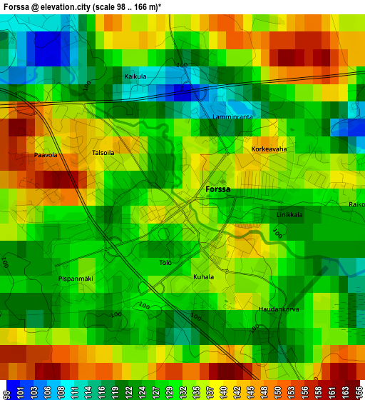
Below is the Elevation map of Forssa, which displays elevation range with different colors. Scale of the first map is from 98 to 166 m (322 to 545 ft) with average elevation of 131.3 meters (=431 ft) [note 1]
These maps also provides idea of topography and contour of this city, they are displayed at different zoom levels. More info about maps, scale and edge coordinates you can find below images.
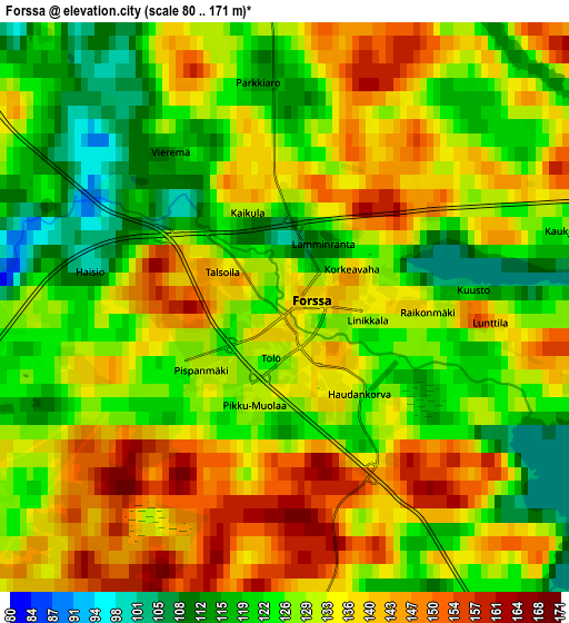
| \ | Map #1 | Map #2 | Topo.Map |
| Scale [m] | 98..166 m | 80..171 m | × |
| Scale [ft] | 322..545 ft | 262..561 ft | × |
| Average | 131.3 m = 431 ft | 130.4 m = 428 ft | × |
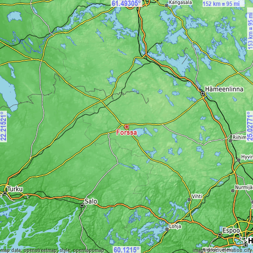
| Width | 4.77 km = 3 mi | 9.53 km = 5.9 mi | 152.5 km = 94.8 mi |
| Height | 4.77 km = 3 mi | 9.53 km = 5.9 mi | 152.5 km = 94.8 mi |
| ↑Max Latitude | 60.836042° | 60.85745° | 61.49305° |
| Latitude at center | 60.81462° | 60.81462° | 60.81462° |
| ↓Min Latitude | 60.793183° | 60.771733° | 60.1215° |
| ← Min Longitude | 23.577515° | 23.533569° | 22.21521° |
| Longitude center | 23.62146° | 23.62146° | 23.62146° |
| →Max Longitude | 23.665405° | 23.709351° | 25.02771° |
Nearby cities:
Cities around Forssa sort by population:
• Somero elevation 93 m
22.5 km,  192°
192°
• Tammela 119 m
8 km,  93°
93°
• Jokioinen 122 m
7.8 km,  259°
259°
• Urjala 111 m
30.3 km,  350°
350°
• Kärkölä 132 m
28.4 km,  142°
142°
• Ypäjä 88 m
18.4 km, 264°
• Kylmäkoski 85 m
37.9 km,  5°
5°
• Humppila 109 m
19.1 km,  313°
313°
• Renko 111 m
37.2 km,  75°
75°
• Mellilä 78 m
36.8 km, 261°
• Koski Tl 78 m
31.5 km,  234°
234°
• Loimaa 82 m
30.9 km,  277°
277°
Multilingual:
 En español:
Forssa elevación 133 m.
 En France:
Forssa élévation 133 m.


Sources and notes:
- [note 1] Map square and city borders are not equal. Map elevation data is calculated only from area inside that square.
- [src 1] Elevation data from geonames database provided with same terms of usage.
- [src 2] The elevation map of Forssa is generated using GMTED2010 database with 7.5 arcsec (225m) resolution.
- [src 3] Base (background) map © OpenStreetMap contributors tiles are generated by Geofabrik and OpenTopoMap.
Copyright & License:
This Forssa Elevation Map is licensed under CC BY-SA. You may reuse any part from this page, if you give a proper credit by linking to this URL:
 More info on terms of use page.