Kellokoski elevation
Kellokoski (Uusimaa, Helsinki), Finland elevation is 62 meters and Kellokoski elevation in feet is 203 ft above sea level [src 1]. Kellokoski is a populated place (feature code) with elevation that is 15 meters (49 ft) smaller than average city elevation in Finland.
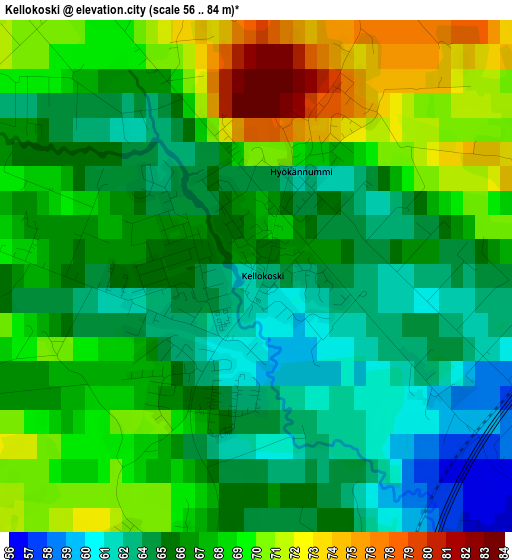
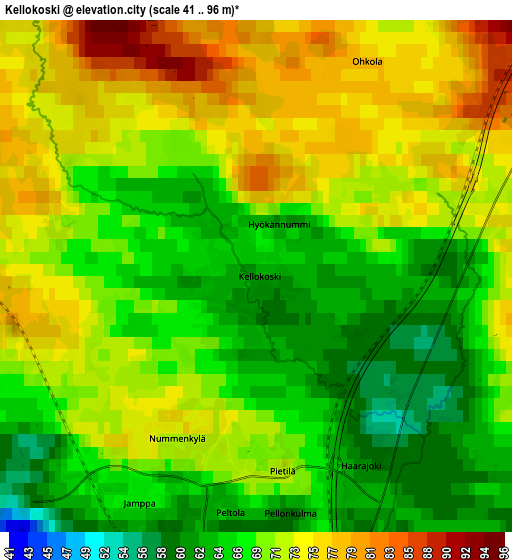
Below is the Elevation map of Kellokoski, which displays elevation range with different colors. Scale of the first map is from 56 to 84 m (184 to 276 ft) with average elevation of 66.6 meters (=219 ft) [note 1]
These maps also provides idea of topography and contour of this city, they are displayed at different zoom levels. More info about maps, scale and edge coordinates you can find below images.
| \ | Map #1 | Map #2 | Topo.Map |
| Scale [m] | 56..84 m | 41..96 m | × |
| Scale [ft] | 184..276 ft | 135..315 ft | × |
| Average | 66.6 m = 219 ft | 69.6 m = 228 ft | × |
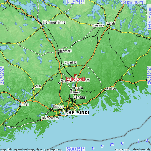
| Width | 4.81 km = 3 mi | 9.61 km = 6 mi | 153.8 km = 95.6 mi |
| Height | 4.81 km = 3 mi | 9.61 km = 6 mi | 153.8 km = 95.6 mi |
| ↑Max Latitude | 60.554321° | 60.575917° | 61.21713° |
| Latitude at center | 60.53271° | 60.53271° | 60.53271° |
| ↓Min Latitude | 60.511085° | 60.489445° | 59.83351° |
| ← Min Longitude | 25.065225° | 25.021279° | 23.70292° |
| Longitude center | 25.10917° | 25.10917° | 25.10917° |
| →Max Longitude | 25.153115° | 25.197061° | 26.51542° |
Nearby cities:
Cities around Kellokoski sort by population:
• Vantaa elevation 18 m
26.8 km,  188°
188°
• Hyvinge 113 m
17.3 km,  310°
310°
• Järvenpää 51 m
6.6 km, 189°
• Nurmijärvi 78 m
18.2 km,  245°
245°
• Tuusula 58 m
15 km,  197°
197°
• Kerava 54 m
14.4 km,  180°
180°
• Sibbo 27 m
19.4 km,  153°
153°
• Mäntsälä 59 m
15.9 km,  45°
45°
• Pornainen 50 m
15.9 km,  113°
113°
• Askola 58 m
26.8 km,  89°
89°
• Pukkila 54 m
28.2 km,  62°
62°
• Nickby 32 m
19.2 km, 150°
Multilingual:
 En español:
Kellokoski elevación 62 m.
 En France:
Kellokoski élévation 62 m.
 Auf Deutsch:
Kellokoski höhe über dem Meeresspiegel ist 62 m.

Sources and notes:
- [note 1] Map square and city borders are not equal. Map elevation data is calculated only from area inside that square.
- [src 1] Elevation data from geonames database provided with same terms of usage.
- [src 2] The elevation map of Kellokoski is generated using GMTED2010 database with 7.5 arcsec (225m) resolution.
- [src 3] Base (background) map © OpenStreetMap contributors tiles are generated by Geofabrik and OpenTopoMap.
Copyright & License:
This Kellokoski Elevation Map is licensed under CC BY-SA. You may reuse any part from this page, if you give a proper credit by linking to this URL:
 More info on terms of use page.