Nastola elevation
Nastola (Päijänne Tavastia, Lahti), Finland elevation is 112 meters and Nastola elevation in feet is 367 ft above sea level [src 1]. Nastola is a populated place (feature code) with elevation that is 35 meters (115 ft) bigger than average city elevation in Finland.
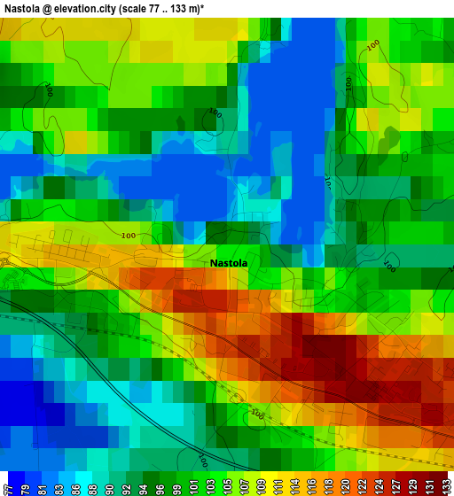
Below is the Elevation map of Nastola, which displays elevation range with different colors. Scale of the first map is from 77 to 133 m (253 to 436 ft) with average elevation of 100.6 meters (=330 ft) [note 1]
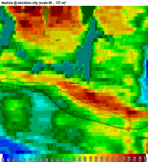
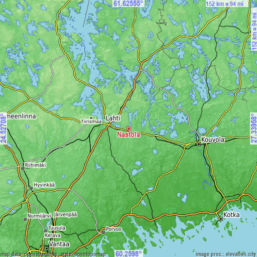
These maps also provides idea of topography and contour of this city, they are displayed at different zoom levels. More info about maps, scale and edge coordinates you can find below images.
| \ | Map #1 | Map #2 | Topo.Map |
| Scale [m] | 77..133 m | 66..137 m | × |
| Scale [ft] | 253..436 ft | 217..449 ft | × |
| Average | 100.6 m = 330 ft | 100.1 m = 328 ft | × |
| Width | 4.75 km = 3 mi | 9.49 km = 5.9 mi | 151.9 km = 94.4 mi |
| Height | 4.75 km = 3 mi | 9.49 km = 5.9 mi | 151.8 km = 94.3 mi |
| ↑Max Latitude | 60.971331° | 60.992649° | 61.62555° |
| Latitude at center | 60.95° | 60.95° | 60.95° |
| ↓Min Latitude | 60.928654° | 60.907294° | 60.2598° |
| ← Min Longitude | 25.889385° | 25.845439° | 24.52708° |
| Longitude center | 25.93333° | 25.93333° | 25.93333° |
| →Max Longitude | 25.977275° | 26.021221° | 27.33958° |
Nearby cities:
Cities around Nastola sort by population:
• Lahti elevation 105 m
15.1 km,  283°
283°
• Heinola 104 m
29 km,  11°
11°
• Hollola 104 m
29.2 km,  292°
292°
• Orimattila 76 m
19.5 km,  214°
214°
• Asikkala 74 m
37.7 km,  321°
321°
• Iitti 80 m
22.7 km,  105°
105°
• Myrskylä 53 m
31.5 km,  188°
188°
• Jaala 108 m
31.7 km,  68°
68°
• Artjärvi 60 m
23.9 km,  161°
161°
• Kärkölä 128 m
37.1 km,  264°
264°
• Järvelä 107 m
36.3 km, 255°
• Hollola 140 m
24 km, 283°
Multilingual:
 En español:
Nastola elevación 112 m.
 En France:
Nastola élévation 112 m.


Sources and notes:
- [note 1] Map square and city borders are not equal. Map elevation data is calculated only from area inside that square.
- [src 1] Elevation data from geonames database provided with same terms of usage.
- [src 2] The elevation map of Nastola is generated using GMTED2010 database with 7.5 arcsec (225m) resolution.
- [src 3] Base (background) map © OpenStreetMap contributors tiles are generated by Geofabrik and OpenTopoMap.
Copyright & License:
This Nastola Elevation Map is licensed under CC BY-SA. You may reuse any part from this page, if you give a proper credit by linking to this URL:
 More info on terms of use page.