Orimattila elevation
Orimattila (Päijänne Tavastia, Lahti), Finland elevation is 76 meters and Orimattila elevation in feet is 249 ft above sea level [src 1]. Orimattila is a seat of a third-order administrative division (feature code) with elevation that is 1 meters (3 ft) smaller than average city elevation in Finland.
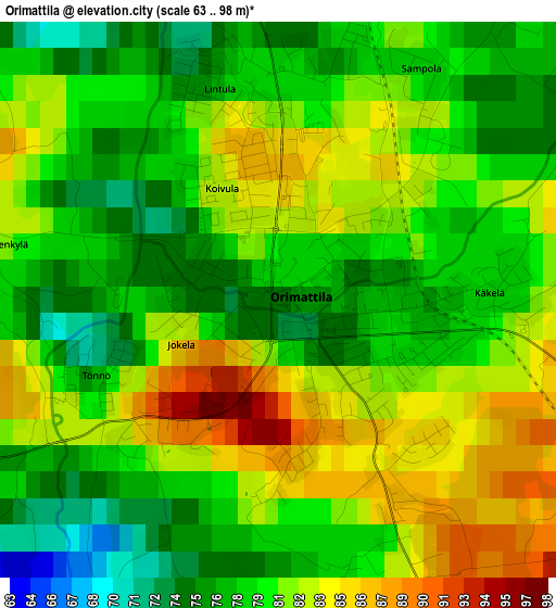
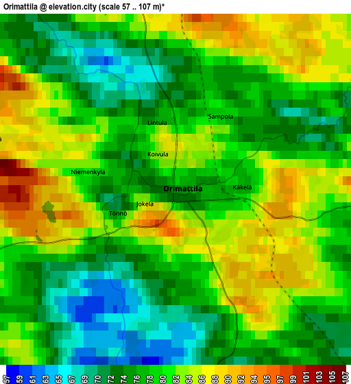
Below is the Elevation map of Orimattila, which displays elevation range with different colors. Scale of the first map is from 63 to 98 m (207 to 322 ft) with average elevation of 80 meters (=262 ft) [note 1]
These maps also provides idea of topography and contour of this city, they are displayed at different zoom levels. More info about maps, scale and edge coordinates you can find below images.
| \ | Map #1 | Map #2 | Topo.Map |
| Scale [m] | 63..98 m | 57..107 m | × |
| Scale [ft] | 207..322 ft | 187..351 ft | × |
| Average | 80 m = 262 ft | 79.2 m = 260 ft | × |
| Width | 4.77 km = 3 mi | 9.53 km = 5.9 mi | 152.5 km = 94.8 mi |
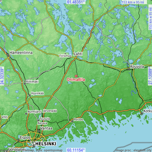
| Height | 4.77 km = 3 mi | 9.53 km = 5.9 mi | 152.5 km = 94.8 mi |
| ↑Max Latitude | 60.826299° | 60.847713° | 61.48351° |
| Latitude at center | 60.80487° | 60.80487° | 60.80487° |
| ↓Min Latitude | 60.783427° | 60.76197° | 60.11154° |
| ← Min Longitude | 25.685695° | 25.641749° | 24.32339° |
| Longitude center | 25.72964° | 25.72964° | 25.72964° |
| →Max Longitude | 25.773585° | 25.817531° | 27.13589° |
Nearby cities:
Cities around Orimattila sort by population:
• Lahti elevation 105 m
20.1 km,  349°
349°
• Hollola 104 m
31.6 km,  329°
329°
• Mäntsälä 59 m
29.5 km,  229°
229°
• Nastola 112 m
19.5 km,  34°
34°
• Askola 58 m
31 km,  193°
193°
• Myrskylä 53 m
16.3 km,  156°
156°
• Pukkila 54 m
19.4 km,  207°
207°
• Artjärvi 60 m
19.7 km,  109°
109°
• Liljendal 22 m
31.2 km,  145°
145°
• Kärkölä 128 m
28.8 km,  295°
295°
• Järvelä 107 m
25.1 km,  285°
285°
• Hollola 140 m
25 km, 330°
Multilingual:
 En español:
Orimattila elevación 76 m.
 En France:
Orimattila élévation 76 m.
 Auf Deutsch:
Orimattila höhe über dem Meeresspiegel ist 76 m.

Sources and notes:
- [note 1] Map square and city borders are not equal. Map elevation data is calculated only from area inside that square.
- [src 1] Elevation data from geonames database provided with same terms of usage.
- [src 2] The elevation map of Orimattila is generated using GMTED2010 database with 7.5 arcsec (225m) resolution.
- [src 3] Base (background) map © OpenStreetMap contributors tiles are generated by Geofabrik and OpenTopoMap.
Copyright & License:
This Orimattila Elevation Map is licensed under CC BY-SA. You may reuse any part from this page, if you give a proper credit by linking to this URL:
 More info on terms of use page.