Rautalampi elevation
Rautalampi (Northern Savonia, Sisä-Savo), Finland elevation is 85 meters and Rautalampi elevation in feet is 279 ft above sea level [src 1]. Rautalampi is a seat of a third-order administrative division (feature code) with elevation that is 8 meters (26 ft) bigger than average city elevation in Finland.
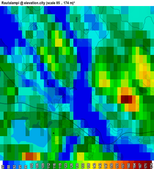
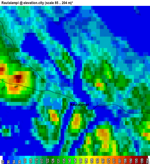
Below is the Elevation map of Rautalampi, which displays elevation range with different colors. Scale of the first map is from 85 to 174 m (279 to 571 ft) with average elevation of 106.6 meters (=350 ft) [note 1]
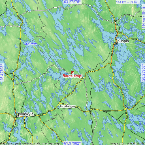
These maps also provides idea of topography and contour of this city, they are displayed at different zoom levels. More info about maps, scale and edge coordinates you can find below images.
| \ | Map #1 | Map #2 | Topo.Map |
| Scale [m] | 85..174 m | 85..204 m | × |
| Scale [ft] | 279..571 ft | 279..669 ft | × |
| Average | 106.6 m = 350 ft | 107 m = 351 ft | × |
| Width | 4.49 km = 2.8 mi | 8.98 km = 5.6 mi | 143.8 km = 89.4 mi |
| Height | 4.49 km = 2.8 mi | 8.98 km = 5.6 mi | 143.7 km = 89.3 mi |
| ↑Max Latitude | 62.653524° | 62.673704° | 63.27275° |
| Latitude at center | 62.63333° | 62.63333° | 62.63333° |
| ↓Min Latitude | 62.613122° | 62.592901° | 61.97982° |
| ← Min Longitude | 26.789385° | 26.745439° | 25.42708° |
| Longitude center | 26.83333° | 26.83333° | 26.83333° |
| →Max Longitude | 26.877275° | 26.921221° | 28.23958° |
Nearby cities:
Cities around Rautalampi sort by population:
• Laukaa elevation 89 m
51.4 km,  241°
241°
• Pieksämäki 119 m
40.1 km,  157°
157°
• Leppävirta 114 m
51.2 km,  108°
108°
• Suonenjoki 104 m
15.4 km,  96°
96°
• Suolahti 123 m
50.7 km,  261°
261°
• Hankasalmi 116 m
34.6 km,  216°
216°
• Karttula 102 m
30.1 km,  13°
13°
• Konnevesi 117 m
26.5 km,  265°
265°
• Vesanto 110 m
39.5 km,  327°
327°
• Tervo 110 m
35.5 km,  353°
353°
• Jäppilä 112 m
41.8 km,  132°
132°
• Sumiainen 84 m
40.3 km, 273°
Multilingual:
 En español:
Rautalampi elevación 85 m.
 En France:
Rautalampi élévation 85 m.
 Auf Deutsch:
Rautalampi höhe über dem Meeresspiegel ist 85 m.

Sources and notes:
- [note 1] Map square and city borders are not equal. Map elevation data is calculated only from area inside that square.
- [src 1] Elevation data from geonames database provided with same terms of usage.
- [src 2] The elevation map of Rautalampi is generated using GMTED2010 database with 7.5 arcsec (225m) resolution.
- [src 3] Base (background) map © OpenStreetMap contributors tiles are generated by Geofabrik and OpenTopoMap.
Copyright & License:
This Rautalampi Elevation Map is licensed under CC BY-SA. You may reuse any part from this page, if you give a proper credit by linking to this URL:
 More info on terms of use page.